- San Pedro de Atacama
Infobox City
official_name = San Pedro de Atacama
other_name =
native_name =
nickname =
motto =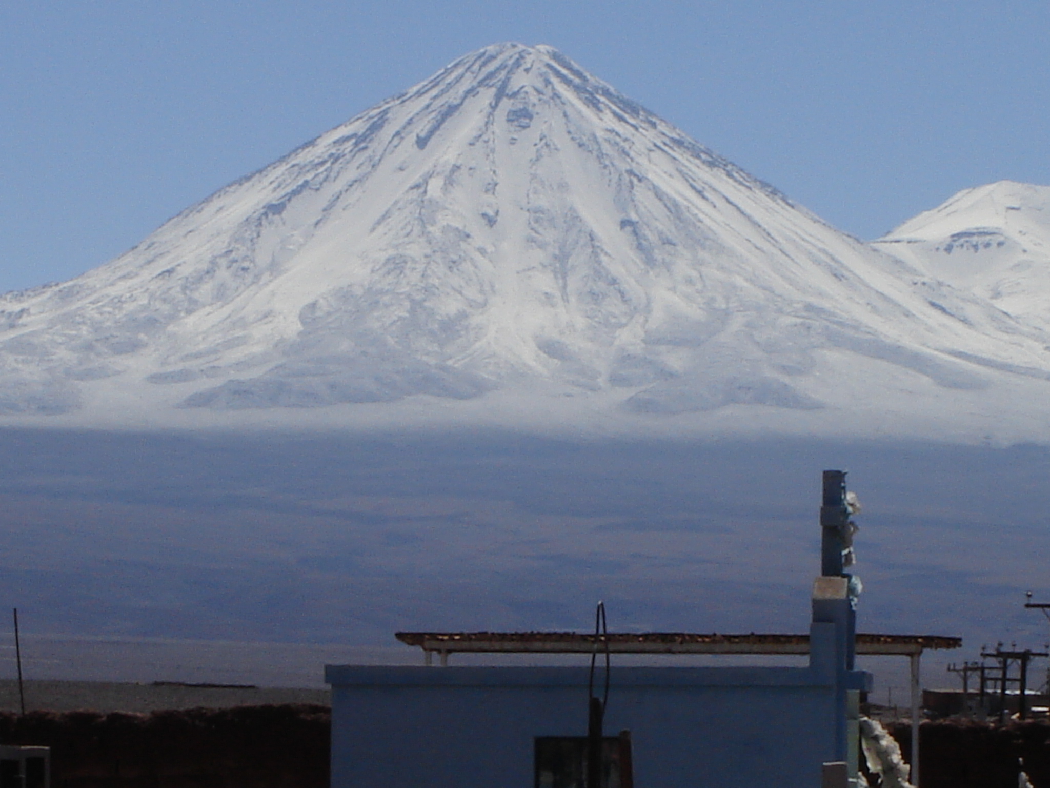
imagesize =300px
image_caption =Licancabur , View of the volcano from San Pedro de Atacama.
flag_size = 150px
image_
seal_size =
image_shield =
shield_size = 100px
image_blank_emblem =
blank_emblem_size =
flag_size = 150px
image_
seal_size =
image_shield =
shield_size = 100px
image_blank_emblem =
blank_emblem_size =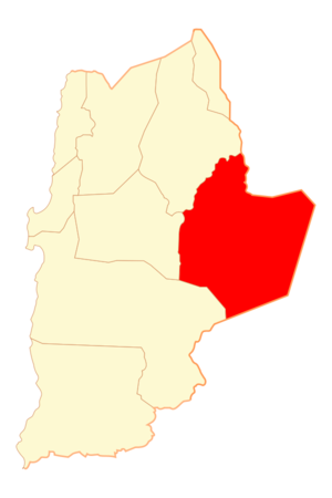
mapsize = 100px
map_caption =Location of the Commune of San Pedro de Atacama
pushpin_
pushpin_label_position = bottom
pushpin_map_caption =Location in Chile
pushpin_mapsize = 80
subdivision_type = Country
subdivision_name =Chile
subdivision_type1 = Region
subdivision_name1 = Antofagasta
subdivision_type2 = Province
subdivision_name2 = El Loa
subdivision_type3 =
subdivision_name3 =
subdivision_type4 =
subdivision_name4 =
government_type =
leader_title = Mayor
leader_name = Sandra Berna Martínez (2004-2008)
leader_title1 =
leader_name1 =
leader_title2 =
leader_name2 =
leader_title3 =
leader_name3 =
established_title =
established_date =
established_title2 = Founded
established_date2 = 1450 aprox.
established_title3 =
established_date3 =
area_magnitude =
area_total_km2 = 23439
area_total_sq_mi =
area_land_km2 =
area_land_sq_mi =
area_water_km2 =
area_water_sq_mi =
area_water_percent =
area_urban_km2 =
area_urban_sq_mi =
area_metro_km2 =
area_metro_sq_mi =
population_as_of =2002
population_note =
settlement_type = Town
population_total = 4969
population_density_km2 = 0.2
population_density_sq_mi =
population_metro =
population_density_metro_km2 =
population_density_metro_sq_mi =
population_urban =
population_density_urban_km2 =
population_density_urban_mi2 =
timezone =
utc_offset = -4
timezone_DST =
utc_offset_DST = -3
latd=22 |latm= 55|lats= |latNS=S
longd=68 |longm=12 |longs= |longEW=W
elevation_m =
elevation_ft =
postal_code_type =
postal_code =
area_code =
website =
footnotes =San Pedro de Atacama is a
Chile an town and commune inEl Loa Province ,Antofagasta Region . It is a popular tourist destination.San Pedro de Atacama grew, over centuries, around an
oasis in theAtacama desert . It is located east ofAntofagasta , some 100 km (60 mi) southeast ofCalama and theChuquicamata copper mine, overlooking theLicancabur volcano. It features a significant archeological museum, theR. P. Gustavo Le Paige Archaeological Museum , with a large collection of relics and artifacts from the region. Native ruins nearby now attract increasing numbers of tourists interested in learning aboutpre-Colombian cultures. Tourists also visit for other popular activities includingsandboarding and stargazing, with the views of the stars from the Atacama unrivalled across the continent.The town lies at an average
altitude of approximately 2,400m (7,900 ft) and visitors often experience mildaltitude sickness such as dizziness, lethargy and headaches. The local climate is extremely dry (with little or no rainfall recorded in the town itself) and mild, with daytime temperatures between 25-30 degrees Celsius (77-86°F) in the summer (December to February) and 18-25 degrees Celsius (64-77°F) in the winter (June to August). Nighttime temperatures routinely drop below zero and can reach as low as -10°C (14°F) in the winter.In the past it was found that the town's water supply was naturally contaminated with high levels of the heavy metal
arsenic which leaches from adjacent salt lakes, with levels of as high as 600µg per litre (60 times theWHO recommended maximum) being recorded. Interestingly the indigenous population seem to have developed a natural tolerance to this otherwise toxic metal and suffered few ill effects from drinking the water. Recently a filtration plant has been installed in the town which has reduced the levels of arsenic and other contaminants in the local water supply.Main sights
*
El Tatio , a geyser field with over 80 active geysers.
*Salar de Atacama , a giant salt area (8,000 km²/3,100 mi²) in the middle of the Atacama Desert.
*Chaxas Lagoon, in the Atacama Salt, inhabited by pink flamingoes.
*Pukará de Quitor (Fort Quitor). A fortification built by theAtacameño people in the 12th century.
*Puritama Hot Springs
*Laguna Miscanti (Miscanti Lagoon), an altiplanic lagoon at an altitude of 4,100 m (13,500 ft).
*Licancabur , a notable volcano near San Pedro de Atacama.
*"Valle de la Muerte" (Death Valley): a valley where gigantic dunes and rocks abound.
*Valle de la Luna ("Valley of the Moon"), a moon-like landscape with ruins of old Chilean salt mines, and worker huts.ee also
*
Los Flamencos National Reserve
*Llano de Chajnantor Observatory
*Lascar Volcano
*Monturaqui crater Image gallery
External links
* [http://www.sanpedrochile.com/ San Pedro de Atacama website]
* [http://www.ucn.cl/museo/detalle.asp?tipo3 R. P. Gustavo Le Paige Archeological Museum]
* [http://www.sanpedrodeatacama.org SanPedrodeAtacama.Net & Org]

Wikimedia Foundation. 2010.