- Llano County, Texas
Infobox U.S. County
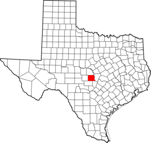
county = Llano County
state = Texas

map size = 250
founded =1856
seat = Llano | area_total_sq_mi =966
area_land_sq_mi =935
area_water_sq_mi =31
area percentage = 3.25%
census yr = 2000
pop = 17044
density_km2 =7
web = www.co.llano.tx.us
|Llano County (pronEng|ˈlænoʊ) is a
county located in theU.S. state ofTexas . In2000 , its population was 17,044. Itscounty seat is Llano,GR|6 and the county is named for theLlano River .Geography
According to the U.S. Census Bureau, the county has a total area of 966
square mile s (2,502km² ). 2,421 km² (935 sq. mi.) of it is land and 81 km² (31 sq. mi.) of it (3.25%) is water.Enchanted Rock , a designated state natural area and popular tourist destination, is located in southern Llano county.Two significant rivers, the Llano River and the Colorado River, flow through Llano County. These rivers contribute to Lake Buchanan,
Inks Lake , and Lake Lyndon B. Johnson, which are all located partially within the county.Major Highways
*
*
*Adjacent counties
*San Saba County (north)
*Burnet County (east)
*Blanco County (southeast)
*Gillespie County (south)
*Mason County (west)Demographics
As of the 2000 census, there were 17,044 people, 7,879 households, and 5,365 families residing in the county. The
population density was 18 people per square mile (7/km²). There were 11,829 housing units at an average density of 13 per square mile (5/km²). The racial makeup of the county was 96.27% White, 0.30% Black or African American, 0.42% Native American, 0.38% Asian, 0.03% Pacific Islander, 1.77% from other races, and 0.84% from two or more races. 5.13% of the population were Hispanic or Latino of any race.There were 7,879 households out of which 16.90% had children under the age of 18 living with them, 59.50% were married couples living together, 5.90% had a female householder with no husband present, and 31.90% were non-families. 28.30% of all households were made up of individuals and 16.00% had someone living alone who was 65 years of age or older. The average household size was 2.13 and the average family size was 2.56.
In the county, the population was spread out with 15.90% under the age of 18, 4.50% from 18 to 24, 18.40% from 25 to 44, 30.50% from 45 to 64, and 30.70% who were 65 years of age or older. The median age was 53 years. For every 100 females there were 94.40 males. For every 100 females age 18 and over, there were 91.70 males.
The median income for a household in the county was $34,830, and the median income for a family was $40,597. Males had a median income of $30,839 versus $21,126 for females. The
per capita income for the county was $23,547. About 7.20% of families and 10.30% of the population were below thepoverty line , including 17.20% of those under age 18 and 6.00% of those age 65 or over.Cities and towns
*Buchanan Dam
*Castell
*Horseshoe Bay
*Kingsland
*Llano
*Sunrise Beach Village
*TowReferences
External links
* [http://www.co.llano.tx.us/ Llano County government’s website]
*Handbook of Texas|id=LL/hcl12|name=Llano County
Wikimedia Foundation. 2010.