Distances Between Ports

Distances Between Ports
Distances-between-ports.jpg
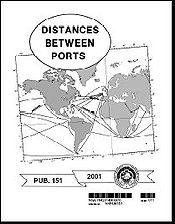
The front cover of Distances Between Ports.
Purpose: Provide distances between major ports.
Publication Frequency: Irregular
Published by: Defense Mapping Agency Hydrographic Topographic Center
Available Online: Yes [1]

Distances Between Ports (PUB 151) is a publication that lists the distances between major ports. Reciprocal distances between two ports may differ due to different routes chosen because of currents and climatic conditions. To reduce the number of listings needed, junction points along major routes are used to consolidate routes converging from different directions.

This book can be most effectively used for voyage planning in conjunction with the proper volume(s) of the Sailing Directions (Planning Guide). It is corrected via the Notice to Mariners.

The positions listed for ports are central positions that most represent each port. The distances are between positions shown for each port and are generally over routes that afford the safest passage. Most of the distances represent the shortest navigable routes, but in some cases, longer routes, that take advantage of favorable currents, have been used. In other cases, increased distances result from routes selected to avoid ice or other dangers to navigation, or to follow required separation schemes.

Source

The text of this article originated from section 414 of The American Practical Navigator, a document produced by the government of the United States of America.

See also

Yacht foresail.svg Nautical portal

External links


Wikimedia Foundation. 2010.

Игры ⚽ Поможем сделать НИР

Look at other dictionaries:

  • Land Between the Lakes National Recreation Area — Infobox protected area | name = Land Between the Lakes National Recreation Area iucn category = V caption = locator x = 186 locator y = 103 location = Lyon and Trigg counties in Kentucky and Stewart County in Tennessee, USA nearest city = Dover,… …   Wikipedia

  • logistics — /loh jis tiks, leuh /, n. (used with a sing. or pl. v.) 1. the branch of military science and operations dealing with the procurement, supply, and maintenance of equipment, with the movement, evacuation, and hospitalization of personnel, with the …   Universalium

  • Nautical publications — is a technical term used in maritime circles describing a set of publications, generally published by national governments, for use in safe navigation of ships, boats, and similar vessels. The nature of waterways described by any given nautical… …   Wikipedia

  • Nautical chart — A nautical chart is a graphic representation of a maritime area and adjacent coastal regions. Depending on the scale of the chart, it may show depths of water and heights of land (topographic map), natural features of the seabed, details of the… …   Wikipedia

  • Alaska Marine Highway — The Alaska Marine Highway System operates along the southcentral coast of the state, the eastern Aleutian islands and the Inside Passage of Alaska and British Columbia, Canada. Ferries serve communities in Southeastern Alaska that have no road… …   Wikipedia

  • World Port Index — The World Port Index (PUB 150) contains a tabular listing of thousands of ports throughout the world, describing their location, characteristics, known facilities, and available services. Of particular interest are the applicable volume of… …   Wikipedia

  • Notice to mariners — The front cover of a Notice to Mariners. Purpose: Provide corrections to navigational publications and nautical charts. Publication Frequency: Weekly Published by: National Geospatial Intelligence Agency Available Online: Yes …   Wikipedia

  • Nautical almanac — This article is about nautical almanacs in general. For other uses including other specific nautical almanacs, see Nautical almanac (disambiguation). Two sample pages of the 2002 Nautical Almanac published by the U.S. Naval Observatory A nautical …   Wikipedia

  • Passage planning — or voyage planning is a procedure to develop a complete description of a vessel s voyage from start to finish. The plan includes leaving the dock and harbor area, the en route portion of a voyage, approaching the destination, and mooring.… …   Wikipedia

  • United States Coast Pilots — U.S. Coast Pilots The front cover of Coast Pilots Volume Five. Purpose: Provide detailed information about U.S. near coastal waters. Publication Frequenc …   Wikipedia

Share the article and excerpts

Direct link
Do a right-click on the link above
and select “Copy Link”