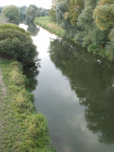
- Ipeľ
Geobox River
name = Ipeľ
map_size =
map_caption =
other_name = _hu. Ipoly
other_name1 = _de. Eipel
other_name2 =
country = Slovakia
country1 = Hungary
region =
region1 =
city =
city1 =
length = 232
length_imperial =
watershed = 5151
watershed_imperial =
discharge_location = mouth
discharge_average = 21
discharge_average_imperial =
discharge_max_month =
discharge_max = 70
discharge_max_imperial =
discharge_min_month =
discharge_min = 3
discharge_min_imperial =
discharge1_location =
discharge1_average =
discharge1_average_imperial =
source_name =
source_location =Lom nad Rimavicou
source_region = Slovakia
source_country =
source_country1 =
source_elevation =
source_elevation_imperial =
source_lat_d =
source_lat_m =
source_lat_s =
source_lat_NS =
source_long_d =
source_long_m =
source_long_s =
source_long_EW =
mouth_name = Danube River
mouth_location =Chľaba /Szob
mouth_country =
mouth_region =
mouth_country1 =
mouth_elevation =
mouth_elevation_imperial =
mouth_lat_d =
mouth_lat_m =
mouth_lat_s =
mouth_lat_NS =
mouth_long_d =
mouth_long_m =
mouth_long_s =
mouth_long_EW =
tributary_left =
tributary_left1 =
tributary_right =
tributary_right1 =

image_size =
image_caption = Ipeľ river nearŠahy Ipeľ or archaic Jupoľ (Slovak, Hungarian: Ipoly, German: "Eipel") is a 232 km long
river inSlovakia andHungary , tributary to the riverDanube . Its source is in centralSlovakia in theSlovenské rudohorie Mountains. It flows south to the Hungarian border, and then southwest, west and again south along the border until it flows into the Danube nearSzob .Ipeľ flows through or makes border of Banská Bystrica and Nitra regions in Slovakia, and Nógrád and Pest counties in Hungary.
Towns and villages
*
Poltár (SK)
*Kalinovo (SK)
*Boľkovce (SK)
* Litke (HU)
*Szécsény (HU)
*Balassagyarmat (HU)
*Šahy (SK)
*Salka (SK)
*Szob (HU)
Wikimedia Foundation. 2010.
