- Mayaguana Airport
-
Mayaguana Airport IATA: MYG – ICAO: MYMM Summary Location Mayaguana Elevation AMSL 11 ft / 3 m Coordinates 22°22′46″N 073°00′49″W / 22.37944°N 73.01361°WCoordinates: 22°22′46″N 073°00′49″W / 22.37944°N 73.01361°W Map Location in The Bahamas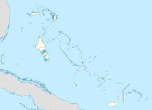
 MYMM
MYMMRunways Direction Length Surface m ft 06/24 2,224 7,297 Asphalt Source: DAFIF[1] Mayaguana Airport (IATA: MYG, ICAO: MYMM) is an airport in Mayaguana in the Bahamas.
Airlines and destinations
Airlines Destinations Bahamasair Inagua, Nassau References
- ^ Airport information for MYMM at World Aero Data. Data current as of October 2006.Source: DAFIF.
Categories:- Airports in the Bahamas
- North American airport stubs
- Bahamas geography stubs

Wikimedia Foundation. 2010.