- San Andrés, San Andrés y Providencia
Infobox Islands
name = San Andrés
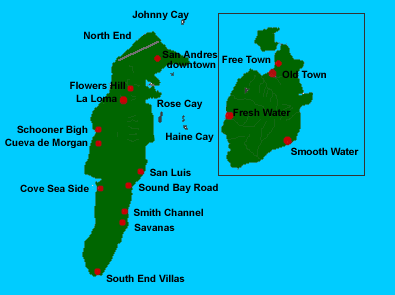
image caption = San Andrés and Providencia Islands
image size =
locator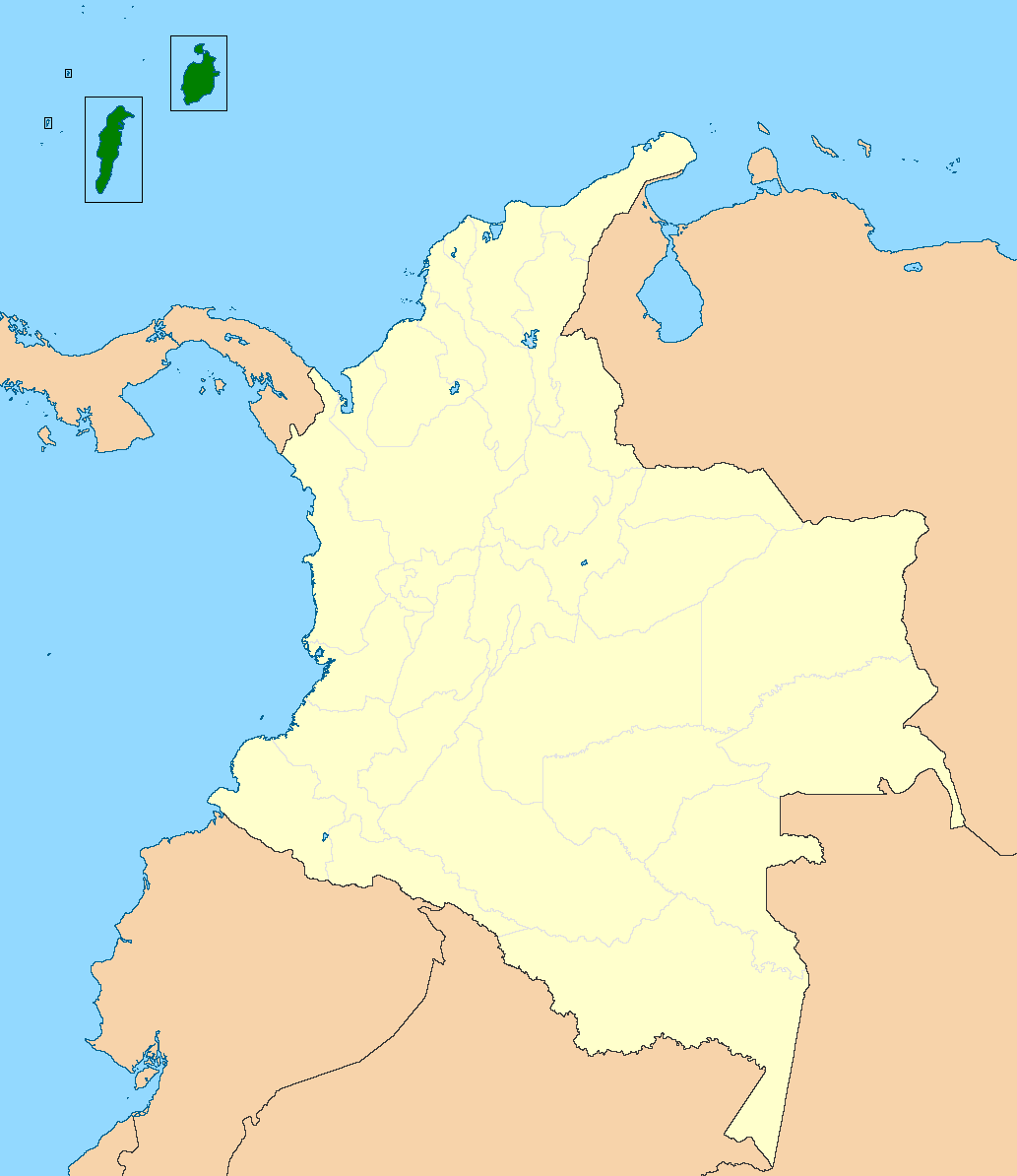
map_custom = no
native name = Isla de San Andrés
native name link = Spanish language
nickname =
location =Caribbean Sea
coordinates = coord|12|33|N|81|43|W|display=inline
archipelago =
total islands =
major islands = San Andres
area =
length =
width =
highest mount =
elevation =
country = Colombia
country admin divisions title = Department
country admin divisions =San Andrés y Providencia
country admin divisions title 1 =
country admin divisions 1 =
country admin divisions title 2 =
country admin divisions 2 =
country largest city =
country largest city population =
population = 100,000
population as of =
density =
ethnic groups = 20%Raizal s and 80% mainland Colombians
additional info =San Andrés is the capital of the
Colombia n department ofSan Andrés y Providencia . It is situated at the north end of San Andrés Island. The population is considered to be about 20%Raizal s and 80% mainland Colombians. It’s known as the 7 colors sea, because you can see that the water has several tones of green, blue and turquoises among others.This Island is dedicated mainly to the tourism and commercial fishing.The economy is mainly sustained by the tourism and the commercial fishing, the touristic points are: The Blowhole The aquarium Johnny Kay The commercial area and plaza. San Luis The natural poolMain activities for the tourist are Snorkeling Diving Feed the fishes from your hands at the natural pool and the aquarium Swim with the sea rays. The crystal bottom vessels Take the sun, it’s awesome so hot you can’t imagine.
Wikimedia Foundation. 2010.