- Arrondissement of Bruges
Infobox Belgium Arrondissement
name=Bruges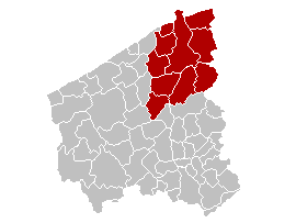
map-West Flanders
region=BE-REG-FLE
province=BE-PROV-WV
area=661.29
population=274,435
population-date=01/01/2006
municipalities=10The Arrondissement of Bruges ( _nl. Arrondissement Brugge; _fr. Arrondissement de Bruges) is one of the eight administrative arrondissements in the Province of
West Flanders ,Belgium .It is both an administrative and a judicial arrondissement. However, the Judicial Arrondissement of Bruges also comprises the municipalities of the
Arrondissement of Ostend , most of theArrondissement of Tielt (except the municipalities ofMeulebeke ,Dentergem ,Oostrozebeke andWielsbeke ), as well as the municipality ofLichtervelde (in theArrondissement of Roeselare ).History
The Arrondissement of Bruges was created in 1800 as the first
arrondissement in the Department of Lys ( _nl. Departement Leie). It originally comprised the cantons ofArdooie ,Bruges ,Gistel ,Ostend ,Ruiselede ,Tielt andTorhout . In 1818, the arrondissements of Ostend, Roeselare, Tielt and Torhout were created. This resulted in the arrondissement losing more than half of its territory.The Arrondissement of Torhout already ceased to exist in 1823 and the canton of Torhout was added to the Arrondissement of Bruges again. As a result of the merger of the municipalities of 1977, the village of
Wijnendale (which was added toTorhout and was part ofIchtegem prior to that) was added to the arrondissement from theArrondissement of Ostend and the then municipality of Wenduine (which was merged into De Haan) was ceded to the Arrondissement of Ostend.Municipalities
The Administrative Arrondissement of Bruges consists of the following municipalities:
*Beernem
*Blankenberge
*Bruges
*Damme
*Jabbeke
*Knokke-Heist
*Oostkamp
*Torhout
*Zedelgem
*Zuienkerke

Wikimedia Foundation. 2010.