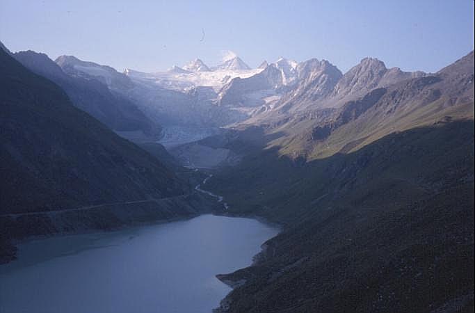
Lac de Moiry

Lac de Moiry
Lac de Moiry
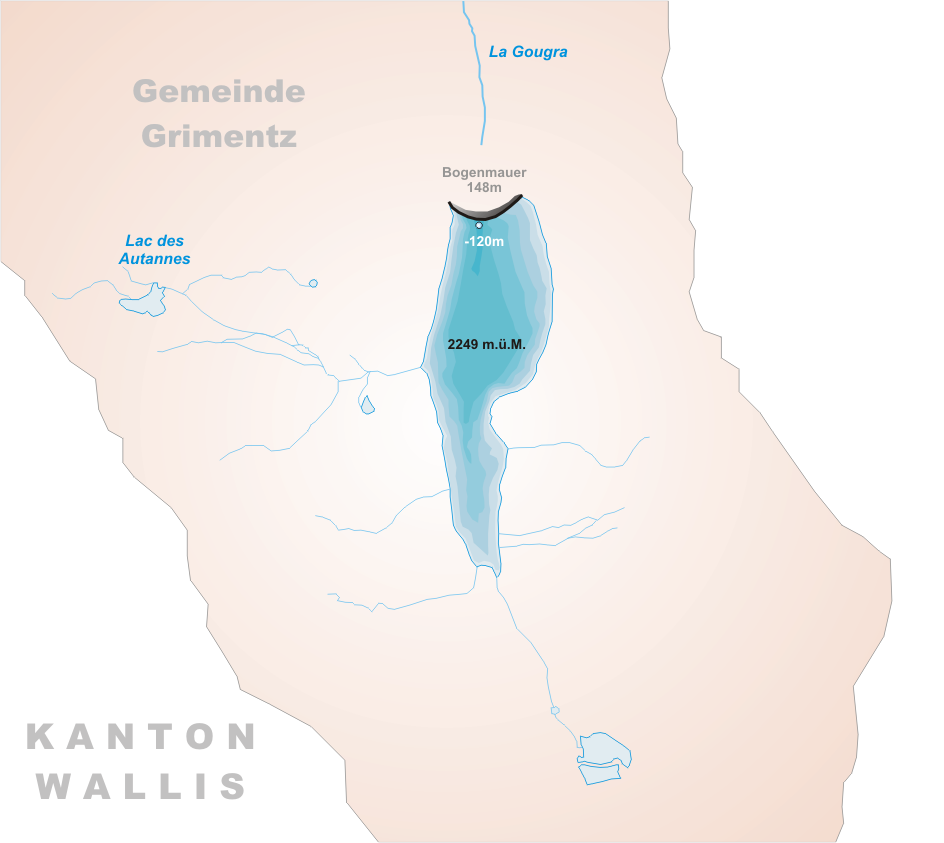
Location Grimentz, Valais
Coordinates 46°7′49″N 7°34′14″E / 46.13028°N 7.57056°E / 46.13028; 7.57056Coordinates: 46°7′49″N 7°34′14″E / 46.13028°N 7.57056°E / 46.13028; 7.57056
Primary outflows Gougra
Basin countries Switzerland
Surface area 1.40 km²
Max. depth 120 m
Water volume 78 mio m³
Surface elevation 2249 m
Map of the lake

Lac de Moiry is a reservoir in the municipality of Grimentz, Switzerland. The lake has a surface area of 1.40 km² and an elevation of 2,249 m. The maximum depth is 120 m.

The dam is 148 m high and was completed in 1958.

Media related to Lac de Moiry at Wikimedia Commons


External links


Wikimedia Foundation. 2010.

Игры ⚽ Нужна курсовая?

Look at other dictionaries:

  • Lac de Moiry — Daten Lage: Kanton Wallis Fläche 1.40 km² …   Deutsch Wikipedia

  • Lac de Moiry — Barrage de Moiry Pour les articles homonymes, voir Moiry. Barrage de Moiry …   Wikipédia en Français

  • Lac d'Emosson — Lac d’Emosson …   Deutsch Wikipedia

  • Lac de Brenet — Lac Brenet Daten Lage: Kanton Waadt Fläche 0.80 km² …   Deutsch Wikipedia

  • Lac de l'Hongrin — Daten Lage: Kanton Waadt Fläche 1.60 km² maximale Tiefe …   Deutsch Wikipedia

  • Lac du Vieux Emosson — Daten Lage: Kanton Wallis Fläche 0.55 km² …   Deutsch Wikipedia

  • Lac d’Emosson — Lac d’Emosson …   Deutsch Wikipedia

  • Lac Brenet — von Les Charbonnières aus Geographische Lage Kanton Waadt Abfluss (Orbe) Ort …   Deutsch Wikipedia

  • Lac des Dix — Staumauer Grande Dixence mit Stausee Lac des Dix Geographische Lage Kanton Wallis Zuflüsse diverse Bergbäche …   Deutsch Wikipedia

  • Lac d’Émosson — Daten Lage: Wallis Fläche …   Deutsch Wikipedia

Share the article and excerpts

Direct link
Do a right-click on the link above
and select “Copy Link”