- Forma Urbis Romae
-
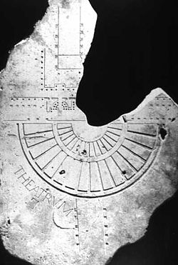
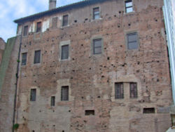
The Forma Urbis Romae or Severan Marble Plan is a massive marble map of ancient Rome, created under the emperor Septimius Severus between 203 and 211. It originally measured 18 m (60 ft) wide by 13 m (45 ft) high and was carved into 150 marble slabs mounted on an interior wall of the Temple of Peace.
Created at a scale of approximately 1 to 240, the map was detailed enough to show the floor plans of nearly every temple, bath, and insula in the central Roman city. The boundaries of the plan were decided based on the available space on the marble, instead of by geographical or political borders as modern maps usually are.
The Plan was gradually destroyed during the Middle Ages, with the marble stones being used as building materials or for making lime. In 1562, the young antiquarian sculptor Giovanni Antonio Dosio excavated fragments of the Forma Urbis from a site near the Church of SS. Cosma e Damiano, under the direction of the humanist condottiere Torquato Conti, who had purchased excavation rights from the canons of the church. Conti made a gift of the recovered fragments to Cardinal Alessandro Farnese, who entrusted them to his librarian Onofrio Panvinio and his antiquarian Fulvio Orsini. Little interest seems to have been elicited by the marble shards.[1]
In all about 10% of the original surface area of the plan has since been recovered, in the form of over one thousand marble fragments, which are kept in the Palazzo dei Conservatori of the Capitoline Museums.
Contents
Projects
Piecing together the surviving fragments of the plan is an activity that has engrossed scholars for centuries. Renaissance scholars managed to match and identify around 250 of the pieces, usually by recognizing famous landmarks such as the Colosseum and the Circus Maximus. A research project at Stanford University in 2002 had some success in reassembling the fragments with pattern recognition algorithms.
See also
- Topography of ancient Rome
Notes
- ^ Rodolfo Lanciani, Storia delle scavi a Roma (Rome) 1903, II, pp 169ff, 208ff.
References
- Henric Jordan Forma Urbis Romae. Regionum XIIII (Berlin, 1874)
- Carettoni, Gianfilippo; Colini, Antonio; Cozza, Lucos; and Gatti, Guglielmo, eds. La pianta marmorea di Roma antica. Forma urbis Romae (Rome, 1960)
- Tucci, Pier Luigi, ‘New fragments of ancient plans of Rome’, Journal of Roman Archaeology 20 (2007) 469-480
External links
- Stanford Digital Forma Urbis Romae Project
- BBC news
- Rodolfo Lanciani, Forma Urbis Romae 1893-1901 Lanciani's own unsurpassed map of ancient Rome, printed in 46 separate plates
Categories:- Topography of ancient Rome
- Maps of Ancient Rome
Wikimedia Foundation. 2010.


