Melksham Without

Melksham Without

Coordinates: 51°22′16″N 2°08′20″W / 51.371°N 2.139°W / 51.371; -2.139

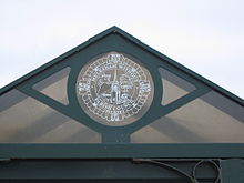
Melksham Without parish council logo on a bus stop near Berryfield
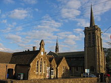
Although Shaw is a small village, it has a church and a primary school

Melksham Without is a civil parish in the English county of Wiltshire. It surrounds, but does not include, the town of Melksham and is the largest rural parish in Wiltshire, with a population of 6226 (as of 2001)[1] and an area of 29 square kilometres (7,200 acres).

The parish includes the communities of Beanacre, Berryfield, Bowerhill, Sandridge, Shaw, Whitley and The Spa.

Unusually the parish shares some land in common with the parish of Broughton Gifford. The parish council operates from an office in Melksham.

Contents

See also

References

External links

External links

Media related to Melksham Without at Wikimedia Commons


Wikimedia Foundation. 2010.

Игры ⚽ Нужно сделать НИР?

Look at other dictionaries:

  • Melksham — Coordinates: 51°22′25″N 2°08′16″W / 51.373553°N 2.137898°W / 51.373553; 2.137898 …   Wikipedia

  • Chippenham (UK Parliament constituency) — Chippenham County constituency for the House of Commons Boundary of Chippenham in Wiltshire for the 2010 general election …   Wikipedia

  • West Wiltshire — is a local government district in Wiltshire, England and was formed on 1 April, 1974, further to the Local Government Act 1972, as a merger of the former urban districts of Bradford on Avon, Melksham, Trowbridge, Warminster and Westbury, along… …   Wikipedia

  • Bowerhill — infobox UK place country=England static static image caption=Falcon Way latitude=51.36 longitude= 02.12 official name=Bowerhill population= shire district= shire county=Wiltshire region=South West England constituency westminster= post… …   Wikipedia

  • List of civil parishes in Wiltshire — This is a list of civil parishes in Wiltshire, England.Kennet*Aldbourne *All Cannings *Alton *Avebury *Baydon *Beechingstoke *Berwick Bassett *Bishops Cannings *Broad Hinton *Bromham *Burbage *Buttermere *Charlton *Cheverell Magna *Cheverell… …   Wikipedia

  • Shaw, Wiltshire — infobox UK place country = England static static image caption=Christ Church at Shaw latitude= 51.39 longitude= 02.16 civil parish=Melksham Without official name=Shaw population= shire district= shire county=Wiltshire region=South West England… …   Wikipedia

  • Berryfield — infobox UK place country=England static static image caption=Semington Road latitude=51.36 longitude= 02.15 official name=Berryfield population= shire district= shire county=Wiltshire region=South West England constituency westminster= post… …   Wikipedia

  • Redstocks — infobox UK place country = England static static image caption=Main road latitude= 51.36 longitude= 02.10 official name=Redstocks population= shire district= shire county=Wiltshire metropolitan borough= metropolitan county= region=South West… …   Wikipedia

  • Sandridge, Wiltshire — infobox UK place country=England static static image caption=Forest Sandridge Church of England School latitude=51.38 longitude= 02.10 official name=Sandridge population= shire district= shire county=Wiltshire region=South West England… …   Wikipedia

  • Beanacre — infobox UK place country=England static static image caption=Church of St. Barnabas latitude=51.40 longitude= 02.14 official name=Beanacre population= shire district= shire county=Wiltshire region=South West England constituency westminster= post …   Wikipedia

Share the article and excerpts

Direct link
Do a right-click on the link above
and select “Copy Link”