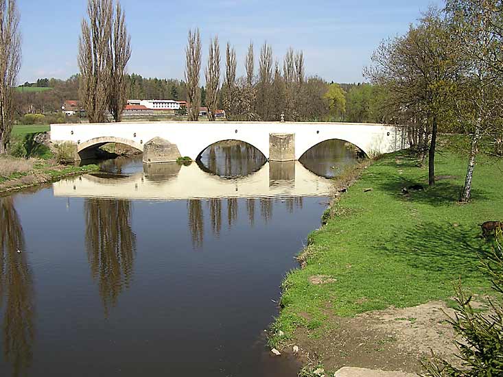
- Radbuza
Geobox River
name = Radbuza
native_name =
other_name =
other_name1 =

image_size =
image_caption = Radbuza in Dobřany
country = Czech Republic
country1 =
state =
state1 =
region =
region1 =
district =
district1 =
city =
city1 =
length = 112
watershed = 2179
discharge_location =
discharge_average = 11
discharge_max =
discharge_min =
discharge1_location =
discharge1_average =
source_name =
source_location = Český les
source_lat_d = 49
source_lat_m = 29
source_lat_s = 13
source_lat_NS = N
source_long_d = 12
source_long_m = 39
source_long_s = 58
source_long_EW = E
source_elevation = 869
source_length =
mouth_name = Mže
mouth_location =Pilsen
mouth_lat_d =
mouth_lat_m =
mouth_lat_s =
mouth_lat_NS =
mouth_long_d =
mouth_long_m =
mouth_long_s =
mouth_long_EW =
mouth_elevation =
tributary_left =
tributary_left1 =
tributary_right = Úhlava
tributary_right1 =
free_name =
free_value =
map_size =
map_caption =The Radbuza (IPA2|ˈradbʊza; German: "Radbusa") is a 112 km long river in the
Czech Republic , the right tributary of theMže . Its source is situated at the foot of Lysá mountain (869 metres) near the village of Závist, nearDomažlice . It passes through the villages and towns ofRybník , Smolov, Bělá nad Radbuzou,Horšovský Týn , Staňkov,Holýšov , Stod, Chotěšov, Zbůch and Dobřany before flowing into the riverMže inPlzeň . Its major tributaries are Zubřina, Merklinka andÚhlava . The basin area of the Radbuza is 2,179 km².Gallery of the Radbuza

Rybník .
Mže inPilsen .
Pilsen during the floods in 2002
Pilsen during the floods in 2002.
Wikimedia Foundation. 2010.
