- Úhlava
Infobox River
river_name = Úhlava
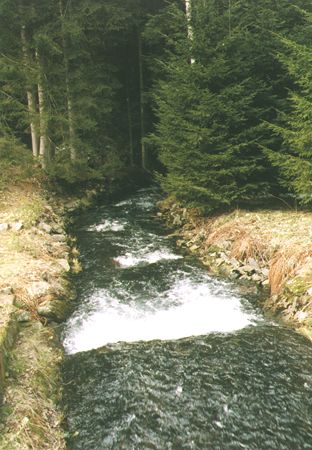
caption = Úhlava in theŠumava mountains
origin =Šumava
mouth =Radbuza
basin_countries =Czech Republic
length = 108 km
elevation = 1,110 metres
discharge =
watershed = 919 km²The Úhlava ( _de. Angel) is a 108 km long river in the
Czech Republic , right tributary of theRadbuza . Its source is situated at the slope ofPancíř mountain (1,214 metres) in theŠumava mountains, Klatovy District. It passes villages and townsNýrsko ,Janovice ,Bezděkov ,Klatovy ,Švihov ,Lužany , andPřeštice before flowing into the riverRadbuza inPlzeň . Its major affluents isChodská Úhlava . The basin area of the Radbuza is 919 km².
Wikimedia Foundation. 2010.