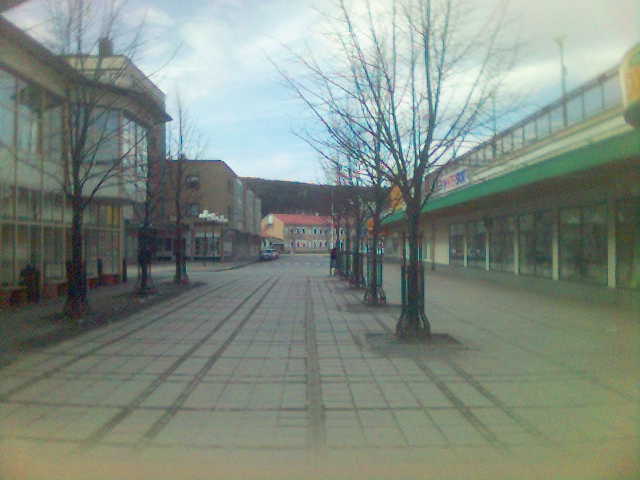
- Kramfors
Infobox Settlement
official_name = Kramfors
image_caption = Kramfors
pushpin_
subdivision_type = Country
subdivision_name =Sweden
subdivision_type1 = Municipality
subdivision_name1 =Kramfors Municipality
subdivision_type2 = County
subdivision_name2 =Västernorrland County
subdivision_type3 = Province
subdivision_name3 =Ångermanland
area_footnotes = cite web |title=Tätorternas landareal, folkmängd och invånare per km2 2000 och 2005 |publisher=Statistics Sweden |url=http://www.scb.se/statistik/MI/MI0810/2005A01B/T%E4torternami0810tab1.xls |format=xls |language=Swedish |accessdate=2008-05-15]
area_total_km2 = 7.38
population_as_of = 2005-12-31
population_footnotes =
population_total = 6,235
population_density_km2 = 845
timezone = CET
utc_offset = +1
timezone_DST = CEST
utc_offset_DST = +2
latd=62 |latm=56 |lats= |latNS=N
longd=17 |longm=48 |longs= |longEW=E
website =Kramfors is a town (pop. 6,300) in
Ångermanland ,Sweden and the seat ofKramfors Municipality ,Västernorrland County .Geographically the town is situated on the western shore of the
Ångerman River . This river was the reason that Kramfors was founded, because in the 19th century it was a main transportation line for lumber poles, and along it sawmills andpulp mill s sprung up. Christopher Kramm chose to locate the river's first steam driver saw at this location, and then named it after himself.The municipality of Kramfors has about 20,000 inhabitants and it is situated almost in the middle of Sweden with the most central location of Northern Sweden. Within 100 kilometres from Kramfors you can reach 250,000 people and within 200 kilometres about half a million. It is not possible to reach so many people from any other place in Northern Sweden. Furthermore, the two big Norrland towns Sundsvall and Umeå are situated within a commuting distance.
Kramfors is well known for it's beautiful landscape. Especially the High Coast area with World Heritage-status, it has a varying landscape which affords many opportunities for a full outdoor life.
This settlement, called Kramfors, was in Gudmundrå municipality, but got in 1889 the status of a so called "municipalsamhälle" (which was a kind of
borough , still remaining part of the original municipality). In 1947 it was awarded the title of a city, as one of the last in the country. Since the municipal reform, in 1974, it is the seat of Kramfors Municipality. Kramfors is, despite its small population, for historical reasons, however, normally still referred to as a "city".Statistics Sweden , however, only counts localities with more than 10,000 inhabitants as cities.In the 1960s and 70's, the industry were in recession. Today, Kramfors's population is in a steady decline.
In Kramfors is one of the
tennis high school of Sweden situatied.Kramfors also hosts the Folke Bernadotte Academy, a government agency focused on improving international conflict and crisis management, with a special interest in peace operations. They offer courses in peacekeeping intelligence and information operations that is open to all nations and to non-governmental organizations.
References
Wikimedia Foundation. 2010.

