- Alligator Alley
Infobox road
marker_
highway_name=Alligator Alley
alternate_name=Everglades Parkway
maint=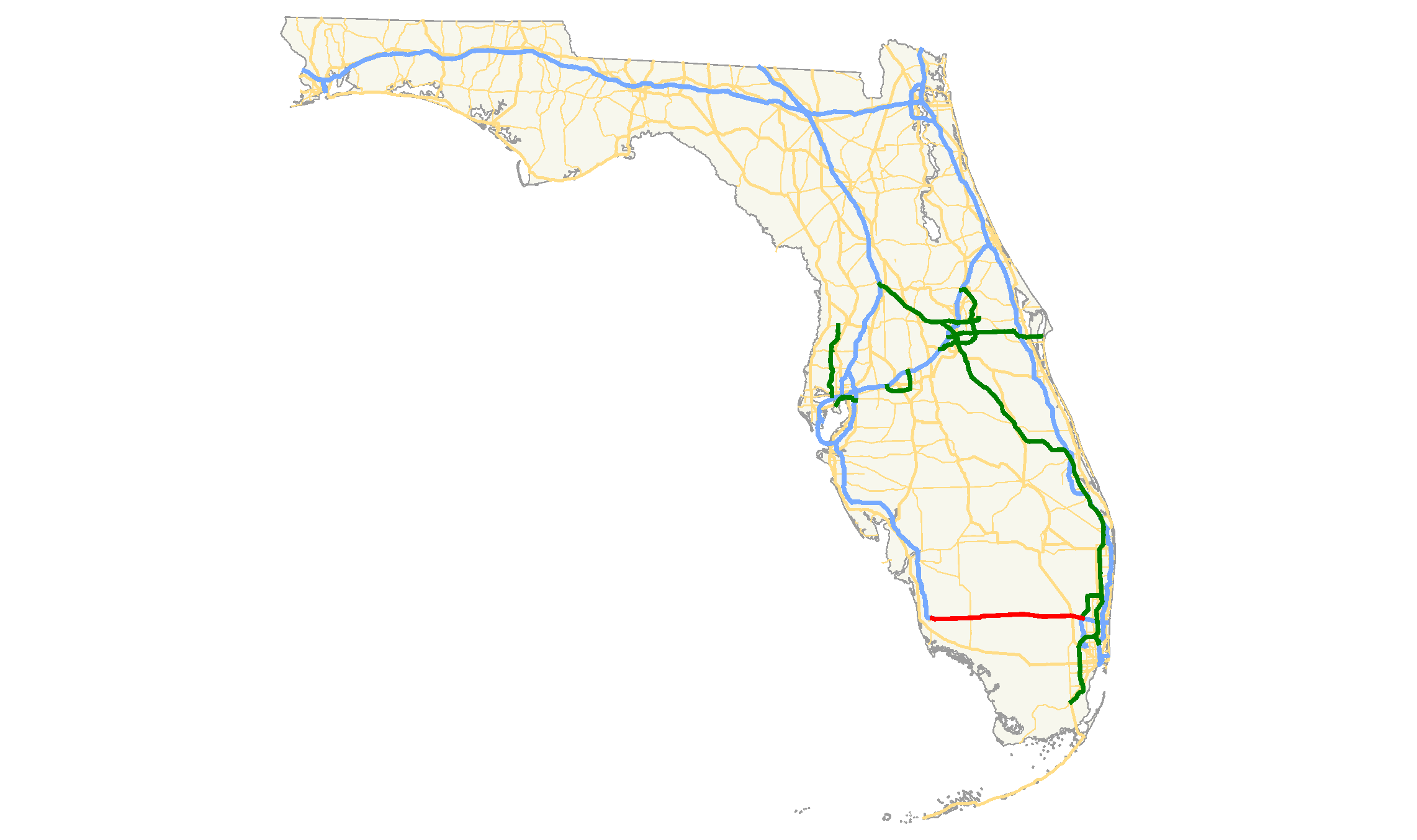
length_mi=84.28
length_round=2
length_ref=cite web|url=http://www.fhwa.dot.gov/planning/nhpn/|title=National Highway Planning Network GIS data|publisher=FHWA|date=version 2005.08|accessdate=2007-07-09]
established=1969
direction_a=West
starting_terminus=
junction=
direction_b=East
ending_terminus=Alligator Alley (also known as Everglades Parkway [cite web|url=http://www.naples.net/history/aalley.htm|accessmonthday=3 July |accessyear=2006|title=Alligator Alley Story] ) is a section of Interstate 75 (State Road 93) and State Road 84 extending from Naples on the west coast of
Florida to Weston on the east. First opened in 1969, [cite web|url=http://web.archive.org/web/20041108120658/www.southfloridaroads.com/94.html|accessmonthday=3 July |accessyear=2006|title=South Florida Roads] most of the highway traverses theEverglades .The name was given by the
American Automobile Association during planning; they believed it would be a useless road, an "alley foralligator s." However, since alligators often frequent the waterways beside the road, the nickname has a somewhat literal meaning.History
It was originally built as a toll
two-lane freeway connecting the two coasts of Florida, and was later connected to Interstate 75 as an east-west continuation of thehighway , which otherwise ran north and south. It is still a toll road, with automobile drivers paying $2.50 when traveling west on the road. Before the completion of its re-engineering, Alligator Alley was signed as State Road 84. It is now I-75, but it still has a concurrency with SR 84; I-75 and SR 84 split again in Naples. Today, Alligator Alley is one of only two sections of Interstate 75 that has a toll. The other tolled section is theMackinac Bridge in NorthernMichigan .Between 1986 and 1992 it was widened to four lanes, with many bridges designed to let water and wildlife pass underneath. This helped to reduce the environmental impact of the highway somewhat, especially upon the severely endangered
Florida panther , as well as reducing the danger of the highway, which is notorious for high-speed accidents.Rest Areas
*Broward County Rest Area half-way between Exits 23 & 49
*Collier County Rest Area half-way between Exits 49 & 80References
Wikimedia Foundation. 2010.