- Parsley Hay railway station
Parsley Hay railway station was located at gbmapping|SK146637 in Parsley Hay, a hamlet about 15 km south east of
Buxton ,Derbyshire , on theLNWR line toAshbourne . The nearest large settlement is the village ofHartington .It was originally built on the
Cromford and High Peak Railway (which ran fromWhaley Bridge toCromford ) when it was extended toBuxton in 1894 by the LNWR which had acquired it. In 1899 the LNWR built a junction just south of the station for a line to Ashbourne.In common with the other stations on this line, the platforms and buildings were of timber construction. From this point on to Ashbourne the line was single with passing loops at the stations, though provision was made for doubling which never occurred.
In contrast to the first part of the line from Buxton, from the previous station at Hurdlow the line had dropped gently and this continued to the next at Hartington, though the curves involved limited the linespeed to 40 mph.
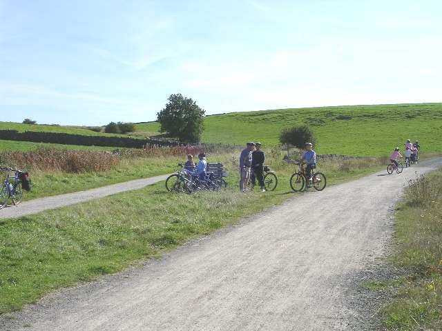
thumb|The meeting of the Tissington & High Peak Trails at Parsley Hay.The station closed in October, 1963 while the line southwards closed in October, 1967 with that to Hindlow following in November.Today these two disused trackbeds form the route of two walking and cycling routes. The
High Peak Trail follows the old Cromford and High Peak.The track bed from Ashbourne to Parsley Hay was acquired by
Derbyshire County Council and thePeak National Park to become theTissington Trail which was one of the first of such ventures in the country. Later, Ashbourne Tunnel was acquired bySustrans . Parsley Hay, being located at the junction of these walk/cycleways, is ideally located for a cycle hire centre (run by the Park Authority).The trackbed at this point is also part of the
Pennine Bridleway , a 130-mile leisure route which includes 73 miles through Derbyshire.ee also
*
Cromford and High Peak Railway External links
* [http://www.peakdistrict.gov.uk/hptt/ Tissington & High Peak Trails - access and facilities]
* [http://www.ramblers.org.uk/info/paths/penninebridleway.html The Pennine Bridleway]
* [http://www.geograph.org.uk/gridref/SK1463 Images at geograph]
Wikimedia Foundation. 2010.