- Miłosław
-
Miłosław 
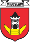
Coat of armsCoordinates: 52°12′24″N 17°28′59″E / 52.20667°N 17.48306°E Country  Poland
Voivodeship Greater Poland County Września Gmina Miłosław Area – Total 4.07 km2 (1.6 sq mi) Population (2006) – Total 3,589 – Density 881.8/km2 (2,283.9/sq mi) Postal code 62-320 Website http://www.ug.miloslaw.info Miłosław [miˈwɔswaf] is a town in Września County, Greater Poland Voivodeship, Poland, with 3,872 inhabitants (2007).
A battle between Prussian and Polish forces took place here during the 1848 uprising in Prussian Poland.
Town and seat Miłosław
Villages Bagatelka • Białe Piątkowo • Biechówko • Biechowo • Bugaj • Chlebowo • Chrustowo • Czeszewo • Czeszewo-Budy • Franulka • Gorzyce • Kębłowo • Kozubiec • Książno • Lipie • Mikuszewo • Nowa Wieś Podgórna • Pałczyn • Rudki • Skotniki • SzczodrzejewoCoordinates: 52°12′24″N 17°28′59″E / 52.20667°N 17.48306°E
Categories:- Greater Poland geography stubs
- Cities and towns in Greater Poland Voivodeship
- Września County
Wikimedia Foundation. 2010.

