- Cox's Bazar Airport
-
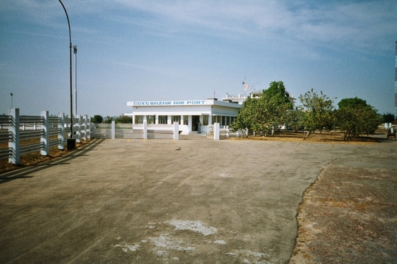
Cox's Bazar Airport 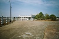
IATA: CXB – ICAO: VGCB Location of airport in Bangladesh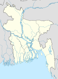
 CXB
CXBSummary Airport type Public Operator Civil Aviation Authority of Bangladesh Location Cox's Bazar Elevation AMSL 12 ft / 4 m Coordinates 21°27′07″N 091°57′50″E / 21.45194°N 91.96389°ECoordinates: 21°27′07″N 091°57′50″E / 21.45194°N 91.96389°E Runways Direction Length Surface ft m 17/35 6,790 2,070 Asphalt Cox's Bazar Airport (IATA: CXB, ICAO: VGCB) is an airport in Cox's Bazar, Bangladesh.
Airlines and destinations
Airlines Destinations Biman Bangladesh Airlines Dhaka, Chittagong GMG Airlines Chittagong, Dhaka United Airways Dhaka Regent Airways Dhaka, Chittagong External links
- Airport information for VGCB at World Aero Data. Data current as of October 2006.
- Civil Aviation Authority of Bangladesh: Airports
 Airports in Bangladesh
International Shahjalal International Airport, Dhaka (DAC) · Shah Amanat International Airport, Chittagong (CGP) · Osmani International Airport, Sylhet (ZYL)Domestic Jessore Airport, Jessore (JSR) · Cox's Bazar Airport, Cox's Bazar (CXB) · Barisal Airport, Barisal (BZL) · Shah Makhdum Airport, Rajshahi (RJH) · Saidpur Airport, Saidpur (SPD) · Khan Jahan Ali Airport, Bagerhat (under construction)STOL (Short Take-off and Landing) ports Tejgaon STOLport · Comilla STOLport · Bogra STOLport · Thakurgaon STOLport · Lalmonirhat STOLport · Shamshernagar STOLport · Ishurdi STOLportUnused Airports Sandwip Airport · Chakaria Airport · Feni Airport · Rajendrapur Airport · Maulvi Bazar Airport · Ishwardi Airport Division · Rasulpur Airport · Sirajganj Airport · Pahar Kanchanpur AirportAirport names shown in bold have scheduled passenger service on commercial airlines.
This article about transport in Bangladesh is a stub. You can help Wikipedia by expanding it.