- Kinnegad
Infobox Irish Place
name = Kinnegad
gaeilge = "Cionn Átha Gad"
crest
motto =
map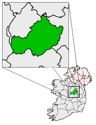
pin coords =
north coord = 53.44722
west coord = 7.108201
irish grid =
area =
elevation = 112m
province =Leinster
county =County Westmeath /County Meath
town pop = 2149
rural pop = included above
census yr = 2006
web = www.westmeathcoco.ie|Kinnegad ("Cionn Átha Gad" in Irish) is a town on the
County Westmeath /County Meath border,Ireland . It is located at the junction of the N6 and the N4 - two of Ireland's main east-west roads. It is roughly 60 km from the capital, Dublin.Construction
There has been a lot of building in the area including a new shopping centre (with only one shop in it) and new housing estates and a new 48 bedroom hotel called "The Hilamar Hotel", which sponsor the Westmeath Senior Gaelic Football Team, which is located on the main street, where the well known Harry's of Kinnegad once stood. There are also several pubs, Donnelly's, Scanlon's, Brian Coyne's, Denis Coyne's, The Phoenix and Bracken's.
t. Marys Church
Beside the "Hilamar Hotel", the Catholic Church of St.Marys is located. It is part of the Diocese of Meath, who's Bishop is Michael Smith. The Parish priests of Kinnegad are Monsignar Eamonn Marron and Father Tom Gilroy. The building used to be the tallest building in Kinnegad, until Lagan Cement was built
chool
The town has a large Catholic National School (Although children with other religions are welcome to the school), St. Etchen's Kinnegad N.S, which has just been extended with a two-storey building, with six classrooms downstairs and two large rooms for the resource teachers, to cater for the increase of population in the town over the last 10 years.
port
The main sports team in the town is the Coralstown/Kinnegad Gaelic football Club which has teams for both male and female players aged under eight right through to senior level. The colours of the team are normally red shirts and socks, and white shorts.Its clubhouse has four dressing rooms, toilets and a gym. It also got an additional three football pitches.
The town also has a soccer club, Kinnegad Juniors Athletic Football Club.
Housing Estates
There are many housing estates in kinnegad. Some of these include Heathfield, Heathfield Close, Riverside, Riverside lawns, Manorfield, Tircroghan, Cluain Craoibh, St. Etchens Court and a few more small ones.
Commuters
Kinnegad is home to many commuters originally from Dublin who have settled in Kinnegad with their families, who commute to Dublin daily via the N4 and the recently opened M4 motorway.
ee also
*List of towns and villages in Ireland
External links
* [http://www.westmeathcoco.ie/services/censusInformation/maps/General%20Census%20Data.htm Census 2006 information]
* [http://www.westmeathcoco.ie/docs/notices/0bce2d17-8a4a-4ae2-8533-d9108d9bf36d.pdf STRATEGIC DEVELOPMENT FRAMEWORK FOR THE MIDLANDS GATEWAY; General stastic & regional information]
Wikimedia Foundation. 2010.