Mbereshi

Mbereshi
Mbereshi is located in Zambia
{{{alt}}}
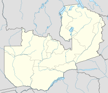
Location of Mbereshi

Mbereshi (also spelled and pronounced Mbeleshi) is a village in the Luapula Province of Zambia, named after the Mbereshi River on its north side. It was the site of a large mission founded in 1900 by the London Missionary Society. In 1915 the mission established the first girls' school in the territory, as well as a boy's school and a large hospital. These are now government institutions. Mbereshi contains a number of examples of mission buildings, including a large church which is now part of the United Church of Zambia.[1]

Mbereshi lies on the main tarred highway of the Luapula River valley running from Mansa to Nchelenge and is 10 kilometres (6.2 mi) north-east of Mwata Kazembe's town of Mwansabombwe.

References

  1. ^ Bwalya Chuba: "Mbeleshi in a history of the London Missionary Society". Pula Press, Gaborone, 2000.

Coordinates: 9°44′S 28°47′E / 9.733°S 28.783°E / -9.733; 28.783


Wikimedia Foundation. 2010.

Игры ⚽ Нужно сделать НИР?

Look at other dictionaries:

  • Mbereshi River — The Mbereshi River (also spelled and pronounced Mbeleshi ) drains the northern Zambian plateau north of Kawambwa and flows west into the Luapula valley. It enters the Luapula swamps near the Mofwe Lagoon. It gives its name to the village and… …   Wikipedia

  • Kazembe — This article is about the Kazembe kings and chiefs. For Kazembe town, see Kazembe (Mwansabombwe). Mwata Kazembe XVII Paul Kanyembo Lutaba in 1961 For more than 250 years Kazembe has been an influential kingdom or chieftainship of the Kiluba… …   Wikipedia

  • List of cities and towns in Zambia — Map of Zambia This is a list of cities, towns, villages and missions in Zambia. Contents 1 Cities …   Wikipedia

  • Luapula Province border dispute — This article deals mainly with a disputed area on the border of Zambia, in Luapula Province.Where it all began 1894 treatyZambia s formal northern frontier boundary was legally signed in the Anglo Belgian Treaty of 1894, long after the 1884… …   Wikipedia

  • Luapula River — The Luapula River is a section of Africa s second longest river, the Congo. It is a transnational river forming for nearly all its length part of the border between Zambia and the DR Congo. It joins Lake Bangweulu (wholly in Zambia) to Lake Mweru …   Wikipedia

  • Chambeshi River — The Chambeshi River is the easternmost stream in red. The Chambeshi (or Chambezi) River of northeastern Zambia is the most remote headstream of the Congo River (in terms of length) and therefore considered its source. (However, in terms of volume …   Wikipedia

  • Kawambwa — is a town in the Zambian province of Luapula located on the edge of the northern Zambian plateau above the Luapula valley at an altitude of 1300 m. It was chosen as an administrative district of the same name by the British colonial authorities… …   Wikipedia

  • List of Zambia-related topics — Zambia, officially known as the Republic of Zambia (IPA2|ˈzæmbɪə), is a landlocked country in Southern Africa. The neighbouring countries are the Democratic Republic of the Congo to the north, Tanzania to the north east, Malawi to the east,… …   Wikipedia

  • Kazembe (Mwansabombwe) — This article is about the town. For the Chief, Mwata Kazembe, see Kazembe. Kazembe (Mwansabombwe) …   Wikipedia

  • Mofwe Lagoon — The Mofwe Lagoon is the largest of several lagoons in the Luapula River swamps south of Lake Mweru, in the Luapula Province of Zambia. Contents 1 Geography 2 See also 3 Sources 4 …   Wikipedia

Share the article and excerpts

Direct link
Do a right-click on the link above
and select “Copy Link”