- Dordogne River
Infobox River | river_name = Dordogne
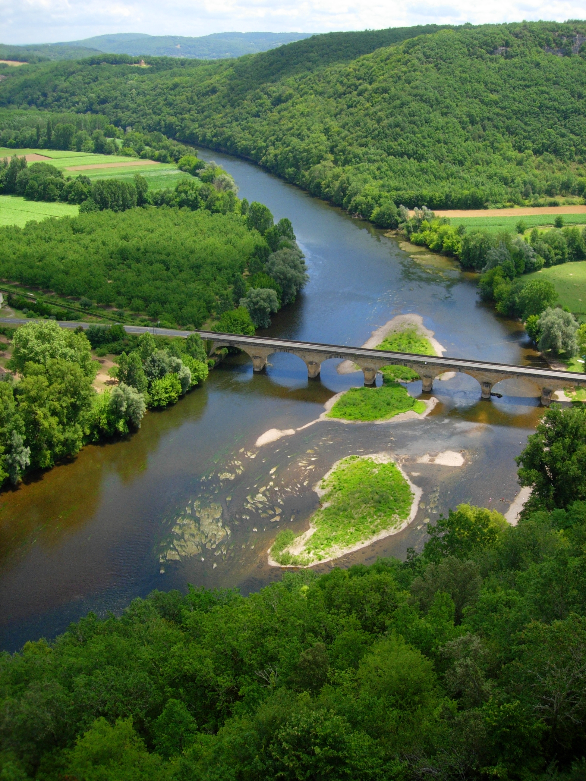
caption = The Dordogne inPérigord .
origin =Massif Central
mouth =Garonne
coord|45|2|29|N|0|36|24|W|name=Gironde-Dordogne|display=inline,title
basin_countries =France
length = 483 km
elevation = 1,720 m
discharge = 450 m³/s
watershed = 23,870 km²The Dordogne (Occitan : "Dordonha") is ariver in south-central and southwestFrance .Name
Contrary to appearances, the name of the Dordogne is not a recent word [as the
Midouze , aportmanteau that fuses the names of its two precursors, theMidou and the Douze.] resulting from the names of the "Dore" and the "Dogne". It comes from an ancient "Durānius" [Sidonius Apollinaris ] , dérived from aPre-Celtic root "dur- , dor-" (as theDurance ).The medieval forms adopted a redoubled suffix "-ononia" [influenced by the suffix "
-onna ", frequent in river names, in France.] : "Dorononia fluvius" [Gregory of Tours ] (sixth century ), "Dornonia" (eighth century ) that evolves in "Dordonia" (ninth century ) by a phenomenon ofdissimilation , giving the impression of an etymology *"Dore-Dogne".Geography
The river rises on the flanks of
Puy de Sancy (1 885 m) in the mountains of Auvergne, from the confluence of two small torrents above the town ofMont-Dore : the "Dore" [Not to be confused with the Dore.] and the "Dogne". It flows generally west about 500 km through the Limousin andPérigord regions before flowing into theGironde , its commonestuary with theGaronne , at the "Ambès beak", in the north of the city ofBordeaux .Nature
The Dordogne is one of the few rivers in the world that exhibits the phenomenon known as a
tidal bore .Fact}The Valley of the Dordogne is quite beautiful and contributes significantly to the attractiveness of the region. The main season for
tourism in the Valley of the Dordogne is from June to September with July and August being high tide.Course
The "départements" of France through which the Dordogne River runs, together with some towns in those "départements" that are on or quite near the River, are as follows:
* The "département" of
Puy-de-Dôme - the towns ofMont-Dore (near the source of the River),La Bourboule
* The "département" ofCorrèze - the towns ofArgentat andBort-les-Orgues
* The "département" of Lot - The town ofSouillac
* The "département" ofDordogne - The towns ofBeynac-et-Cazenac , Sarlat, Saint-Cyprien, and Bergerac
* The "département" ofGironde - the towns ofSainte-Foy-la-Grande andLibourne Tributaries
Main
tributaries from source to mouth:* (R)
Rhue
* (R)Diège
* (R)Luzège
* (L) Sumène
* (L) Auze
* (R)Doustre
* (L)Maronne
* (L)Cère
* (R)Sourdoire
* (L)Ouysse
* (R)Vézère along which many of the great prehistoric caves of Southwest France are located
* (R) Isle
* (L) Laurence"N.B. : (R) = right tributary; (L) = left tributary"
Activities on the River
Aside from the usual activities such as tennis and golf available in many areas of France, there are a number of water-related activities related to the Dordogne River, including:
*
Fishing , an age-old pastime for the locals and for visitors
*Canoeing andkayaking , very popular (canoes & kayaks are easy to rent)
*Boating in a "Gabare" (a traditional skiff peculiar to the Dordogne)
*Rafting
*Swimming
*Motorboating
*Sailing
* Rowing andsculling
*Waterskiing ources
* [http://fr.wikipedia.org/wiki/Dordogne_%28rivi%C3%A8re%29 Entry to the Dordogne] in "Wikipédia, l'encyclopédie libre"
* [http://www.best-of-perigord.tm.fr/ The Best of Dordogne] Guide to tourism in the Valley of the Dordogne (the Perigord)
*http://www.geoportail.fr
* [http://sandre.eaufrance.fr/app/chainage/courdo/htm/P---0000.php?cg=P---0000 The Dordogne at the Sandre database]
Wikimedia Foundation. 2010.