Oregon Route 225

Oregon Route 225

Oregon Route 225 marker

Oregon Route 225
Route information
Maintained by ODOT
Length: 2.52 mi (4.06 km)
Existed: 2002 – present
Major junctions
South end: I-5 (big).svg I-5 in Eugene
North end: OR 126.svg OR 126 Business near Springfield
Highway system

Oregon highways
Routes • Highways

OR 224 OR 226

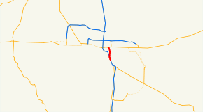
Oregon Route 225 is an Oregon state highway running from OR 126 Business near Springfield to Interstate 5 near Eugene. OR 225 is known as the McVay Highway No. 225 (see Oregon highways and routes). It is 2.52 miles (4.06 km) long and runs north–south, entirely within Lane County.

OR 225 was established in 2002 as part of Oregon's project to assign route numbers to highways that previously were not assigned, and, as of August 2008, was unsigned.

Route description

OR 225 begins at an intersection with OR 126 Business in an unincorporated area between Eugene and Springfield and heads south to an intersection with Interstate 5 in southern Eugene, where it ends.

Major intersections

Milepost City Intersection
0.01 Near Springfield OR 126 Business
2.53 Eugene Interstate 5

References


Wikimedia Foundation. 2010.

Игры ⚽ Поможем написать курсовую

Look at other dictionaries:

  • Oregon Route 99 — This article is about OR 99 south of Junction City. For the split routes north of Junction City, see Oregon Route 99E and Oregon Route 99W. For the former U.S. Route, see U.S. Route 99 in Oregon. Oregon Route 99 …   Wikipedia

  • Oregon Route 224 — For the former unsigned Highway 224, see West 7th Street West 11th Street Highway. Oregon Route 224 …   Wikipedia

  • Oregon Route 226 — For the unsigned Highway 226, see Goshen Divide Highway. Oregon Route 226 Route information …   Wikipedia

  • Oregon Trail — Oregon National Historic Trail Besonderheit: Historische Handels und Siedlungsroute des 19. Jahrhunderts über die Rocky …   Deutsch Wikipedia

  • List of highways numbered 225 — The following highways are numbered 225: Contents 1 Canada 2 China 3 Costa Rica 4 United States Canada Saskatchewan High …   Wikipedia

  • Oregon (Illinois) — Oregon Innenstadt von Oregon Lage in Illinois …   Deutsch Wikipedia

  • Oregon, Illinois — Coordinates: 42°00′52.59″N 89°19′57.13″W / 42.0146083°N 89.3325361°W / 42.0146083; 89.3325361 …   Wikipedia

  • Liste der State-, U.S.- und Interstate-Highways in Oregon — Die I 5 in der Nähe des Mount Shasta Die Liste der State, U.S. und Interstate Highways in Oregon ist eine Aufstellung von State Highways in Oregon, USA nach Art und Nummer. Das Straßennetz wird von der Highway Division der Behörde Oregon… …   Deutsch Wikipedia

  • Lake County, Oregon — Infobox U.S. County county = Lake County state = Oregon map size = 225 founded = October 24, 1874 seat = Lakeview | area total sq mi =8358 area land sq mi =8136 area water sq mi =223 area percentage = 2.66% census yr = 2000 pop = 7422 density km2 …   Wikipedia

  • Willamina, Oregon — Infobox Settlement official name = Willamina, Oregon settlement type = City nickname = motto = imagesize = image caption = image imagesize = image caption = image mapsize = 250x200px map caption = Location in Oregon mapsize1 = map caption1 =… …   Wikipedia

Share the article and excerpts

Direct link
Do a right-click on the link above
and select “Copy Link”