Duke Point, British Columbia
- Duke Point, British Columbia
-
Coordinates: 49°09′41″N 123°53′30″W / 49.161389°N 123.891792°W / 49.161389; -123.891792
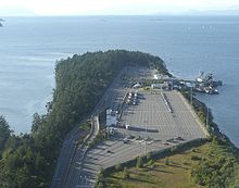
Aerial view of Ferry Terminal
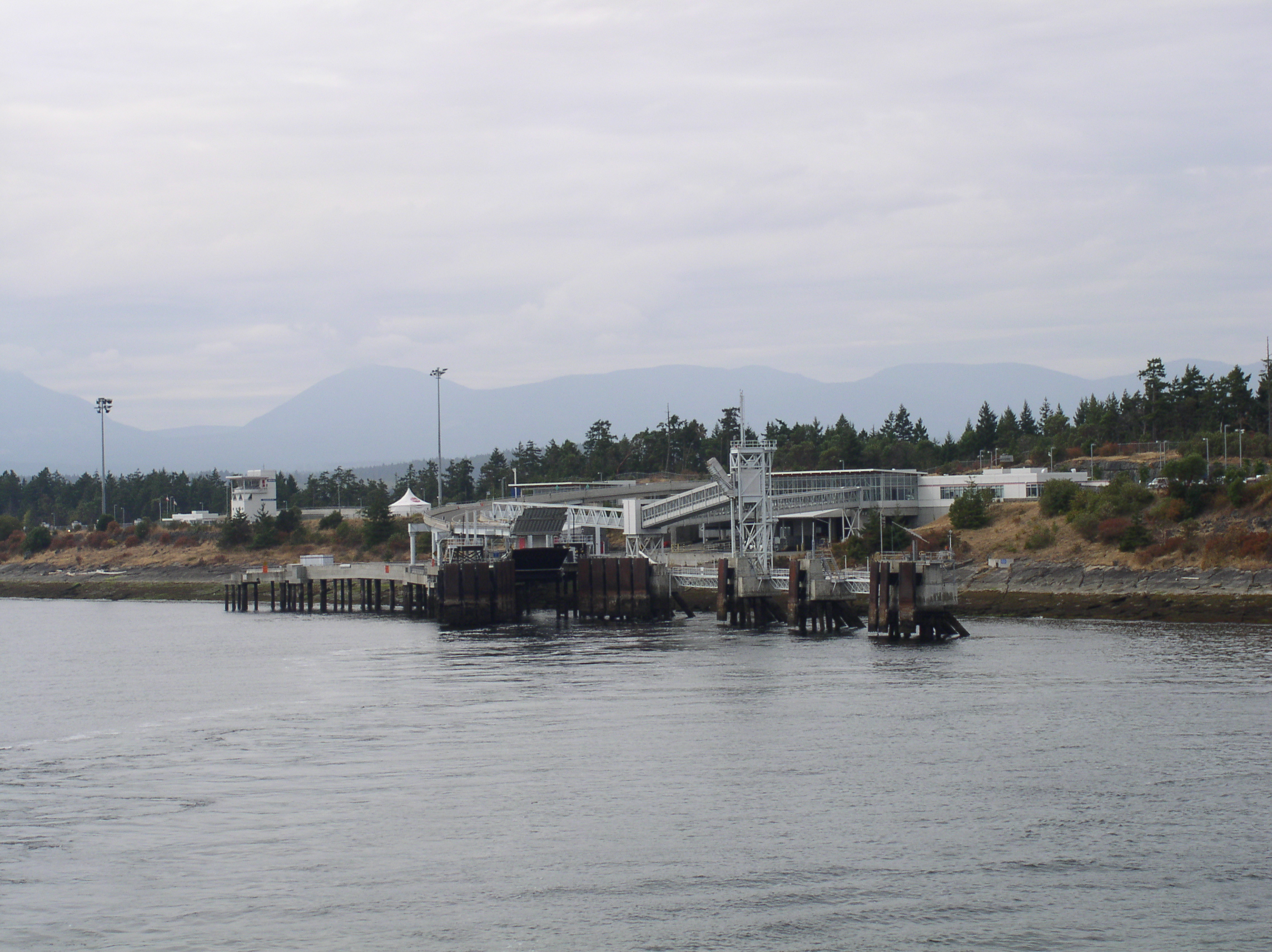
Duke Point is a geographical location in the extreme southeastern part of the city of Nanaimo in British Columbia. It is located on a thin peninsula to the east of the Nanaimo River estuary, just across the Northumberland Channel from Gabriola Island. Located at Duke Point is a major industrial park, which includes sawmills and a pulp mill. BC Ferries operates a major terminal at Duke Point, which provides access to ferry service across the Strait of Georgia to Tsawwassen. The terminal was built in 1997 to divert commercial vehicle traffic away from BC Ferries' other main Nanaimo dock, located at a point in the middle of the city known as Departure Bay, thus easing traffic jams through Nanaimo's city centre. The ferry terminal marks the southern terminus of Highway 19, which connects the terminal to the Trans-Canada Highway just south of Nanaimo's city centre.
Duke Point is the only major terminal in the BC Ferries system without direct transit bus service.[1]
References
- ^ Nanaimo Regional Transit System map
External links
Categories: - BC Ferries
- Neighbourhoods in Nanaimo
- British Columbia Coast geography stubs
Wikimedia Foundation.
2010.
Look at other dictionaries:
British Columbia Coast — Howe Sound, along British Columbia s South Coast. The British Columbia Coast or BC Coast is Canada s western continental coastline on the Pacific Ocean. The usage is synonymous with the term West Coast of Canada. In a sense excluding the urban… … Wikipedia
British Columbia Highway 1 — Infobox road state=BC type=Hwy route=1 alternate name=Trans Canada Highway length km=1039 length round=0 length ref=Fact|date=August 2007 established=1961Fact|date=August 2007 direction a=West direction b=East terminus a=Victoria junction=… … Wikipedia
British Columbia Highway 19 — Infobox road province=BC type=Hwy route=19 maint= length km= length round= length ref= established= direction a= starting terminus= junction= direction b= ending terminus= previous type=Hwy previous route=18 next type=Hwy next route=19AHighway 19 … Wikipedia
British Columbia Ferry Services — Le ferry Queen of Oak Bay de la société BC Ferries en train de quitter le terminal de Horseshoe Bay (Vancouver Ouest) British Columbia Ferry Services Inc. ou plus couramment BC Ferries est une société de droit canadien, fondée en 1960, dont l… … Wikipédia en Français
Outline of British Columbia — See also: Index of British Columbia related articles … Wikipedia
Highway 1 (British Columbia) — Der Highway 1 in British Columbia ist ein Teil des Trans Canada Highways, der Kanadas Westen mit dem Osten verbindet. Der Highway beginnt in Victoria auf Vancouver Island. Nach 124 Kilometern wird er durch eine Fährverbindung unterbrochen. Nach… … Deutsch Wikipedia
Departure Bay, British Columbia — Coordinates: 49°11′31″N 123°57′16″W / 49.192011°N 123.954556°W / 49.192011; 123.954556 … Wikipedia
Chetwynd, British Columbia — District of Chetwynd District … Wikipedia
List of British Columbia Provincial Parks — The following is a list of all British Columbia land currently managed by [http://www.env.gov.bc.ca/bcparks BC Parks] . Any parks that are closed are not currently listed.There were a number of provincial parks, protected areas and ecological… … Wikipedia
Liste der Highways in British Columbia — Folgende Highways stehen unter der Verwaltung des British Columbia Ministry of Transport.[1] Für die Highways 3, 5 und 113 existieren noch spezielle Kennzeichen, die jedoch aufgrund des Urheberrechts in der deutschen Wikipedia nicht als Symbol… … Deutsch Wikipedia
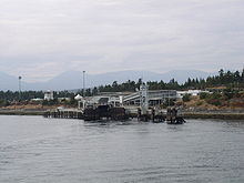 Ferry Terminal