- Texas State Highway 286
Infobox TX State Highway
type=State
route=286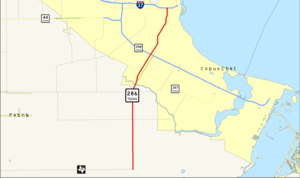
length_mi=15.209
length_ref=TxDOT|SH|286|accessdate=2008-03-11]
length_round=3
formed=1939
dir1=South
dir2=North
from=jct|state=TX|FM|70 at Chapman Ranch
junction=jct|state=TX|SH|358 at Corpus Christi
to=jct|state=TX|I|37 at Corpus Christi
previous_type=State
previous_route=285
next_type=US
next_route=287State Highway 286 or SH 286 is a Texas state highway running from downtown Corpus Christi south to Chapman Ranch. The route was designated on its current route in 1939. Before 1939, this route was known as SH 96, and was propposed to be extended to the southwest to Riviera. It is also locally known as the "Crosstown Expressway"
History
The route from Corpus Christi to Chapman Ranch was originally designated as a portion of SH 96 as early as 1933.cite map|url=http://www.tsl.state.tx.us/arc/maps/images/map6188.jpg|title=Official Map of the Highway System of Texas|publisher=
Texas State Highway Department |year=1933|accessdate=2008-03-11] The highway was redesignated to SH 286 in 1939.Route description
The route of SH 286 runs from FM 70 northward to I-37 in Corpus Christi in Nueces County. The southern terminus is located in rural Nueces County at FM 70 south of Corpus Christi. The highway heads north with intersections at FM 2444 and FM 43 before turning to the northeast and crossing Oso Creek near
Cabaniss Field Naval Air Station . SH 286 becomes a freeway south of SH 357 (Saratoga Boulevard). The freeway portion of the highway is known as the Crosstown Expressway. As the freeway heads to the northeast, it has an interchange with SH 358 (South Padre Island Drive). The freeway continues to the northeast from the interchange through downtown Corpus Christi. The freeway ends at I-37 to the west ofCorpus Christi Bay .cite map|publisher=Google Maps |title=Overview map of SH 286|accessdate=2008-03-11|url=http://maps.google.com/maps?f=d&hl=en&geocode=1932472059787309361,27.586510,-97.453830%3B7144554067830366940,27.797347,-97.409464&saddr=TX-286+%4027.586510,+-97.453830&daddr=Unknown+road+%4027.797347,+-97.409464&doflg=ptm&sll=27.69193,-97.43177&sspn=0.39094,0.543823&ie=UTF8&z=11]Junction list
The entire route is in Nueces County.
References

Wikimedia Foundation. 2010.