- Morteratsch Glacier
-
Morteratsch Glacier 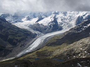
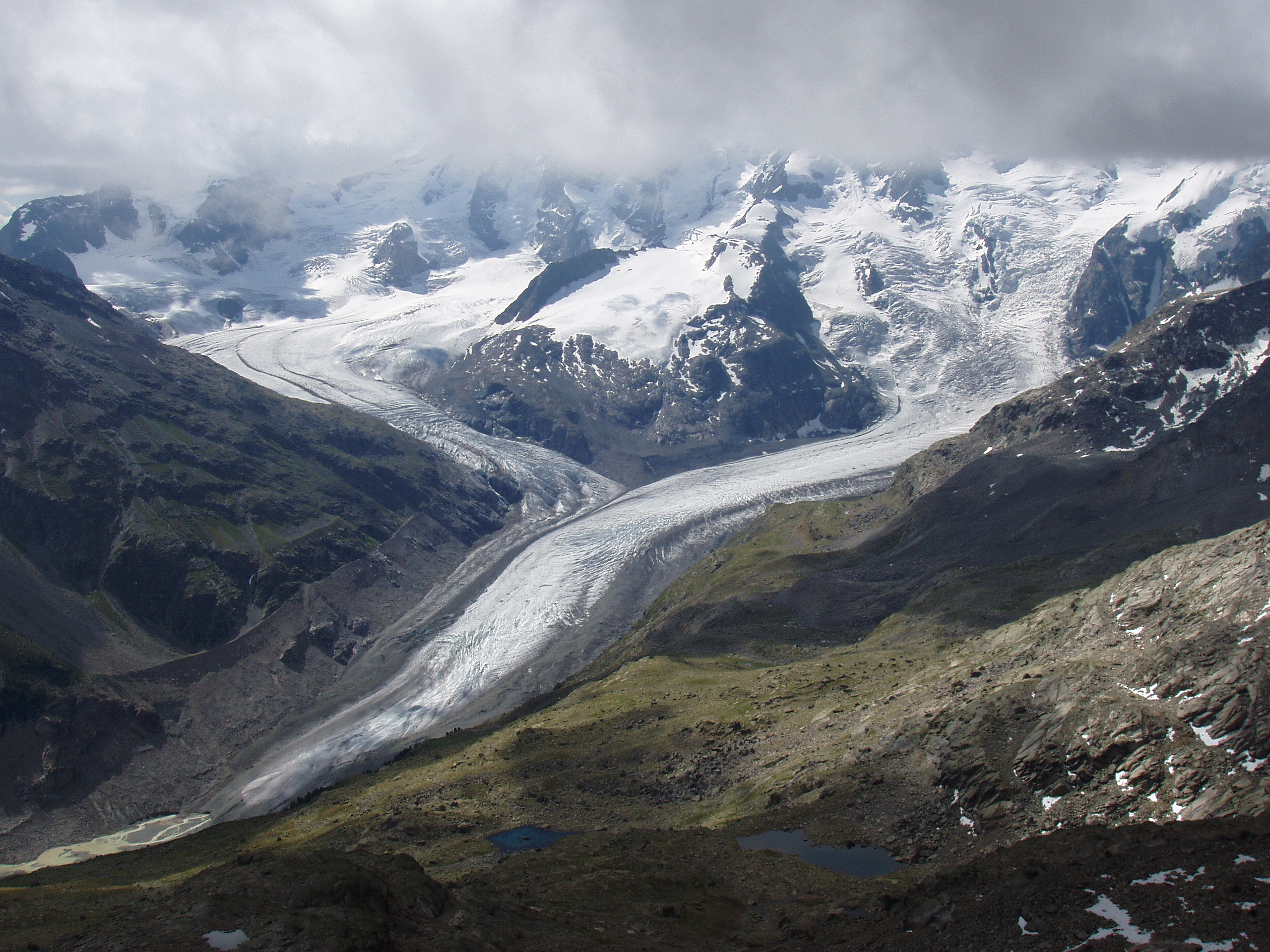
The Morteratsch (right) and Pers (left) glaciers, 2005Type Valley glacier Location Bernina Range, Switzerland Coordinates 46°24′34″N 9°55′54″E / 46.40944°N 9.93167°ECoordinates: 46°24′34″N 9°55′54″E / 46.40944°N 9.93167°E Area 16 km² (incl. Pers Glacier) Length 7 km Terminus Moraine Status Retreating The Morteratsch Glacier (romansh: Vadret da Morteratsch) is the largest glacier by area in the Bernina Range of the Bündner Alps in Switzerland.
It is, just after the Pasterze Glacier and Gepatschferner, the third largest and by volume (1.2 km³) the most massive glacier in the eastern alps. The Morteratsch Glacier is a typical valley glacier with a pronounced ice front. The accumulation zone lies between the peaks of Piz Morteratsch, Piz Bernina, Crast' Agüzza, Piz Argient, Piz Zupò and Bellavista. From Piz Argient to the ice front in the Val Morteratsch, its horizontal extent is about ~7 km (4.3 mi), with an altitude difference of up to 2,000 m (6,600 ft). Together with the Pers Glacier, originating at Piz Palü, which joins the Morteratsch just below the rock formation Isla Persa ("Lost Isle"), it covers an area of about 16 km2 (6.2 sq mi). The volume of the ice is estimated to be about 1.2 km³. The Morteratsch Glacier drains through Inn River and Danube into the Black Sea.
In spring, depending on the snow conditions, a 10-km-long ski-run accessible to skilled skiers is marked on the glacier. It leads from the Diavolezza aerial tramway terminus to the Morteratsch inn and has an altitude difference of 1,100 m (3,600 ft). The RhB Station Morteratsch used to be situated directly at the ice front of the glacier. The ice front has receded over 1,800 m (5,900 ft) in the meantime, and cannot be seen from the station today.
Yearly length change measurements have been recorded since 1878. For the period to 1998, the overall retreat was over 1.8 km (1.1 mi) with a mean annual retreat rate of approximately 17.2 m (56 ft) per year. This long-term average has markedly increased in recent years, receding 30 m (98 ft) per year from 1999–2005. Substantial retreat was ongoing through 2006 as well.[1]
During the time that measurements have been taken, the glacier has advanced a few meters in only four years. Since the large glaciers react slowly to short-term climate changes, these advances cannot be accounted for by increased precipitation in the accumulation zone. On the high moraines to the left and right of the ice front, which are still nearly free of overgrowth, the enormous quantities of ice which were still being pushed down here at the end of the "Little Ice Age" in the middle of the 19th century can be seen.
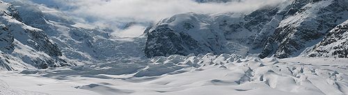 View of the Morteratsch Glacier from the ski run
External links
- Short documentary of the Schweizer Fernsehen (Swiss Television) with fascinating shots of the ice caves within the Morteratsch Glacier ("Schweiz aktuell" of 23 December 2009)
- Short documentary of the Schweizer Fernsehen (Swiss Television) about climate related changes at Morteratsch Glacier ("Schweiz aktuell" of 15 September 2010)
- Picture gallery with fascinating shots of the ice caves within the Morteratsch Glacier
See also
References
- ^ "Glaciers online: Morteratsch". Glaciers online. http://www.swisseduc.ch/glaciers/morteratsch/2005-2006/index-en.html. Retrieved 18 January 2007.
- This article incorporates information from this version of the equivalent article on the German Wikipedia.
Categories:- Bernina Range
- Engadin
- Glaciers of Switzerland
- Geography of Graubünden
- Glaciers of the Alps

Wikimedia Foundation. 2010.