- Coto 47 Airport
-
Coto 47 Airport IATA: OTR – ICAO: MRCC Summary Airport type Public Location Coto 47 Elevation AMSL 8 m / 26 ft Coordinates 08°36′N 082°58′W / 8.6°N 82.967°WCoordinates: 08°36′N 082°58′W / 8.6°N 82.967°W Map Location in Costa Rica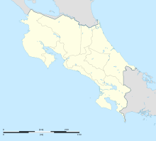
 MRCC
MRCCRunways Direction Length Surface m ft 18/36 1,000 3,281 asphalt Costa Rican AIP[1] Coto 47 Airport (IATA: OTR, ICAO: MRCC) is an airport that serves Coto 47, Costa Rica. It is located in Puntarenas province near the Panama border. The airport is accessible to locations such as Pavones, Sabalos, Neily and Playa Zancudo. A scheduled bus, the Finca 40, leaves for Neily daily, and there are also many taxis available for transport to other locations.[2]
Scheduled Service
Airlines Destinations Sansa Golfito, San Jose [via Golfito] References
Categories:- Airports in Costa Rica
- North American airport stubs
- Costa Rican building and structure stubs

Wikimedia Foundation. 2010.