List of cities in Canada

List of cities in Canada

This is a list of incorporated cities of Canada in alphabetical order categorized by province. More thorough lists of communities are available for each province.

AB
Canadian Provinces and Territories
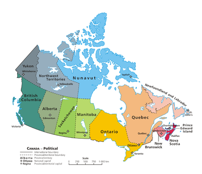
A map showing the provincial capitals and provinces of Canada

Contents

Federal, provincial and territorial capitals

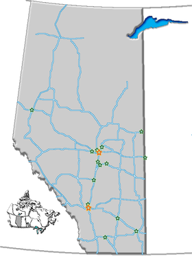
Alberta

To qualify as a city in Alberta, a sufficient population size (10,000 people or more) must be present and a majority of the buildings must be on parcels of land smaller than &100000000000018500000001,850 square metres.[1] A community is not always incorporated as a city even if it meets these requirements. The urban service areas of Fort McMurray and Sherwood Park are hamlets recognized as equivalents of cities, but remain unincorporated. Nine towns are also eligible for city status but remain incorporated as towns.

City Area
(km²)
Population
(2006)
Density
(/km²)
Location Remarks
Airdrie 33.10 &1000000000002892700000028,927 &10000000000000874000000874 51°17′30″N 114°00′51″W / 51.29173°N 114.0143°W / 51.29173; -114.0143 (Airdrie) Part of Calgary Region
Brooks 17.70 &1000000000001249800000012,498 &10000000000000706000000706 50°33′50″N 111°53′56″W / 50.56402°N 111.8988°W / 50.56402; -111.8988 (Brooks)
Calgary 726.50 &10000000000988193000000988,193 &100000000000013600000001,360 51°02′42″N 114°03′26″W / 51.04510°N 114.0571°W / 51.04510; -114.0571 (Calgary) Largest city in Alberta
Part of Calgary Region
Camrose 31.14 &1000000000001562000000015,620 &10000000000000502000000502 53°01′22″N 112°49′42″W / 53.02285°N 112.8282°W / 53.02285; -112.8282 (Camrose)
Cold Lake 59.30 &1000000000001159500000011,595 &10000000000000202000000202 54°27′51″N 110°10′57″W / 54.46417°N 110.1825°W / 54.46417; -110.1825 (Cold Lake)
Edmonton 684.37 &10000000000730372000000730,372 &100000000000010670000001,067 53°32′44″N 113°29′24″W / 53.54543°N 113.4901°W / 53.54543; -113.4901 (Edmonton) Capital of Alberta
Part of Edmonton Capital Region
Fort Saskatchewan 48.12 &1000000000001495700000014,957 &10000000000000311000000311 53°42′46″N 113°12′47″W / 53.71276°N 113.2131°W / 53.71276; -113.2131 (Fort Saskatchewan) Part of Edmonton Capital Region
Grande Prairie 61.08 &1000000000004707600000047,076 &10000000000000771000000771 55°10′12″N 118°47′52″W / 55.16995°N 118.7979°W / 55.16995; -118.7979 (Grande Prairie)
Lacombe 18.24 &1000000000001074200000010,742 &10000000000000643000000643 52°28′06″N 113°44′13″W / 52.46833°N 113.7369°W / 52.46833; -113.7369 (Lacombe) Smallest city in Alberta
Leduc 36.97 &1000000000001696700000016,967 &10000000000000459000000459 53°15′34″N 113°32′56″W / 53.25944°N 113.5490°W / 53.25944; -113.5490 (Leduc) Part of Edmonton Capital Region
Lethbridge 121.97 &1000000000007463700000074,637 &10000000000000612000000612 49°41′39″N 112°49′58″W / 49.69417°N 112.8328°W / 49.69417; -112.8328 (Lethbridge)
Lloydminster 24.19 &1000000000001591000000015,910 &10000000000000658000000658 53°17′03″N 110°00′44″W / 53.28425°N 110.0123°W / 53.28425; -110.0123 (Lloydminster) Portion of city also located in Saskatchewan
(numbers for Alberta portion only)
Medicine Hat 112.01 &1000000000005699700000056,997 &10000000000000509000000509 50°02′30″N 110°40′39″W / 50.04157°N 110.6776°W / 50.04157; -110.6776 (Medicine Hat)
Red Deer 69.23 &1000000000008277200000082,772 &100000000000011960000001,196 52°16′05″N 113°48′40″W / 52.26819°N 113.8111°W / 52.26819; -113.8111 (Red Deer)
Spruce Grove 26.40 &1000000000001949600000019,496 &10000000000000738000000738 53°32′42″N 113°54′03″W / 53.54492°N 113.9008°W / 53.54492; -113.9008 (Spruce Grove) Part of Edmonton Capital Region
St. Albert 35.04 &1000000000005771900000057,719 &100000000000016470000001,647 53°37′49″N 113°37′33″W / 53.63023°N 113.6257°W / 53.63023; -113.6257 (St. Albert) Part of Edmonton Capital Region
Wetaskiwin 16.74 &1000000000001167300000011,673 &10000000000000698000000698 52°58′10″N 113°22′37″W / 52.96947°N 113.3769°W / 52.96947; -113.3769 (Wetaskiwin)
Source: Areas, populations and densities from Statistics Canada, 2006 Census of Canada[2]

British Columbia

In British Columbia, a community can be incorporated as a city if its population exceeds 5,000.[3] Once so incorporated, a city does not lose this status even if its population later declines; the once-thriving city of Greenwood, for example, now has a population of just 625 people.

City Population (2006)[4] Area (km²) Location Remarks
Abbotsford &10000000000123864000000123,864 359.36 49°3′17″N 122°19′41″W / 49.05472°N 122.32806°W / 49.05472; -122.32806 (Abbotsford)
Armstrong &100000000000042410000004,241 5.24 50°26′30″N 119°11′0″W / 50.44167°N 119.183333°W / 50.44167; -119.183333 (Armstrong)
Burnaby &10000000000202799000000202,799 89.12 49°14′34″N 122°57′58″W / 49.24278°N 122.96611°W / 49.24278; -122.96611 (Burnaby) Part of Metro Vancouver
Campbell River &1000000000002957200000029,572 143.48 50°1′28″N 125°14′51″W / 50.02444°N 125.2475°W / 50.02444; -125.2475 (Campbell River)
Castlegar &100000000000072590000007,259 19.8 49°19′30″N 117°39′53″W / 49.325°N 117.66472°W / 49.325; -117.66472 (Castlegar)
Chilliwack &1000000000006921700000069,217 260.19 49°9′28″N 121°57′3″W / 49.15778°N 121.95083°W / 49.15778; -121.95083 (Chilliwack)
Colwood &1000000000001468700000014,687 17.76 48°25′25″N 123°29′29″W / 48.42361°N 123.49139°W / 48.42361; -123.49139 (Colwood) Part of Greater Victoria
Coquitlam &10000000000114565000000114,565 121.69 49°17′0″N 122°47′30″W / 49.283333°N 122.79167°W / 49.283333; -122.79167 (Coquitlam) Part of Metro Vancouver
Courtenay &1000000000002194000000021,940 26.68 49°41′16″N 124°59′40″W / 49.68778°N 124.99444°W / 49.68778; -124.99444 (Courtenay)
Cranbrook &1000000000001826700000018,267 25.14 49°30′40″N 115°46′2″W / 49.51111°N 115.76722°W / 49.51111; -115.76722 (Cranbrook)
Dawson Creek &1000000000001099400000010,994 22.32 55°45′38″N 120°14′8″W / 55.76056°N 120.23556°W / 55.76056; -120.23556 (Dawson Creek)
Duncan &100000000000049860000004,986 2.05 48°46′43″N 123°42′28″W / 48.77861°N 123.70778°W / 48.77861; -123.70778 (Duncan)
Enderby &100000000000028280000002,828 4.23 50°33′3″N 119°8′23″W / 50.55083°N 119.13972°W / 50.55083; -119.13972 (Enderby)
Fernie &100000000000042170000004,217 16.05 49°30′30″N 115°5′20″W / 49.50833°N 115.08889°W / 49.50833; -115.08889 (Fernie)
Fort St. John &1000000000001740200000017,402 22.74 56°15′9″N 120°50′47″W / 56.2525°N 120.84639°W / 56.2525; -120.84639 (Fort St. John)
Grand Forks &100000000000040360000004,036 10.44 49°2′0″N 118°26′24″W / 49.033333°N 118.44°W / 49.033333; -118.44 (Grand Forks)
Greenwood &10000000000000625000000625 2.52 49°5′28″N 118°40′37″W / 49.09111°N 118.67694°W / 49.09111; -118.67694 (Greenwood) Smallest city in British
Columbia and Canada
Kamloops &1000000000008037600000080,376 297.3 50°40′34″N 120°20′26″W / 50.67611°N 120.34056°W / 50.67611; -120.34056 (Kamloops)
Kelowna &10000000000106707000000106,707 211.69 49°53′17″N 119°29′43″W / 49.88806°N 119.49528°W / 49.88806; -119.49528 (Kelowna)
Kimberley &100000000000061390000006,139 58.31 49°40′11″N 115°58′39″W / 49.66972°N 115.9775°W / 49.66972; -115.9775 (Kimberley)
Kitimat &100000000000089870000008,987 242.63 54°2′30″N 128°40′30″W / 54.04167°N 128.675°W / 54.04167; -128.675 (Kitimat)
Langford &1000000000002245900000022,459 39.55 48°26′55″N 123°30′47″W / 48.44861°N 123.51306°W / 48.44861; -123.51306 (Langford) Part of Greater Victoria
Langley &1000000000002360600000023,606 10.22 49°6′15″N 122°39′27″W / 49.10417°N 122.6575°W / 49.10417; -122.6575 (Langley) Part of Metro Vancouver
Merritt &100000000000069980000006,998 24.94 50°6′43″N 120°47′12″W / 50.11194°N 120.78667°W / 50.11194; -120.78667 (Merritt)
Nanaimo &1000000000007869200000078,692 89.3 49°9′53″N 123°56′0″W / 49.16472°N 123.933333°W / 49.16472; -123.933333 (Nanaimo)
Nelson &100000000000092580000009,258 11.72 49°30′0″N 117°17′0″W / 49.5°N 117.283333°W / 49.5; -117.283333 (Nelson)
New Westminster &1000000000005854900000058,549 15.41 49°12′25″N 122°54′40″W / 49.20694°N 122.91111°W / 49.20694; -122.91111 (New Westminster) Part of Metro Vancouver
North Vancouver &1000000000004516500000045,165 11.85 49°19′0″N 123°4′0″W / 49.316667°N 123.066667°W / 49.316667; -123.066667 (North Vancouver) Part of Metro Vancouver
Parksville &1000000000001099300000010,993 14.6 49°18′45″N 124°19′0″W / 49.3125°N 124.316667°W / 49.3125; -124.316667 (Parksville)
Penticton &1000000000003190900000031,909 42.02 49°29′28″N 119°35′19″W / 49.49111°N 119.58861°W / 49.49111; -119.58861 (Penticton)
Pitt Meadows &1000000000001562300000015,623 85.38 49°13′15″N 122°41′0″W / 49.22083°N 122.683333°W / 49.22083; -122.683333 (Pitt Meadows)
Port Alberni &1000000000001754800000017,548 19.92 49°14′2″N 124°48′18″W / 49.23389°N 124.805°W / 49.23389; -124.805 (Port Alberni)
Port Coquitlam &1000000000005268700000052,687 28.85 49°15′44″N 122°46′56″W / 49.26222°N 122.78222°W / 49.26222; -122.78222 (Port Coquitlam) Part of Metro Vancouver
Port Moody &1000000000002751200000027,512 25.62 49°16′30″N 122°51′0″W / 49.275°N 122.85°W / 49.275; -122.85 (Port Moody) Part of Metro Vancouver
Powell River &1000000000001295700000012,957 29.77 49°50′7″N 124°31′29″W / 49.83528°N 124.52472°W / 49.83528; -124.52472 (Powell River)
Prince George &1000000000007098100000070,981 316 53°54′48″N 122°45′1″W / 53.91333°N 122.75028°W / 53.91333; -122.75028 (Prince George)
Prince Rupert &1000000000001281500000012,815 54.9 54°18′44″N 130°19′37″W / 54.31222°N 130.32694°W / 54.31222; -130.32694 (Prince Rupert)
Quesnel &100000000000093260000009,326 35.34 52°58′42″N 122°29′33″W / 52.97833°N 122.4925°W / 52.97833; -122.4925 (Quesnel)
Revelstoke &100000000000072300000007,230 31.9 51°0′36″N 118°12′51″W / 51.01°N 118.21417°W / 51.01; -118.21417 (Revelstoke)
Richmond &10000000000174461000000174,461 128.76 49°10′0″N 123°8′0″W / 49.166667°N 123.133333°W / 49.166667; -123.133333 (Richmond) Part of Metro Vancouver
Rossland &100000000000032780000003,278 57.97 49°4′36″N 117°47′55″W / 49.07667°N 117.79861°W / 49.07667; -117.79861 (Rossland)
Salmon Arm &1000000000001601200000016,012 155.36 50°42′8″N 119°16′20″W / 50.70222°N 119.27222°W / 50.70222; -119.27222 (Salmon Arm)
Surrey &10000000000394976000000394,976 317.19 49°11′15″N 122°51′0″W / 49.1875°N 122.85°W / 49.1875; -122.85 (Surrey) Part of Metro Vancouver
Terrace &1000000000001132000000011,320 41.52 54°30′59″N 128°35′59″W / 54.51639°N 128.59972°W / 54.51639; -128.59972 (Terrace)
Trail &100000000000072370000007,237 34.78 49°5′42″N 117°42′36″W / 49.095°N 117.71°W / 49.095; -117.71 (Trail)
Vancouver &10000000000578041000000578,041 114.71 49°15′0″N 123°6′0″W / 49.25°N 123.1°W / 49.25; -123.1 (Vancouver) Largest city in British Columbia
Part of Metro Vancouver
Vernon &1000000000003594400000035,944 94.2 50°16′1″N 119°16′19″W / 50.26694°N 119.27194°W / 50.26694; -119.27194 (Vernon)
Victoria &1000000000007805700000078,057 19.68 48°25′20″N 123°21′56″W / 48.42222°N 123.36556°W / 48.42222; -123.36556 (Victoria) Capital of British Columbia
Part of Greater Victoria
White Rock &1000000000001875500000018,755 5.16 49°2′0″N 122°49′0″W / 49.033333°N 122.816667°W / 49.033333; -122.816667 (White Rock) Part of Metro Vancouver
Williams Lake &1000000000001074400000010,744 33.11 52°8′30″N 122°8′30″W / 52.14167°N 122.14167°W / 52.14167; -122.14167 (Williams Lake)

Manitoba

Cities and towns in Manitoba
City Population (2006)[5] Area (km²) Location Remarks
Brandon 41,511 465.16 49°50′36″N 99°57′02″W / 49.84334°N 99.95044°W / 49.84334; -99.95044 (Brandon)
Dauphin 7,906 12.65 51°09′00″N 100°02′59″W / 51.15007°N 100.0497°W / 51.15007; -100.0497 (Dauphin)
Flin Flon 5,594 11.55 54°46′07″N 101°52′38″W / 54.76848°N 101.8772°W / 54.76848; -101.8772 (Flin Flon) Smallest city in Manitoba
Portion of city also located in Saskatchewan
(numbers for Manitoba portion only)
Portage la Prairie 12,728 24.67 49°58′22″N 98°17′26″W / 49.97277°N 98.29043°W / 49.97277; -98.29043 (Portage la Prairie)
Selkirk 9,515 24.87 50°08′33″N 96°52′15″W / 50.14250°N 96.87070°W / 50.14250; -96.87070 (Selkirk)
Steinbach 11,066 25.57 49°31′32″N 96°41′05″W / 49.52564°N 96.68467°W / 49.52564; -96.68467 (Steinbach)
Thompson 13,446 17.18 55°44′47″N 97°51′00″W / 55.74630°N 97.85012°W / 55.74630; -97.85012 (Thompson)
Winkler 9,106 17.02 49°10′48″N 97°56′18″W / 49.17991°N 97.93844°W / 49.17991; -97.93844 (Winkler)
Winnipeg 633,451 464.01 49°54′00″N 97°08′20″W / 49.89990°N 97.13888°W / 49.89990; -97.13888 (Winnipeg) Capital of Manitoba
Largest city in Manitoba

New Brunswick

Cities and towns in New Brunswick
City Population (2006)[6] Area (km²) Location Remarks
Bathurst 12,714 47°37′05″N 65°39′04″W / 47.61814°N 65.65112°W / 47.61814; -65.65112 (Bathurst)
Campbellton 7,384 48°00′27″N 66°40′22″W / 48.00751°N 66.67272°W / 48.00751; -66.67272 (Campbellton) Smallest city in New Brunswick
Dieppe 18,565 46°05′40″N 64°44′54″W / 46.09443°N 64.74844°W / 46.09443; -64.74844 (Dieppe) Part of the Moncton Census Metropolitan Area
Edmundston 16,643 47°21′47″N 68°19′34″W / 47.36292°N 68.32603°W / 47.36292; -68.32603 (Edmundston)
Fredericton 50,535 45°57′49″N 66°38′35″W / 45.96354°N 66.64307°W / 45.96354; -66.64307 (Fredericton) Capital of New Brunswick
Miramichi 18,129 47°01′53″N 65°28′05″W / 47.03127°N 65.46817°W / 47.03127; -65.46817 (Miramichi)
Moncton 64,128 46°05′17″N 64°46′38″W / 46.08799°N 64.77711°W / 46.08799; -64.77711 (Moncton) Part of the Moncton Census Metropolitan Area
Saint John 68,043 45°16′24″N 66°03′53″W / 45.27320°N 66.06478°W / 45.27320; -66.06478 (Saint John) Largest city in New Brunswick
Part of the Saint John Census Metropolitan Area

Newfoundland and Labrador

City Population (2006)[7] Area (km²) Location Remarks
Corner Brook 20,083 48°57′03″N 57°56′59″W / 48.95083°N 57.94966°W / 48.95083; -57.94966 (Corner Brook) Smallest city in Newfoundland and Labrador
Mount Pearl 24,671 47°31′07″N 52°48′21″W / 47.51866°N 52.80579°W / 47.51866; -52.80579 (Mount Pearl) Part of the St. John's Metropolitan Area
St. John's 100,646 47°33′41″N 52°42′46″W / 47.56149°N 52.71266°W / 47.56149; -52.71266 (St. John's) Capital of Newfoundland and Labrador
Largest city in Newfoundland and Labrador
Part of the St. John's Metropolitan Area

Northwest Territories

As in the other two Canadian territories, the only incorporated city in the Northwest Territories is its capital, Yellowknife.

Nova Scotia

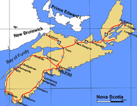
Cities and towns in Nova Scotia

Nova Scotia no longer has any incorporated cities, as they were amalgamated into Regional Municipalities in the 1990s.

Nunavut

As in the other two Canadian territories, the only incorporated city in Nunavut is its capital, Iqaluit.

Ontario

In Ontario, city status is conferred by the provincial government, generally upon the request of the incorporated municipality. A municipality may apply for city status anytime after its population surpasses 10,000. This status is not automatically conferred on a community that reaches this population target, but must be requested by the municipality and granted by the provincial Ministry of Municipal Affairs and Housing. Not all municipalities which reach this population target have pursued city designation (as, for example, Markham, Ajax and Oakville, which in 2006 had census populations of ca. 262,000, 93,000, and 166,000 respectively, but are still designated as towns.) Once designated a city, however, a municipality does not lose this status even if its population later falls back below 10,000 (as, for example, Dryden.)

City status may also be conferred on some rural counties which have been amalgamated such that all municipal governance takes place at the county level with no further municipal subdivisions. Thus, city status in Ontario does not always connote a primarily urbanized community.

City Census division Population
(2006) [8]
Location Remarks
Barrie Simcoe County 128,430 44°23′26″N 79°41′08″W / 44.39047°N 79.68564°W / 44.39047; -79.68564 (Barrie)
Belleville Hastings County 48,821 44°09′46″N 77°22′59″W / 44.16276°N 77.38319°W / 44.16276; -77.38319 (Belleville)
Brampton Peel Region 433,806 43°41′07″N 79°45′36″W / 43.68529°N 79.75988°W / 43.68529; -79.75988 (Brampton) Part of the Greater Toronto Area
Brant Brant 34,415 43°09′10″N 80°10′18″W / 43.15267°N 80.17157°W / 43.15267; -80.17157 (Brant)
Brantford Brant 90,192 43°08′31″N 80°15′44″W / 43.14194°N 80.26221°W / 43.14194; -80.26221 (Brantford)
Brockville Leeds and Grenville 21,957 44°35′25″N 75°40′57″W / 44.59024°N 75.68258°W / 44.59024; -75.68258 (Brockville)
Burlington Halton Region 164,415 43°19′33″N 79°47′56″W / 43.32570°N 79.79885°W / 43.32570; -79.79885 (Burlington) Part of the Greater Toronto Area
Cambridge Waterloo Region 120,371 43°21′41″N 80°18′53″W / 43.36145°N 80.31461°W / 43.36145; -80.31461 (Cambridge)
Chatham-Kent single-tier 108,177
Clarence-Rockland Prescott and Russell 20,790 45°33′05″N 75°17′21″W / 45.55125°N 75.28913°W / 45.55125; -75.28913 (Clarence-Rockland) Part of the National Capital Region
Cornwall Stormont, Dundas and Glengarry 45,965 45°01′15″N 74°43′50″W / 45.02094°N 74.73068°W / 45.02094; -74.73068 (Cornwall)
Dryden Kenora District 8,195 49°46′48″N 92°50′12″W / 49.78008°N 92.83670°W / 49.78008; -92.83670 (Dryden) Smallest city in Ontario
Elliot Lake Algoma District 11,549 46°23′10″N 82°39′04″W / 46.38599°N 82.65100°W / 46.38599; -82.65100 (Elliot Lake)
Greater Sudbury single-tier 157,857 46°29′24″N 80°59′23″W / 46.48989°N 80.98979°W / 46.48989; -80.98979 (Greater Sudbury)
Guelph Wellington County 114,943 43°32′37″N 80°14′54″W / 43.54350°N 80.24826°W / 43.54350; -80.24826 (Guelph)
Haldimand County single-tier 45,212
Hamilton single-tier 504,559 43°15′19″N 79°52′24″W / 43.25515°N 79.87327°W / 43.25515; -79.87327 (Hamilton) Part of the Golden Horseshoe
Kawartha Lakes single-tier 74,561
Kenora Kenora District 15,177 49°46′03″N 94°29′26″W / 49.76747°N 94.49049°W / 49.76747; -94.49049 (Kenora)
Kingston Frontenac County 117,207 44°13′48″N 76°28′50″W / 44.22993°N 76.48042°W / 44.22993; -76.48042 (Kingston)
Kitchener Waterloo Region 204,668 43°27′06″N 80°29′33″W / 43.45179°N 80.49249°W / 43.45179; -80.49249 (Kitchener)
London Middlesex County 352,395 42°59′17″N 81°14′46″W / 42.98809°N 81.24609°W / 42.98809; -81.24609 (London)
Mississauga Peel Region 668,549 43°35′20″N 79°38′40″W / 43.58881°N 79.64436°W / 43.58881; -79.64436 (Mississauga) Part of the Greater Toronto Area
Niagara Falls Niagara Region 82,184 43°06′22″N 79°03′50″W / 43.10602°N 79.06384°W / 43.10602; -79.06384 (Niagara Falls) Part of the Golden Horseshoe
Norfolk County single-tier 60,847
North Bay Nipissing District 53,966 46°18′33″N 79°27′39″W / 46.30913°N 79.46072°W / 46.30913; -79.46072 (North Bay)
Orillia Simcoe County 30,259 44°36′33″N 79°25′16″W / 44.60917°N 79.42111°W / 44.60917; -79.42111 (Orillia)
Oshawa Durham Region 141,590 43°53′46″N 78°51′56″W / 43.89622°N 78.86561°W / 43.89622; -78.86561 (Oshawa) Part of the Greater Toronto Area
Ottawa single-tier 812,129 45°26′24″N 75°41′41″W / 45.44001°N 75.69460°W / 45.44001; -75.69460 (Ottawa) Capital of Canada
Part of the National Capital Region
Owen Sound Grey County 21,753 44°33′51″N 80°56′34″W / 44.56424°N 80.94280°W / 44.56424; -80.94280 (Owen Sound)
Pembroke Renfrew County 13,930 45°49′37″N 77°06′42″W / 45.82702°N 77.11162°W / 45.82702; -77.11162 (Pembroke)
Peterborough Peterborough County 74,898 44°18′32″N 78°19′11″W / 44.30898°N 78.31982°W / 44.30898; -78.31982 (Peterborough)
Pickering Durham Region 87,838 43°50′17″N 79°05′01″W / 43.83798°N 79.08371°W / 43.83798; -79.08371 (Pickering) Part of the Greater Toronto Area
Prince Edward County single-tier 25,496
Port Colborne Niagara Region 18,599 42°53′11″N 79°15′04″W / 42.88646°N 79.25104°W / 42.88646; -79.25104 (Port Colborne) Part of the Golden Horseshoe
Quinte West Hastings County 42,697
Sarnia Lambton County 71,419 42°58′30″N 82°24′25″W / 42.97500°N 82.40682°W / 42.97500; -82.40682 (Sarnia)
Sault Ste. Marie Algoma District 74,948 46°30′24″N 84°20′00″W / 46.50663°N 84.33337°W / 46.50663; -84.33337 (Sault Ste. Marie)
St. Catharines Niagara Region 131,989 43°09′33″N 79°14′49″W / 43.15928°N 79.24696°W / 43.15928; -79.24696 (St. Catharines) Part of the Golden Horseshoe
St. Thomas Elgin County 36,110 42°46′45″N 81°11′34″W / 42.77922°N 81.19270°W / 42.77922; -81.19270 (St. Thomas)
Stratford Perth County 30,461 43°22′12″N 80°58′56″W / 43.36999°N 80.98220°W / 43.36999; -80.98220 (Stratford)
Temiskaming Shores Timiskaming District 10,442
Thorold Niagara Region 18,224 43°06′29″N 79°12′54″W / 43.10808°N 79.21494°W / 43.10808; -79.21494 (Thorold) Part of the Golden Horseshoe
Thunder Bay Thunder Bay 109,140 48°22′54″N 89°14′46″W / 48.38177°N 89.24602°W / 48.38177; -89.24602 (Thunder Bay)
Timmins Cochrane District 42,997 48°28′35″N 81°19′44″W / 48.47640°N 81.32891°W / 48.47640; -81.32891 (Timmins)
Toronto single-tier 2,503,281 43°39′13″N 79°23′02″W / 43.65353°N 79.38390°W / 43.65353; -79.38390 (Toronto) Capital of Ontario
Largest city in Ontario and Canada
Part of the Greater Toronto Area
Vaughan York Region 238,866 43°48′40″N 79°27′00″W / 43.81099°N 79.45012°W / 43.81099; -79.45012 (Vaughan) Part of the Greater Toronto Area
Waterloo Waterloo Region 97,475 43°27′48″N 80°31′12″W / 43.46342°N 80.52009°W / 43.46342; -80.52009 (Waterloo)
Welland Niagara Region 50,331 42°59′36″N 79°14′21″W / 42.99328°N 79.23915°W / 42.99328; -79.23915 (Welland) Part of the Golden Horseshoe
Windsor Essex County 216,473 42°19′03″N 83°02′07″W / 42.31745°N 83.03518°W / 42.31745; -83.03518 (Windsor)
Woodstock Oxford County 35,480 43°07′47″N 80°45′24″W / 43.12979°N 80.75668°W / 43.12979; -80.75668 (Woodstock)

Prince Edward Island

Quebec

In Quebec, provincial law does not currently distinguish between towns and cities — one designation, ville, covers both types of communities regardless of size, as the French language lacks a widely-used term to distinguish town and cities in general. A ville might be informally referred to as a town or a city in English, but this is an arbitrary and subjective distinction. Quebec does, however, distinguish between villes and other types of incorporated municipalities, such as municipalités and villages autochthones. Quebec did at one time distinguish between villes and cités, but no longer does.

All municipalities in Quebec which have ville status are listed here, regardless of whether they are considered towns or cities in unofficial usage.

City Census division Population
2006[9]
Location
Acton Vale Acton 7,797 Montérégie
Alma Lac-Saint-Jean-Est 29,998 Saguenay–Lac-Saint-Jean
Amos Abitibi 12,584 Abitibi-Témiscamingue
Amqui La Matapédia 6,261 Bas-Saint-Laurent
Ancienne-LoretteL'Ancienne-Lorette Quebec City CMA 16,516 Capitale-Nationale
Asbestos Les Sources 6,819 Centre-du-Québec
AssomptionL'Assomption L'Assomption 16,738 Laurentides
Baie-Comeau Manicouagan 22,554 Côte-Nord
Baie-d'Urfé Montreal CMA 3,902 Montréal
Baie-Saint-Paul Charlevoix 7,288 Capitale-Nationale
Barkmere Les Laurentides 87 Laurentides
Beaconsfield Montreal CMA 19,194 Montréal
Beauceville Robert-Cliche 6,226 Chaudière-Appalaches
Beauharnois Beauharnois-Salaberry 11,918 Montérégie
Beaupré La Côte-de-Beaupré 3,006 Capitale-Nationale
Bécancour Bécancour 11,134 Montérégie
Bedford Brome-Missisquoi 2,612 Estrie
Belleterre Témiscamingue 350 Abitibi-Témiscamingue
Belœil La Vallée-du-Richelieu 18,927 Montérégie
Berthierville D'Autray 4,007 Lanaudière
Blainville Thérèse-de-Blainville 46,493 Montérégie
Bois-des-Filion Thérèse-de-Blainville 8,383 Lanaudière
Boisbriand Thérèse-de-Blainville 26,483 Lanaudière
Bonaventure Bonaventure 2,673 Gaspésie
Boucherville Longueuil CMA 39,062 Montérégie
Brome Lake (Lac-Brome) Brome-Missisquoi 5,629 Montérégie
Bromont La Haute-Yamaska 6,049 Estrie
Brossard Longueuil CMA 71,154 Montérégie
Brownsburg-Chatham Argenteuil 6,664 Laurentides
Cabano Témiscouata 3,199 Bas-Saint-Laurent
Candiac Roussillon 15,947 Montérégie
Cap-Chat La Haute-Gaspésie 2,777 Gaspésie–Îles-de-la-Madeleine
Cap-Santé Portneuf 2,666 Capitale-Nationale
Carignan La Vallée-du-Richelieu 7,426 Montérégie
Carleton-sur-Mer Avignon 4,077 Gaspésie–Îles-de-la-Madeleine
Causapscal La Matapédia 2,556 Bas-Saint-Laurent
Chambly La Vallée-du-Richelieu 22,608 Montérégie
Chandler Le Rocher-Percé 7,914 Gaspésie–Îles-de-la-Madeleine
Chapais Nord-du-Québec 1,630 Nord-du-Québec
Charlemagne L'Assomption 5,594 Lanaudière
ChateauguayChâteauguay Roussillon 42,786 Montérégie
Chateau-RicherChâteau-Richer La Côte-de-Beaupré 3,563 Capitale-Nationale
Chibougamau Nord-du-Québec 7,563 Nord-du-Québec
Clermont Charlevoix-Est 3,041 Capitale-Nationale
Coaticook Coaticook 9,204 Estrie
Contrecoeur Lajemmerais 5,678 Centre-du-Québec
Cookshire-Eaton Le Haut-Saint-François 5,004 Estrie
Cote-Saint-LucCôte-Saint-Luc Montreal CMA 31,395 Montréal
Cowansville Brome-Missisquoi 12,182 Montérégie
Danville Les Sources 4,041 Centre-du-Québec
Daveluyville Arthabaska 1,005 Centre-du-Québec
DegelisDégelis Témiscouata 3,209 Bas-Saint-Laurent
Delson Roussillon 7,322 Estrie
Desbiens Lac-Saint-Jean-Est 1,074 Saguenay–Lac-Saint-Jean
Deux-Montagnes Deux-Montagnes 17,402 Laurentides
Disraeli Les Appalaches 2,570 Chaudière-Appalaches
Dolbeau-Mistassini Maria-Chapdelaine 14,546 Lac-Saint-Jean
Dollard-des-Ormeaux Montreal CMA 48,930 Montréal
Donnacona Portneuf 5,564 Capitale-Nationale
Dorval Montreal CMA 18,088 Montréal
Drummondville Drummond 67,392 Centre-du-Québec
Dunham Brome-Missisquoi 3,396 Montérégie
Duparquet Abitibi-Ouest 650 Abitibi-Témiscamingue
East Angus Le Haut-Saint-François 3,357 Estrie
EpiphanieL'Épiphanie L'Assomption 4,606 Lanaudière
Estérel Les Pays-d'en-Haut 256 Capitale-Nationale
Farnham Brome-Missisquoi 7,809 Montérégie
Fermont Caniapiscau 2,633 Côte-Nord
Forestville La Haute-Côte-Nord 3,543 Côte-Nord
Fossambault-sur-le-Lac La Jacques-Cartier 1,532 Capitale-Nationale
Gaspé La Côte-de-Gaspé 14,819 Gaspésie
Gatineau Gatineau 242,124 Outaouais
Gracefield La Vallée-de-la-Gatineau 2,439 Outaouais
Granby La Haute-Yamaska 47,637 Montérégie
Grande-Rivière Le Rocher-Percé 3,409 Gaspésie–Îles-de-la-Madeleine
Hampstead Montreal CMA 6,996 Montréal
Hudson Vaudreuil-Soulanges 5,088 Montérégie
Huntingdon Le Haut-Saint-Laurent 2,587 Montérégie
Ile-CadieuxL'Île-Cadieux Vaudreuil-Soulanges 128 Montérégie
Ile-DorvalL'Île-Dorval Montreal CMA 59 Montréal
Ile-PerrotL'Île-Perrot Vaudreuil-Soulanges 9,927 Montréal
Joliette Joliette 19,045 Lanaudière
Kingsey Falls Arthabaska 2,086 Estrie
Kirkland Montreal CMA 20,491 Montréal
Lac-Delage La Jacques-Cartier 530 Capitale-Nationale
Lac-Mégantic Le Granit 5,967 Estrie
Lac-Saint-Joseph La Jacques-Cartier 266 Capitale-Nationale
Lac-Sergent Portneuf 423 Capitale-Nationale
Lachute Argenteuil 11,832 Laurentides
Laval Laval 376,845 Montréal
Lavaltrie D'Autray 12,112 Lanaudière
Lebel-sur-Quévillon Nord-du-Québec 2,729 Nord-du-Québec
LeryLéry Roussillon 2,385 Montérégie
LevisLévis Lévis 130,006 Chaudière-Appalaches
Longueuil Longueuil CMA 229,330 Montérégie
Lorraine Thérèse-de-Blainville 9,613 Laurentides
Louiseville Maskinongé 7,433 Lanaudière
Macamic Abitibi-Ouest 2,726 Abitibi-Témiscamingue
Magog Memphrémagog 23,880 Estrie
Malartic La Vallée-de-l'Or 3,640 Abitibi-Témiscamingue
MalbaieLa Malbaie Charlevoix-Est 8,959 Capitale-Nationale
Maniwaki La Vallée-de-la-Gatineau 4,102 Outaouais
Marieville Rouville 7,904 Montérégie
Mascouche Les Moulins 34,626 Lanaudière
Matagami Nord-du-Québec 1,555 Nord-du-Québec
Matane Matane 14,742 Gaspésie–Îles-de-la-Madeleine
Mercier Roussillon 10,121 Montérégie
MetabetchouanMétabetchouan–Lac-à-la-Croix Lac-Saint-Jean-Est 4,084 Saguenay–Lac-Saint-Jean
MetisMétis-sur-Mer La Mitis 604 Gaspésie–Îles-de-la-Madeleine
Mirabel Mirabel 34,626 Laurentides
Mont-Joli La Mitis 6,568 Bas-Saint-Laurent
Mont-Laurier Antoine-Labelle 13,405 Outaouais
Mont-Saint-Hilaire La Vallée-du-Richelieu 15,720 Montérégie
Mont-Tremblant Les Laurentides 8,892 Laurentides
Montmagny Montmagny 11,724 Bas-Saint-Laurent
Montreal Montreal CMA 1,620,693 Montréal
Montréal-Est Montreal CMA 3,822 Montréal
Montreal West Montreal CMA 5,184 Montréal
Mount Royal Montreal CMA 18,933 Montréal
Murdochville La Côte-de-Gaspé 812 Gaspésie–Îles-de-la-Madeleine
Neuville Portneuf 3,638 Capitale-Nationale
New Richmond Bonaventure 3,748 Gaspésie–Îles-de-la-Madeleine
Nicolet Nicolet-Yamaska 7,827 Centre-du-Québec
Normandin Maria-Chapdelaine 3,220 Saguenay–Lac-Saint-Jean
Notre-Dame-de-l'Île-Perrot Vaudreuil-Soulanges 9,885 Montérégie
Notre-Dame-des-Prairies Joliette 8,230 Lanaudière
Notre-Dame-du-Lac Témiscouata 2,060 Abitibi-Témiscamingue
Otterburn Park La Vallée-du-Richelieu 8,464 Montérégie
Paspébiac Bonaventure 3,159 Gaspésie–Îles-de-la-Madeleine
Percé Le Rocher-Percé 3,419 Gaspésie–Îles-de-la-Madeleine
Pincourt Vaudreuil-Soulanges 11,197 Montérégie
Plessisville L'Érable 6,677 Centre-du-Québec
PocatiereLa Pocatière Kamouraska 4,575 Bas-Saint-Laurent
PohenegamookPohénégamook Témiscouata 2,940 Bas-Saint-Laurent
Pointe-Claire Montreal CMA 30,161 Montréal
Pont-Rouge Portneuf 7,518 Capitale-Nationale
Port-Cartier Sept-Rivières 6,758 Côte-Nord
Portneuf Portneuf 3,086 Capitale-Nationale
PrairieLa Prairie Roussillon 21,763 Montérégie
Princeville L'Érable 5,571 Centre-du-Québec
Prévost La Rivière-du-Nord 10,132 Laurentides
Quebec City Quebec City CMA 659,545 Capitale-Nationale
Repentigny L'Assomption 76,237 Lanaudière
Richelieu Rouville 5,208 Montérégie
Richmond Le Val-Saint-François 3,336 Estrie
Rimouski Rimouski-Neigette 42,240 Bas-Saint-Laurent
Rivière-du-Loup Rivière-du-Loup 18,586 Bas-Saint-Laurent
Rivière-Rouge Antoine-Labelle 4,152 Laurentides
Roberval Le Domaine-du-Roy 10,544 Saguenay–Lac-Saint-Jean
Rosemère Thérèse-de-Blainville 14,173 Laurentides
Rouyn-Noranda Rouyn-Noranda 39,924 Abitibi-Témiscamingue
Saguenay Le Saguenay-et-son-Fjord 143,692 Saguenay–Lac-Saint-Jean
Sainte-Adèle Les Pays-d'en-Haut 10,634 Laurentides
Sainte-Agathe-des-Monts Les Laurentides 9,679 Laurentides
Sainte-Anne-de-Beaupré La Côte-de-Beaupré 2,803 Capitale-Nationale
Sainte-Anne-de-Bellevue Montreal CMA 5,197 Montréal
Sainte-Anne-des-Monts La Haute-Gaspésie 6,772 Gaspésie–Îles-de-la-Madeleine
Sainte-Anne-des-Plaines Thérèse-de-Blainville 13,001 Laurentides
Saint-Augustin-de-Desmaures Quebec City CMA 17,281 Capitale-Nationale
Saint-Basile Portneuf 2,560 Capitale-Nationale
Saint-Basile-le-Grand La Vallée-du-Richelieu 15,605 Montérégie
Saint-Bruno-de-Montarville Longueuil CMA 24,388 Montérégie
Sainte-Catherine Roussillon 16,211 Montérégie
Sainte-Catherine-de-la-Jacques-Cartier La Jacques-Cartier 5,021 Capitale-Nationale
Saint-Césaire Rouville 5,151 Montérégie
Saint-Constant Roussillon 23,957 Montérégie
Saint-Eustache Deux-Montagnes 42,062 Laurentides
Saint-Félicien Le Domaine-du-Roy 10,477 Saguenay–Lac-Saint-Jean
Saint-Gabriel D'Autray 2,828 Lanaudière
Saint-Georges Beauce-Sartigan 30,113 Chaudière-Appalaches
Saint-Hyacinthe Les Maskoutains 55,823 Montérégie
Saint-Jean-sur-Richelieu Le Haut-Richelieu 87,492 Montérégie
Saint-Jérôme La Rivière-du-Nord 63,729 Laurentides
Saint-Joseph-de-Beauce Robert-Cliche 4,454 Chaudière-Appalaches
Saint-Joseph-de-Sorel Pierre-De Saurel 1,686 Montérégie
Sainte-Julie Lajemmerais 29,019 Montérégie
Saint-Lambert Longueuil CMA 21,599 Montérégie
Saint-Lazare Vaudreuil-Soulanges 17,016 Montérégie
Saint-Lin-Laurentides Montcalm 14,159 Laurentides
Saint-Marc-des-Carrières Portneuf 2,774 Capitale-Nationale
Sainte-Marguerite-du-Lac-Masson Les Pays-d'en-Haut 2,498 Laurentides
Sainte-Marie La Nouvelle-Beauce 11,584 Chaudière-Appalaches
Sainte-Marthe-sur-le-Lac Deux-Montagnes 11,311 Laurentides
Saint-Ours Pierre-De Saurel 1,700 Montérégie
Saint-Pamphile L'Islet 2,704 Bas-Saint-Laurent
Saint-Pascal Kamouraska 3,504 Bas-Saint-Laurent
Saint-Pie Les Maskoutains 5,109 Montérégie
Saint-Raymond Portneuf 9,273 Capitale-Nationale
Saint-Rémi Les Jardins-de-Napierville 6,136 Montérégie
Saint-Sauveur Les Pays-d'en-Haut 9,191 Laurentides
Sainte-Thérèse Thérèse-de-Blainville 25,224 Laurentides
Saint-Tite Mékinac 3,826 Mauricie
Salaberry-de-Valleyfield Beauharnois-Salaberry 39,672 Montérégie
SarreLa Sarre Abitibi-Ouest 7,336 Abitibi-Témiscamingue
Schefferville Caniapiscau 202 Nord-du-Québec
Scotstown Le Haut-Saint-François 588 Estrie
Senneterre La Vallée-de-l'Or 2,993 Abitibi-Témiscamingue
Sept-Îles Sept-Rivières 27,827 Côte-Nord
Shawinigan Shawinigan 51,904 Mauricie
Sherbrooke Sherbrooke 186,952 Estrie
Sorel-Tracy Pierre-De Saurel 34,076 Montérégie
Stanstead Memphrémagog 2,957 Estrie
Sutton Brome-Missisquoi 3,805 Montérégie
Témiscaming Témiscamingue 2,697 Abitibi-Témiscamingue
Terrebonne Les Moulins 94,703 Lanaudière
Thetford Mines Les Appalaches 25,704 Chaudière-Appalaches
Thurso Papineau 2,299 Outaouais
Trois-Pistoles Les Basques 3,500 Bas-Saint-Laurent
Trois-Rivières Francheville 129,100 Mauricie
TuqueLa Tuque La Tuque 11,821 Mauricie
Val-d'Or La Vallée-de-l'Or 31,123 Abitibi-Témiscamingue
Valcourt Le Val-Saint-François 2,349 Estrie
Varennes Lajemmerais 20,950 Montérégie
Vaudreuil-Dorion Vaudreuil-Soulanges 25,789 Montérégie
Victoriaville Arthabaska 40,486 Centre-du-Québec
Ville-Marie Témiscamingue 2,696 Abitibi-Témiscamingue
Warwick Arthabaska 4,804 Centre-du-Québec
Waterloo La Haute-Yamaska 4,054 Estrie
Waterville Coaticook 1,926 Estrie
Westmount Montreal CMA 20,494 Montréal
Windsor Le Val-Saint-François 5,239 Estrie

Saskatchewan

In Saskatchewan, towns must have a population of 5,000 or more[10] and meet other criteria in order to incorporate as a city, although in the early 20th century several centres such as Saskatoon and Regina were granted city status despite having a smaller population. The City of Melville retains its city status despite dropping below 5,000 people in the 1990s. Kindersley, with a population that fluctuates around the 5,000 mark, has applied for city status in recent years.

City Census division Population
2006[11]
Location Notes
Estevan 10,084 49°08′22″N 102°59′36″W / 49.13949°N 102.9934°W / 49.13949; -102.9934 (Estevan)
Flin Flon 242 54°45′28″N 101°52′15″W / 54.75783°N 101.8708°W / 54.75783; -101.8708 (Flin Flon) Portion of city also located in Manitoba
(numbers for Saskatchewan portion only)
Humboldt 4,998 52°12′04″N 105°07′24″W / 52.20115°N 105.1233°W / 52.20115; -105.1233 (Humboldt)
Lloydminster 9,100 53°17′03″N 110°00′11″W / 53.28412°N 110.0030°W / 53.28412; -110.0030 (Lloydminster) Portion of city also located in Alberta
(numbers for Saskatchewan portion only)
Martensville 4,968 52°17′23″N 106°40′00″W / 52.289722°N 106.666667°W / 52.289722; -106.666667 (Martensville)
Meadow Lake 4,771 54°08′00″N 108°31′00″W / 54.133333°N 108.516667°W / 54.133333; -108.516667 (Meadow Lake)
Melfort 5,192 52°51′39″N 104°36′51″W / 52.86080°N 104.6142°W / 52.86080; -104.6142 (Melfort)
Melville 4,149 50°55′46″N 102°48′17″W / 50.92944°N 102.8046°W / 50.92944; -102.8046 (Melville) Smallest city in Saskatchewan
Moose Jaw 35,689 50°23′32″N 105°32′06″W / 50.39231°N 105.5350°W / 50.39231; -105.5350 (Moose Jaw)
North Battleford 13,190 52°46′34″N 108°17′52″W / 52.77622°N 108.2978°W / 52.77622; -108.2978 (North Battleford)
Prince Albert 34,138 53°12′12″N 105°45′11″W / 53.20335°N 105.7530°W / 53.20335; -105.7530 (Prince Albert)
Regina 179,246 50°26′53″N 104°36′57″W / 50.44810°N 104.6158°W / 50.44810; -104.6158 (Regina) Capital of Saskatchewan
Part of the Regina Metropolitan Area
Saskatoon 202,340 52°07′51″N 106°39′36″W / 52.13073°N 106.6601°W / 52.13073; -106.6601 (Saskatoon) Largest city in Saskatchewan
Part of the Saskatoon Metropolitan Area
Swift Current 14,946 50°17′05″N 107°47′57″W / 50.28485°N 107.7993°W / 50.28485; -107.7993 (Swift Current)
Weyburn 9,433 49°39′47″N 103°51′11″W / 49.66297°N 103.8530°W / 49.66297; -103.8530 (Weyburn)
Yorkton 15,038 51°12′40″N 102°27′35″W / 51.21122°N 102.4597°W / 51.21122; -102.4597 (Yorkton)

Yukon

As in the other two Canadian territories, the only incorporated city in the Yukon is its capital, Whitehorse. Dawson was also previously incorporated as a city, but when the criteria were changed in the 1980s, its status was reduced to that of a town due to population. Through special provision, however, it is officially the town of the city of Dawson.

See also

References

  1. ^ Alberta Queen's Printer (2010-01-01). "Municipal Government Act - Revised Statutes of Alberta 2000, Chapter M-26 (Section 82)". http://www.qp.alberta.ca/574.cfm?page=m26.cfm&leg_type=Acts&isbncln=9780779745739. Retrieved 2010-06-03. 
  2. ^ Statistics Canada (2007). "Population and dwelling counts, for Canada, provinces and territories, and census subdivisions (municipalities), 2006 and 2001 censuses - 100% data (Alberta)". http://www12.statcan.gc.ca/census-recensement/2006/dp-pd/hlt/97-550/Index.cfm?TPL=P1C&Page=RETR&LANG=Eng&T=302&SR=1&S=1&O=A&RPP=9999&PR=48&CMA=0. Retrieved 2010-06-03. 
  3. ^ Government of British Columba - Local Government Act
  4. ^ Statistics Canada (2007). "Population and dwelling counts, for Canada, provinces and territories, and census subdivisions (municipalities), 2006 and 2001 censuses - 100% data (British Columbia)". http://www12.statcan.gc.ca/census-recensement/2006/dp-pd/hlt/97-550/Index.cfm?TPL=P1C&Page=RETR&LANG=Eng&T=302&SR=1&S=1&O=A&RPP=9999&PR=59&CMA=0. Retrieved 2010-06-19. 
  5. ^ Statistics Canada (2007). "Population and dwelling counts, for Canada, provinces and territories, and census subdivisions (municipalities), 2006 and 2001 censuses - 100% data (Manitoba)". http://www12.statcan.gc.ca/census-recensement/2006/dp-pd/hlt/97-550/Index.cfm?TPL=P1C&Page=RETR&LANG=Eng&T=302&SR=1&S=1&O=A&RPP=9999&PR=46&CMA=0. Retrieved 2010-06-19. 
  6. ^ Statistics Canada (2007). "Population and dwelling counts, for Canada, provinces and territories, and census subdivisions (municipalities), 2006 and 2001 censuses - 100% data (New Brunswick)". http://www12.statcan.gc.ca/census-recensement/2006/dp-pd/hlt/97-550/Index.cfm?TPL=P1C&Page=RETR&LANG=Eng&T=302&SR=1&S=1&O=A&RPP=9999&CMA=0&PR=13. Retrieved 2010-06-19. 
  7. ^ Statistics Canada (2007). "Population and dwelling counts, for Canada, provinces and territories, and census subdivisions (municipalities), 2006 and 2001 censuses - 100% data (Newfoundland and Labrador)". http://www12.statcan.gc.ca/census-recensement/2006/dp-pd/hlt/97-550/Index.cfm?TPL=P1C&Page=RETR&LANG=Eng&T=302&SR=1&S=1&O=A&RPP=9999&CMA=0&PR=10. Retrieved 2010-06-19. 
  8. ^ Statistics Canada (2007). "Population and dwelling counts, for Canada, provinces and territories, and census subdivisions (municipalities), 2006 and 2001 censuses - 100% data (Ontario)". http://www12.statcan.gc.ca/census-recensement/2006/dp-pd/hlt/97-550/Index.cfm?TPL=P1C&Page=RETR&LANG=Eng&T=302&SR=1&S=1&O=A&RPP=9999&CMA=0&PR=35. Retrieved 2010-06-19. 
  9. ^ Statistics Canada (2007). "Population and dwelling counts, for Canada, provinces and territories, and census subdivisions (municipalities), 2006 and 2001 censuses - 100% data (Quebec)". http://www12.statcan.gc.ca/census-recensement/2006/dp-pd/hlt/97-550/Index.cfm?TPL=P1C&Page=RETR&LANG=Eng&T=302&SR=1&S=1&O=A&RPP=9999&CMA=0&PR=24. Retrieved 2010-06-19. 
  10. ^ ;Saskatchewan Queen's Printer. "The Cities Act (Chapter C-11.1 of The Statutes of Saskatchewan, 2002)". http://www.qp.gov.sk.ca/documents/english/Statutes/Statutes/c11-1.pdf. Retrieved 2010-06-04. 
  11. ^ Statistics Canada (2007). "Population and dwelling counts, for Canada, provinces and territories, and census subdivisions (municipalities), 2006 and 2001 censuses - 100% data (Saskatchewan)". http://www12.statcan.gc.ca/census-recensement/2006/dp-pd/hlt/97-550/Index.cfm?TPL=P1C&Page=RETR&LANG=Eng&T=302&SR=1&S=1&O=A&RPP=9999&CMA=0&PR=47. Retrieved 2010-06-19. 

External links


Wikimedia Foundation. 2010.

Игры ⚽ Нужна курсовая?

Look at other dictionaries:

  • List of towns in Canada — This is a list of towns in Canada. Only municipalities legally incorporated as towns are listed here.Alberta *Athabasca *Banff *Barrhead *Bashaw *Bassano *Beaumont *Beaverlodge *Bentley *Black Diamond *Blackfalds *Bon Accord *Bonnyville *Bow… …   Wikipedia

  • List of cities in Alberta — Airdrie Brooks Calgary Camrose Cold Lake …   Wikipedia

  • List of cities and towns in Newfoundland and Labrador — This page lists cities and towns of the province of Newfoundland and Labrador, Canada. This list contains only incorporated municipalities. Unincorporated settlements are listed at List of communities in Newfoundland and Labrador Contents:… …   Wikipedia

  • List of mammals of Canada — The North American Beaver, Castor canadensis, is the national animal of Canada This is a list of the mammal species recorded in Canada. There are approximatively 200 mammal species native to Canada. Its large territorial size and variety of… …   Wikipedia

  • List of companies of Canada — Contents A B C D E F G H I J K L M N O P Q R S T U V W X Y Z This is a list of companies of Canada, businesses operating out of Canada, incorporated in Canada, or multinati …   Wikipedia

  • List of universities in Canada — BC AB SK MB ON …   Wikipedia

  • List of cities in Minnesota — Contents: Top · 0–9 · A B C D E F G H I J K L M N O P Q R S T U V W X Y Z Largest citi …   Wikipedia

  • List of cities and towns of Upper Canada — List of cities and towns of Upper Canada* York, Upper Canada * Newark, Upper Canada * Sandwich * Cornwall * Kingston …   Wikipedia

  • List of cities by latitude — The following is a list of cities by latitude. Both the latitude and longitude are shown for all cities and sorted by latitude started from the North Pole down to the South Pole. Each heading should be considered the exact value. This means that… …   Wikipedia

  • List of cities by time of continuous habitation — This is a list of present day cities by the time period over which they have been continuously inhabited. The age claims listed are generally disputed and may indeed be obsolete. Differences in opinion can result from different definitions of… …   Wikipedia

Share the article and excerpts

Direct link
Do a right-click on the link above
and select “Copy Link”