- Spanbroek
Dutch town locator maps
mun_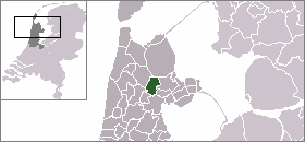
town_
caption = Spanbroek in the municipality of Opmeer.Spanbroek (coord|52|42|N|4|58|E|type:city(100)) is a village in the Dutch province of
North Holland . It is a part of the municipality ofOpmeer , and lies about 9 km northwest ofHoorn ."ANWB Topografische Atlas Nederland", Topografische Dienst and ANWB, 2005.]Spanbroek received city rights in
1414 . It was a separate municipality until 1959, when it was merged withOpmeer . [Repertorium Nederlandse Gemeenten]References
External links
* [http://www.kuijsten.de/atlas/nh/spanbroek.html Map of the former municipality in 1868]

Wikimedia Foundation. 2010.