- Bridger Mountains (Montana)
Geobox|Range
name=Bridger Mountains
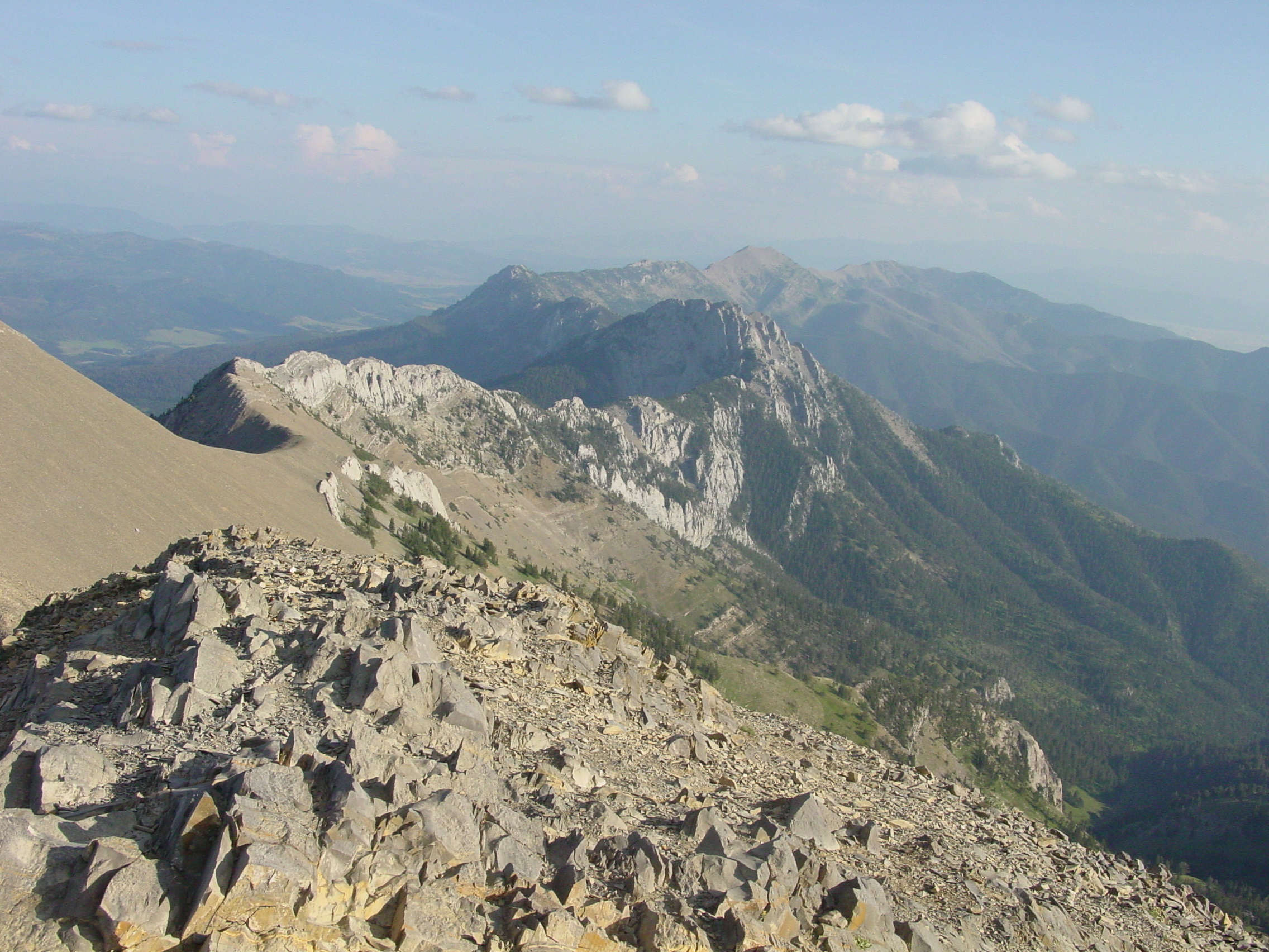
image_caption=View of the Bridger Range looking south from the summit of Sacajawea Peak.
country=United States
state=Montana
parent=Rocky Mountains
geology= | orogeny= | border=
length_imperial=| length_orientation=
width_imperial= | width_orientation=
highest=Sacajawea Peak
highest_elevation_imperial=9665
highest_lat_d=|highest_lat_m=|highest_lat_s=|highest_lat_NS=N
highest_long_d=|highest_long_m=|highest_long_s=|highest_long_EW=W

map_caption=Location within the state of MontanaThe Bridger Range (highest point: Sacagawea Peak 9665 ft/2945 m) is a subrange of the
Rocky Mountains , in southernMontana in theUnited States . The range runs mostly in a north - south direction betweenBozeman and Livingston and is separated from the Gallatin Range to the south by Bozeman Pass. Bozeman Pass (5712 ft/1,741 m) is a narrow pass that lies between the two aforementioned cities. Sacagawea Peak is a prominent peak visible to the northeast from Bozeman. Most of the range is withinGallatin National Forest .Mountains
The Bridger Range has many named and unnamed peaks. Some of the most well known peaks are:
*Sacagawea Peak (9665 ft/2946 m)
*Hardscrabble Peak (9575 ft/2918 m)
*Saddle Peak ( 9162 ft/2793 m)
*Ross Peak (9004 ft/2744 m)
*Mount Baldy (8914 ft/2717 m)
*Bridger Peak (8635 ft/ 2632 m).kiing
The Bridger Range is also home to ski area
Bridger Bowl . With the firstrope tow installed in 1951, Bridger Bowl became a primarily locals mountain, the area has a top elevation of 8700 ft and a base elevation of 6100 ft. On average the ski area receives 350 inches of snow every year.Backcountry skiing is also very popular with snow being available on peaks such as Sacagawea from early November until late May/early June. Beginning the 2005-2006 ski season, Bridger Bowl will allow backcountry travel from the ski area via access gates on the northern and southern boundaries.Hiking
Though many hiking trails exist, Sacagawea Peak is a favorite hiking area in the Bridgers. The hike is a short, yet rather strenuous, 2.2 mile one-way trek through pine forest,
alpine tundra andscree fields to the top of Sacagawea Peak. The Bridger Ridge Run is a 20 mile race which takes place mid-August. The race follows the ridge line from Fairy Lake to the southern end of the range.On the southern most part of the range, the "M" hike exists. The "M" is a collection of painted white rocks in the middle of the mountain to represent
Montana State University - Bozeman . This is a short, easy, and popular hike by many of the college students.History
The Native American
Sacagawea led theLewis and Clark Expedition through Bozeman Pass and some have suggested the pass should have been named after her instead ofJohn Bozeman .The range is named after
Jim Bridger , who pioneered theBridger Trail through mountains in southernWyoming into theBighorn Basin in 1864.On
January 10 ,1938 ,Northwest Airlines Flight 2 crashed in the Bridger Mountains, killing all 10 aboard. This was the first fatal crash of aNorthwest Airlines aircraft.External links
* [http://www.bridgerbowl.com Bridger Bowl Ski Area]
* [http://www.winddrinkers.org/BRR/BridgerRidge.html Bridger Ridge Run]
* [http://www.bozemannet.com/attractions/bridger_mountains.php Information about geological history]
* [http://www.bridgercloud.com Bridger Community]
Wikimedia Foundation. 2010.