Groot-Ammers

Groot-Ammers

Dutch town locator maps
mun_


town_


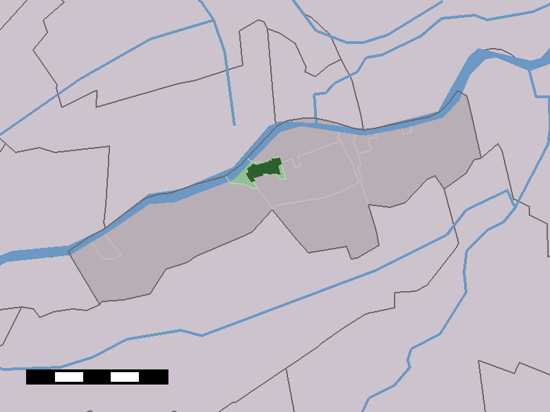
caption = The town centre (dark green) and the statistical district (light green) of Groot-Ammers in the municipality of Liesveld.

Groot-Ammers (coord|51|55|N|4|49|E|type:city(2822)) is a town in the Dutch province of South Holland. It is a part of the municipality of Liesveld, and lies about 13 km southeast of Gouda on the Lek River.

In 2001, the town of Groot-Ammers had 2822 inhabitants. The built-up area of the town was 0.56 km², and contained 1059 residences.Statistics Netherlands (CBS), [http://www.cbs.nl/nl-NL/menu/themas/milieu-natuur-ruimte/ruimte/publicaties/cartografie-geografie/geografische-data/2001-bevolkingskernen-in-nederland.htm "Bevolkingskernen in Nederland 2001"] . (Statistics are for the continuous built-up area).] The statistical area "Groot-Ammers", which also can include the surrounding countryside, has a population of around 3100.Statistics Netherlands (CBS), [http://statline.cbs.nl/ "Statline: Kerncijfers wijken en buurten 2003-2005"] . As of January 1, 2005.]

History

In 1042 Groot-Ammers is mentioned for the first time in history. The lords of Liesvelt built their castle around that time as one of the largest and strongest castles of the Netherlands. The surroundings of the castle, including Groot-Ammers, stood under the influence of these lords.

Willem Frederik of Nassau bought the barony of Liesvelt in 1636.

In modern times the barony of Liesvelt became the municipality of Groot-Ammers. In 1986 Groot-Ammers and bordering municipalities aggregated to form the municipality of Liesveld.

References


Wikimedia Foundation. 2010.

Игры ⚽ Поможем написать реферат

Look at other dictionaries:

  • Groot-Ammers — 51°55′25″N 4°49′14″E / 51.92361, 4.82056 …   Wikipédia en Français

  • Liesveld — Gemeinde Liesveld Flagge Wappen Provinz Südholland Bürgermeister …   Deutsch Wikipedia

  • Anciennes communes de la Hollande-Méridionale — En 1812, la province néerlandaise de la Hollande Méridionale comptait 148 communes. En 1820, après l annulation des modifications faites sous l Empire français, ce nombre était de nouveau porté à 251. Depuis 2010, il n y en a plus que 78.… …   Wikipédia en Français

  • Liesveld — Infobox Settlement official name = Liesveld flag size = 120x100px image shield = Liesveld logo.png shield size = 120x100px mapsize = 280px subdivision type = Country subdivision name = Netherlands subdivision type1 = Province subdivision name1 =… …   Wikipedia

  • Thijs Al — Infobox Cyclist ridername = Thijs Al image caption = Al during an indoor cyclo cross race in Hasselt fullname = Thijs Joris Al nickname = dateofbirth = birth date and age|1980|6|16 country = NED height = 1.80m weight = 70 73 kg currentteam =… …   Wikipedia

  • Hendrikse — Klaas Hendrikse (* 1947 in Groot Ammers) ist ein niederländischer Prediger der Protestantischen Kirche in den Niederlanden. Für Bekanntheit sorgte er als der „atheistische Pfarrer“ („atheïstische dominee“). Leben Hendrikse studierte an der… …   Deutsch Wikipedia

  • Liste aller niederländischen Gemeinden A–L — In diese Liste werden alle Gemeinden, die auf dem Gebiet der jetzigen Niederlande bestehen oder bestanden haben, aufgenommen. Die Liste beginnt im Jahr 1805/10. Vor 1830 können die Angaben unvollständig sein. Kleinere Grenzkorrekturen oder… …   Deutsch Wikipedia

  • Graafland — 51°53′30″N 4°51′23″E / 51.89167, 4.85639 …   Wikipédia en Français

  • Langerak (Hollande-Méridionale) — Pour les articles homonymes, voir Langerak. 51°55′59″N 4°52′34″E / …   Wikipédia en Français

  • Liesveld — Héraldique …   Wikipédia en Français

Share the article and excerpts

Direct link
Do a right-click on the link above
and select “Copy Link”