- Didderse
-
Didderse 

 DidderseLocation of Didderse within Gifhorn district
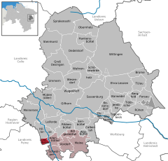

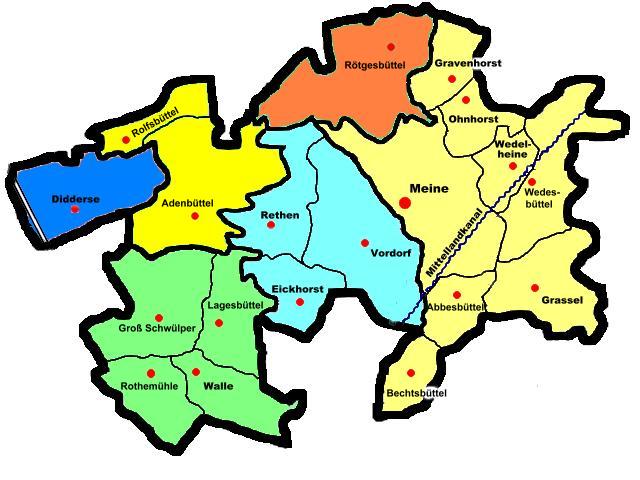
Coordinates 52°22′51″N 10°24′9″E / 52.38083°N 10.4025°ECoordinates: 52°22′51″N 10°24′9″E / 52.38083°N 10.4025°E Administration Country Germany State Lower Saxony District Gifhorn Municipal assoc. Papenteich Mayor Randolf Moos (SPD) Basic statistics Area 7.41 km2 (2.86 sq mi) Elevation 60 m (197 ft) Population 1,336 (31 December 2010)[1] - Density 180 /km2 (467 /sq mi) Other information Time zone CET/CEST (UTC+1/+2) Licence plate GF Postal code 38530 Area code 05373 Website www.papenteich.de 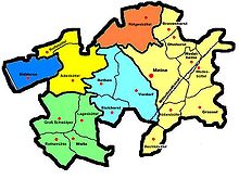 Map of the Papenteich
Didderse is a municipality in the district of Gifhorn, in Lower Saxony, Germany. It is a member municipality of the Samtgemeinde Papenteich.
Contents
Geography
Neighbourhood
* distance from downtown
City of Celle (37 km) City of Gifhorn (22 km) Wipshausen, District Peine (3 km) Municipality Hillerse (5 km) Village Rolfsbüttel (4 km) 
Municipality Adenbüttel (3 km) City of Wolfsburg (24 km) Ersehof, District Peine (1 km) Neubrück, District Peine (0 km) City of Peine (12 km) City of Braunschweig (16 km) Geographical position
Diddersel is situated north of Braunschweig, between the Harz and the Lüneburg Heath, directly on the Oker banks. However, administrative it belongs to the district of Gifhorn. Didderse is around 500m to the east to the German highway 214 and around 6 km to the north of Bundesautobahn 2. Other bigger towns nearby are: Wolfsburg, Salzgitter, Wolfenbüttel, Gifhorn, Peine and Celle.
History
The first documentary mentioning of Didderse was in the year 780. In former times the village was known as Tiddenhusen. After the community reform from 1974 Didderse belonged to the district of Peine. This connection insisted just for a few years. In 1981 Didderse was reintegrated into the district of Gifhorn.
Culture
Religion
Didderse is by the majority Protestantism. It forms a Parish together with the villages Hillerse, Rolfsbüttel and Neubrück.
Politics
The last election for the community government took place on the 10th September, 2006 with an election turnout of 62.16%. Since that day the district council consists as follows:
Adenbüttel | Barwedel | Bergfeld | Bokensdorf | Brome | Calberlah | Dedelstorf | Didderse | Ehra-Lessien | Gifhorn | Groß Oesingen | Hankensbüttel | Hillerse | Isenbüttel | Jembke | Leiferde | Meine | Meinersen | Müden (Aller) | Obernholz | Osloß | Parsau | Ribbesbüttel | Rötgesbüttel | Rühen | Sassenburg | Schönewörde | Schwülper | Sprakensehl | Steinhorst | Tappenbeck | Tiddische | Tülau | Ummern | Vordorf | Wagenhoff | Wahrenholz | Wasbüttel | Wesendorf | Weyhausen | Wittingen
References
- ^ "Bevölkerungsfortschreibung" (in German). Landesbetrieb für Statistik und Kommunikationstechnologie Niedersachsen. 31 December 2009. http://www1.nls.niedersachsen.de/statistik/html/parametereingabe.asp?DT=K1000014&CM=Bev%F6lkerungsfortschreibung.
Categories:- Municipalities in Lower Saxony
- Gifhorn district


Wikimedia Foundation. 2010.