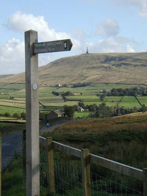
- Mary Towneley Loop
-
Coordinates: 53°42′14″N 1°13′59″W / 53.704°N 1.233°W


The Mary Towneley Loop is a 47-mile (76 km) circular route that forms part of the Pennine Bridleway National Trail, along the borders of Lancashire and Yorkshire.
It is named in memory of Mary, Lady Towneley, who drew attention to the poor state of England's bridleways and the need for a long-distance route for horse-riders by riding with two friends in September 1986 from Hexham in Northumberland to Ashbourne in Derbyshire. She died in 2001.
An annual relay race, organized by Rossendale Harriers, takes place in late January or early February. Teams consisting of five pairs of runners race over five relay legs to complete the entire 47 miles and 6,400 feet of ascent of the loop, clockwise from Fearns Sports College in Stacksteads. The 2011 race took place on 30th January and hosted 109 teams, 1,090 individual runners from clubs across the north of England, and was won by Salford Harriers.
References
- http://www.nationaltrail.co.uk/penninebridleway/downloads.asp?PageId=37
- http://www.idonohoe.com/mountian_bike9.htm
- http://www.lancashire.gov.uk/environment/countryside/bridleways/bmtloop.asp
http://www.penninebridlewayrelay.co.uk/index.htm
Categories:- Long-distance footpaths in England
- Bridleroutes in the United Kingdom
- Lancashire geography stubs
- West Yorkshire geography stubs
Wikimedia Foundation. 2010.