- Wangdue Phodrang
Infobox Settlement
official_name = Wangdue Phodrang
other_name =
native_name =
nickname =
settlement_type =
motto =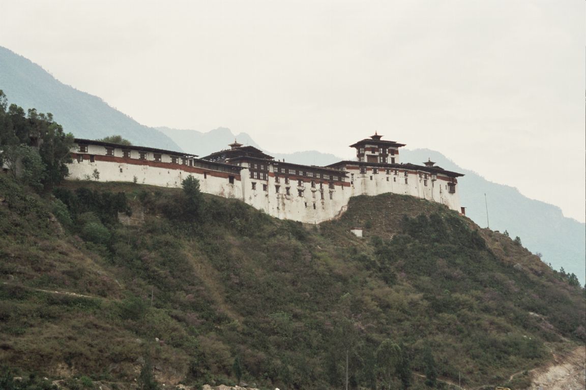
imagesize = 300px
image_caption = Dzong at Wangdue Phodrang, Bhutan
flag_size =
image_
seal_size =
image_shield =
shield_size =
image_blank_emblem =
blank_emblem_type =
blank_emblem_size =
mapsize =
map_caption =
mapsize1 =
map_caption1 =
image_dot_
dot_mapsize =
dot_map_caption =
dot_x = |dot_y =
pushpin_
pushpin_label_position =bottom
pushpin_mapsize =300
pushpin_map_caption =Location in Bhutan
subdivision_type = Country
subdivision_name =
subdivision_type1 = District
subdivision_name1 =Wangdue Phodrang District
subdivision_type2 =
subdivision_name2 =
subdivision_type3 =
subdivision_name3 =
subdivision_type4 =
subdivision_name4 =
government_footnotes =
government_type =
leader_title =
leader_name =
leader_title1 =
leader_name1 =
leader_title2 =
leader_name2 =
leader_title3 =
leader_name3 =
leader_title4 =
leader_name4 =
established_title =
established_date =
established_title2 =
established_date2 =
established_title3 =
established_date3 =
area_magnitude =
unit_pref =Imperial
area_footnotes =
area_total_km2 =
area_land_km2 =
area_water_km2 =
area_total_sq_mi =
area_land_sq_mi =
area_water_sq_mi =
area_water_percent =
area_urban_km2 =
area_urban_sq_mi =
area_metro_km2 =
area_metro_sq_mi =
area_blank1_title =
area_blank1_km2 =
area_blank1_sq_mi =
population_as_of =
population_footnotes =
population_note =
population_total =
population_density_km2 =
population_density_sq_mi =
population_metro =
population_density_metro_km2 =
population_density_metro_sq_mi =
population_urban =
population_density_urban_km2 =
population_density_urban_sq_mi =
population_blank1_title =Ethnicities
population_blank1 =
population_blank2_title =Religions
population_blank2 =
population_density_blank1_km2 =
population_density_blank1_sq_mi =
timezone =BTT + 6
utc_offset =
timezone_DST =
utc_offset_DST =
latd=27|latm=29|lats=|latNS=N
longd=90|longm=54|longs=|longEW=E
elevation_footnotes =
elevation_m =
elevation_ft =
postal_code_type =
postal_code =
area_code =
blank_name =
blank_info =
blank1_name =
blank1_info =
website =
footnotes =Wangdue Phodrang is a
town and capital ofWangdue Phodrang District in centralBhutan . [cite web| url=http://geonames.nga.mil/ggmagaz/geonames4.asp |title=NGA GeoName Database |publisher=National Geospatial Intelligence Agency |accessdate=2008-07-05]The town shares its name with the
dzong , built in 1638 which dominates the district. The name is said to have been given byShabdrung Ngawang Namgyal who was searching for the best location for a dzong to prevent incursions from the south. At the chosen spot the Shabdrung encountered a boy named Wangdi playing beside the river and hence named the dzong "Wangdi's Palace".There are three paved roads in Wangdue Phodrang dzongkhag. The
Lateral Road enters from the west atDochu La Pass, crosses thePana Tsang Chhu at Wangdue Phodrang dzong, and continues east to Tongsa. One spur road heads north from Wangdue Phodrang to the dzong atPunakha and slightly beyond. This becomes the footpath to Gasa. A second spur departs the Lateral Road near thePele La pass halfway between Wangdue and Tongsa, traveling south a short distance toGangteng Gonpa and the Phobjika valley where the rareBlack-necked Crane s ("grus nigricollis") may be found.References
External links
* [http://www.maplandia.com/bhutan/wangdiphodrang/wangdiphodrang/ Satellite map at Maplandia.com]

Wikimedia Foundation. 2010.