- Öland bridge
Infobox Bridge
bridge_name=Ölandsbron
official_name=Ölandsbron
locale=Kalmar
carries=Motor vehicles
crosses=Kalmar Strait
maint=Vägverket
open=30 September 1972
below=36 m
design=
mainspan=130 m
length=6072 m
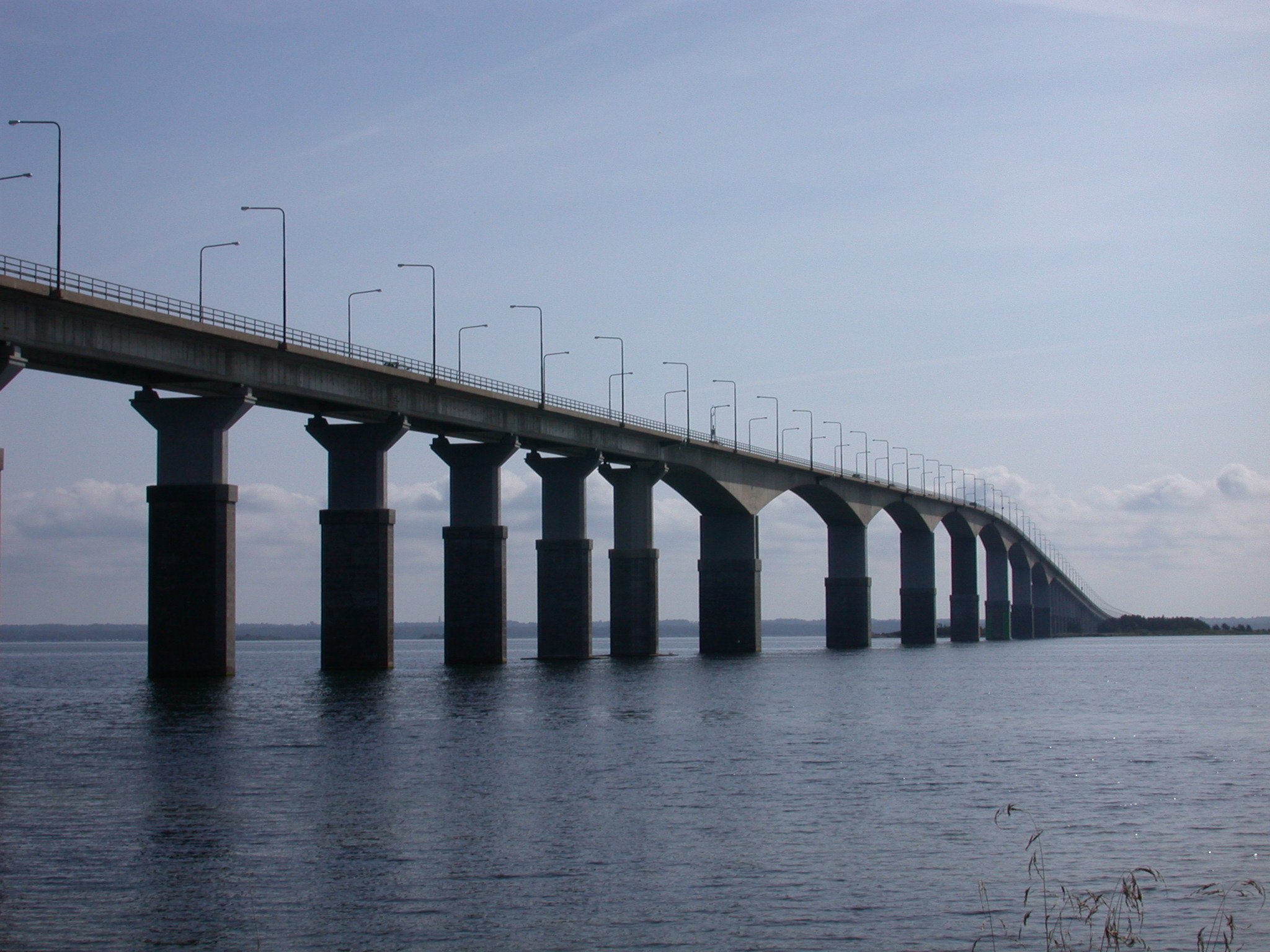
width=13 mThe Öland bridge ( _sv. Ölandsbron) is a road bridge connectingKalmar on mainlandSweden toFärjestaden ("Ferry Town") on the island ofÖland to its east. It is 6,072 m long, supported on 156 pillars, and has a characteristic hump at its western end – created to provide a vertical clearance of 36 m for shipping.A little to the south of the western end of the bridge a small wooden pedestrian and cycle bridge, around 150 m in length and connecting the island of Svinö to the mainland, echoes the form of the Öland bridge. This "replica" is clearly visible to anyone crossing to Öland via the main bridge.
The bridge is the longest in Sweden and one of the longest in all
Europe . TheOresund Bridge linking Sweden withDenmark is longer overall, but not that part of it lying wholly within Sweden.Construction
The Öland bridge was inaugurated on
30 September ,1972 . Among the speakers at the ceremony, which took place on the island side of the bridge, were theCrown Prince (today king)Carl Gustaf . The bridge cost 80 million Swedish Kronor to build. Construction took 4,5 years, and about 100.000 cubic meters ofconcrete was used. The bridge was also prepared for transporting fresh water from the mainland to Öland. The bridge project received much support, but there were also protests. The main objection was that the bridge would threaten the environment, possibly causing a huge influx of tourists to Öland and its valuable nature. [cite book |last= |first=|title=Aktuellt 1973|year=1973|publisher=K G Bertmarks förlag | id = ISSN: 0343-6993]References
External links
*
Wikimedia Foundation. 2010.