Nasketucket River

Nasketucket River
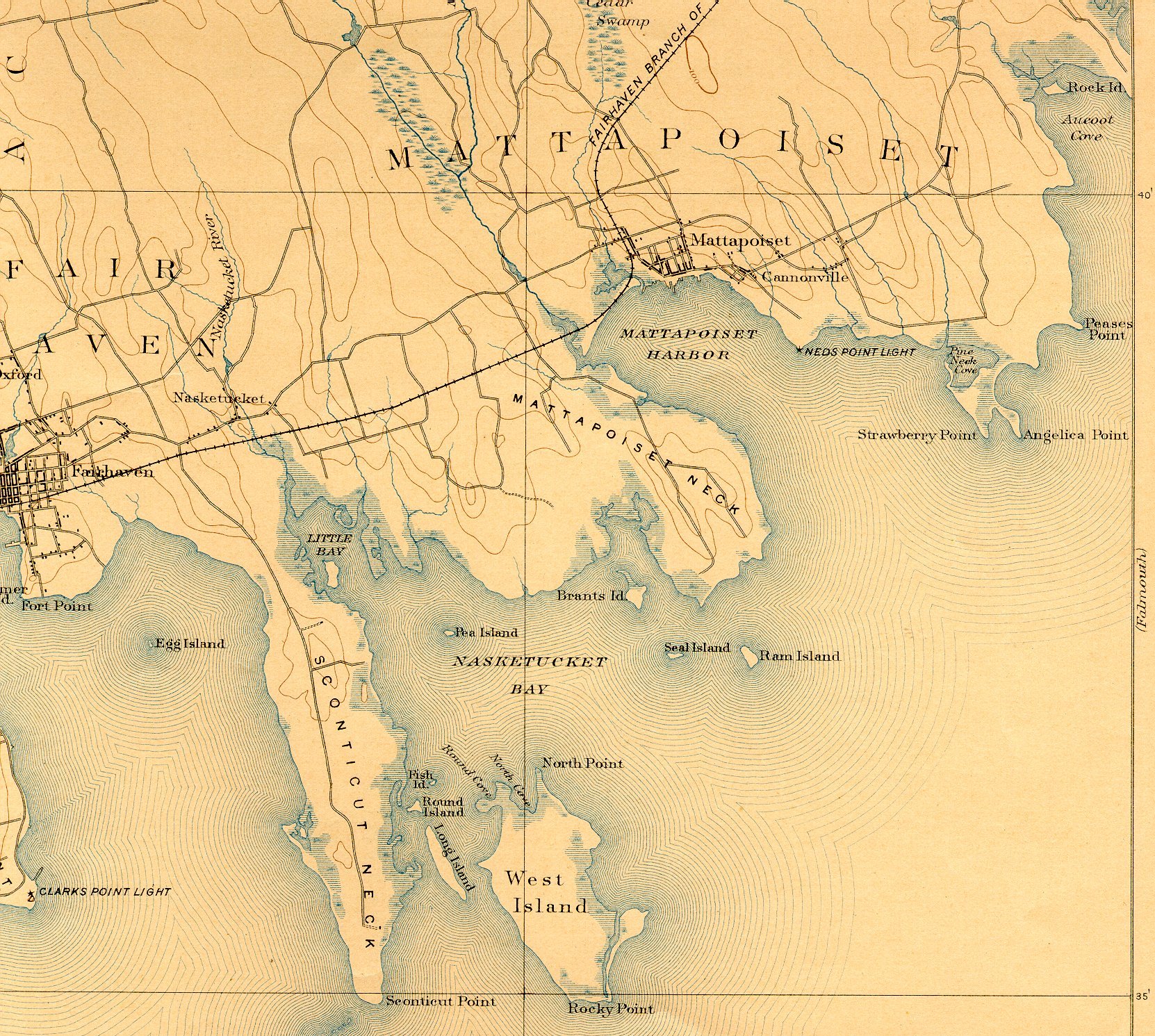
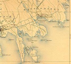
Nasketucket River and vicinity, 1893.

The Nasketucket River is a small river (stream) arising in Fairhaven, Massachusetts, and emptying about 3 miles downstream into Little Bay, a branch of Nasketucket Bay on Buzzards Bay.[1]

References

  1. ^ USGS quadrangle map


Wikimedia Foundation. 2010.

Игры ⚽ Поможем написать реферат

Look at other dictionaries:

  • Mystic River — For other uses, see Mystic River (disambiguation). Mystic River River …   Wikipedia

  • Neponset River — with Granite Avenue in background Basin countries United States Length 29 mi (47 …   Wikipedia

  • Charles River Reservation — Charles River Basin Historic District U.S. National Register of Historic Places U.S. Historic district …   Wikipedia

  • Nashua River Rail Trail — The Nashua River Rail Trail at the Groton School Pond in Groton, MA The Nashua River Rail Trail is a 12.5 mile (20.1 km) paved mixed use rail trail in northern Massachusetts and southern New Hampshire under control of the Massachusetts… …   Wikipedia

  • Mashpee River Reservation — is a park in Mashpee, Massachusetts on the Mashpee River. The Trustees of Reservations owns and maintains the park. Pristine shoreline, natural spawning areas, and excellent water quality make the Mashpee River one of Massachusetts finest sources …   Wikipedia

  • Connecticut River Greenway State Park — consists of a number of separate state land holdings in the Pioneer Valley of western Massachusetts. The park includes critical wildlife and plant habitat as well as areas providing public access to the Connecticut River. The Department of… …   Wikipedia

  • Charles River Peninsula — The Charles River Peninsula is a 30 acre (12 ha) nature preserve in Needham, Massachusetts owned and managed by the Trustees of Reservations. The Charles River turns nearly 180 degrees, creating the peninsula. A 20 acre (8 ha)… …   Wikipedia

  • Mystic River Reservation — The Mystic River Reservation is a publicly owned nature preserve located along the Mystic River in Massachusetts, United States. It forms part of the 75 square mile (190 km2) Mystic River Watershed, and runs through the towns of Arlington,… …   Wikipedia

  • Otter River State Forest — Coordinates: 42°37′27.24″N 72°4′39.39″W / 42.6242333°N 72.0776083°W / 42.6242333; 72.0776083 …   Wikipedia

  • List of rivers of Massachusetts — List of rivers in Massachusetts (U.S. state). All Massachusetts rivers flow to the Atlantic Ocean. The list is arranged by drainage basin from north to south, with respective tributaries indented under each larger stream s name, arranged… …   Wikipedia

Share the article and excerpts

Direct link
Do a right-click on the link above
and select “Copy Link”