- Limes Tripolitanus
-
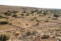
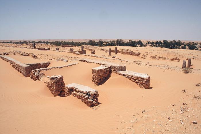
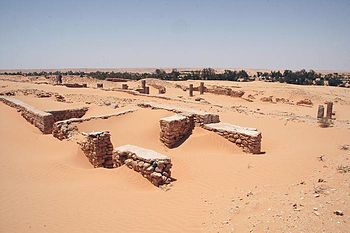 Photo of Roman castrum Golaia (actual Bu Njem) in the Limes Tripolitanus[1]
The Limes Tripolitanus was a frontier zone of defence of the Roman Empire, built in the south of what is now Tunisia and the northwest of Libya. It was primarily intended as a protection for the tripolitanian cities of Leptis Magna, Sabratha and Oea in Roman Libya.
Contents
History

This article is part of the series on:
Military of ancient Rome (portal)
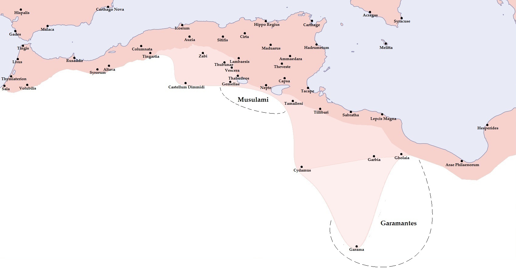
753 BC – AD 476Structural history Roman army (unit types and ranks, legions, auxiliaries, generals) Roman navy (fleets, admirals) Campaign history Lists of wars and battles Decorations and punishments Technological history Military engineering (castra, siege engines, arches, roads) Political history Strategy and tactics Infantry tactics Frontiers and fortifications (limes, Hadrian's Wall) The Limes Tripolitanus was built after Augustus. It was related mainly to the Garamantes menace. Septimius Flaccus in 50 AD did a military expedition that reached the actual Fezzan [2] and further south.
The Romans did not conquer the Garamantes so much as they seduced them with the benefits of trade and discouraged them with the threat of war. The last Garamantes foray to the coast was in AD 69, when they joined with the people of Oea (modern Tripoli) in battle against Leptis Magna.
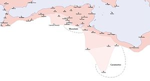 Faustus' campaigning between 197 and 202 AD greatly contributed to the expansion of the Limes Tripolitanus between Nepte and Golaia
The Romans intervened and marched south. According to Edward Bovill, author of the book "The Golden Trade of the Moors", this campaign marked the Romans’ first use of camels in the Sahara, which convinced the Garamantes that their advantage in desert warfare no longer held.
After that the Garamantes started to become a client state of the Roman Empire, but nomads always endangered the fertile area of coastal Tripolitania. Because of this Romans created the Limes Tripolitanus [3]
The first fort on the limes was built at Thiges, to protect from nomad attacks in 75 AD. The limes was expanded under emperors Hadrian and Septimius Severus, in particular under the legatus Quintus Anicius Faustus in 197-201 AD.
Indeed Anicius Faustus was appointed legatus of the Legio III Augusta and built several defensive forts of the Limes Tripolitanus in Tripolitania, among which Garbia [4] and Golaia (actual Bu Ngem)[5] in order to protect the province from the raids of nomadic tribes. He fulfilled his task quickly and successfully.
 Remnants of "Centenaria" at Suq al-Awty
As a consequence the Roman city of Ghirza, situated away from the coast and south of Leptis Magna, developed quickly in a rich agricultural area[6] Ghirza became a "boom town" after 200 CE, when the Roman emperor Septimius Severus (born in Leptis Magna) had organized the Limes Tripolitanus.
Former soldiers were settled in this area, and the arid land was developed.[7] Dams and cisterns were built in the Wadi Ghirza (then not dry like today) to regulate the flash floods. These structures are still visible[8]: there it is among the ruins of Ghirza a temple, which may have been dedicated to the berber semi-god "Gurzil", and the name of the town itself may even be related to his name.[9] The farmers produced cereals, figs, vines, olives, pulses, almonds, dates, and perhaps melons. Ghirza consisted of some forty buildings, including six fortified farms (centenaria). Two of them were really large. It was abandoned in the Middle Ages.
With Diocletian the limes was partially abandoned and the defence of the area was done even by the Limitanei, local soldier-farmers. The Limes survived as an effective protection until Byzantine times (Emperor Justinian restructured the Limes in 533 AD)[10].
Nomad warriors of the Banu Hillal tribe captured the centenaria/castra of the Limes in the XI century and the agricultural production fell to nearly nothing in a few decades: even Leptis Magna and Sabratha were abandoned and only Oea survived, which was from now on known as Tripoli.
In Libya today, very substantial remains survive, e.g., the limes castles at Bu Njem (ancient Golaia) and Gheriat el-Garbia, the frontier village Ghirza, and about 2,000 fortified farms (centenaria) like Gheriat.[11]
Some Forts (castrum)
- Ghadames (30°08′30.0″N 9°30′30.0″E / 30.14167°N 9.50833°E)
- Mizda (31°25′36″N 12°58′36″E / 31.42667°N 12.97667°E)
- Beni Ulid (31°45′29″N 13°59′32″E / 31.75806°N 13.99222°E)
- Bu Ngem (30°34′42.75″N 15°24′48.66″E / 30.5785417°N 15.4135167°E)
- Gheria (30°23′36.0″N 13°35′36.0″E / 30.39333°N 13.59333°E)
External links
- Jona Lendering (2006 (revised December 13, 2008)). "Limes Tripolitanus". Livius. http://www.livius.org/li-ln/limes/tripolitanus.html. Retrieved October 3, 2011.
- Jona Lendering (2006 (revised December 14, 2008)). "Wadi Buzra / Suq al-Awty". Livius. http://www.livius.org/bn-bz/buzra/buzra.html. Retrieved October 3, 2011.
- Jona Lendering; Marco Prins. "Photos from Libya". Livius. http://web.archive.org/web/20080405072449/http://www.livius.org/a/libya.html. Retrieved October 3, 2011.
- "Detailed map showing the Limes Tripolitanus at Tunisia-Libya border". Georgetown University. http://www9.georgetown.edu/faculty/jod/Picts/salama2.html. Retrieved October 3, 2011.
Further reading
- Bacchielli,L. La Tripolitania in "Storia Einaudi dei Greci e dei Romani" (Geografia del mondo tardo-antico). Einaudi Ed. Milano, 2008.
- Graeme Barker e.a., Farming the desert. The UNESCO Libyan Valleys Archaeological Survey (1996 Paris and Tripoli)
- Margot Klee, Grenzen des Imperiums. Leben am römischen Limes (2006 Stuttgart)
- Jona Lendering, 'Sherds from the Desert. The Bu Njem Ostraca' in: Ancient Warfare 1/2 (2007)
- David Mattingly, Roman Tripolitania (1995 London)
- Erwin Ruprechtsberger, Die römische Limeszone in Tripolitanien und der Kyrenaika, Tunesien - Libyen (1993 Aalen)
Notes
- ^ Livius.Org Golaia (Bu Njem)
- ^ Septimius Flaccus
- ^ Map of Limes tripolitanus
- ^ Gheriat el-Garbia
- ^ J.S. Wacher, The Roman world, Volume 1, Taylor & Francis, 2002, ISBN 0415263158, pp. 252-3
- ^ Jona Lendering (2006 (revised May 23, 2009)). "Ghirza: Town (Gh127)". Livius. http://www.livius.org/ga-gh/ghirza/ghirza.html. Retrieved October 3, 2011.
- ^ al_allgi (November 5, 2008). "Tarhuna: A map of the cultivated libyan lands in ancient times". Flickr. http://www.flickr.com/photos/23222457@N04/3006088026. Retrieved October 3, 2011.
- ^ "Ghirza National monuments". LookLex. http://lexicorient.com/libya/ghirza.htm. Retrieved October 3, 2011.
- ^ René Basset (1910). "Recherches Sur La Religion Des Berberes [Research on Berber Religion]". Revue de L’Histoire des Religions. http://www.scribd.com/doc/16819163/Recherches-Sur-La-Religion-Des-Berberes-1910. Retrieved October 3, 2011. (French)
- ^ Bacchielli, L. La Tripolitania, in "Storia Einaudi dei Greci e dei Romani", Geografia del mondo tardo-antico, vol.20
- ^ Jona Lendering (2006 (revised April 14, 2009)). "Gheriat esh-Shergia". Livius. http://www.livius.org/ga-gh/gheriat/gheriat_esh-shergia.html. Retrieved October 3, 2011.
See also
- Limes
- Limes Arabicus
- Roman Libya
- Garamantes
- Limitanei
- Roman expeditions to Sub-Saharan Africa
Categories:


Wikimedia Foundation. 2010.