- Argostoli
Infobox Greek Dimos
name = Argostoli
name_local = Αργοστόλι
periph =Ionian Islands
prefec = Kefalonia and Ithaka
population = 12589
population_as_of = 2001
area = 157.670
elevation =
lat_deg = 38
lat_min = 11
lon_deg = 20
lon_min = 29
postal_code = 281 00
area_code = 26710
licence = ΚΕ
mayor = Giorgos Tsilimidos
website = [http://www.argostoli.gr www.argostoli.gr]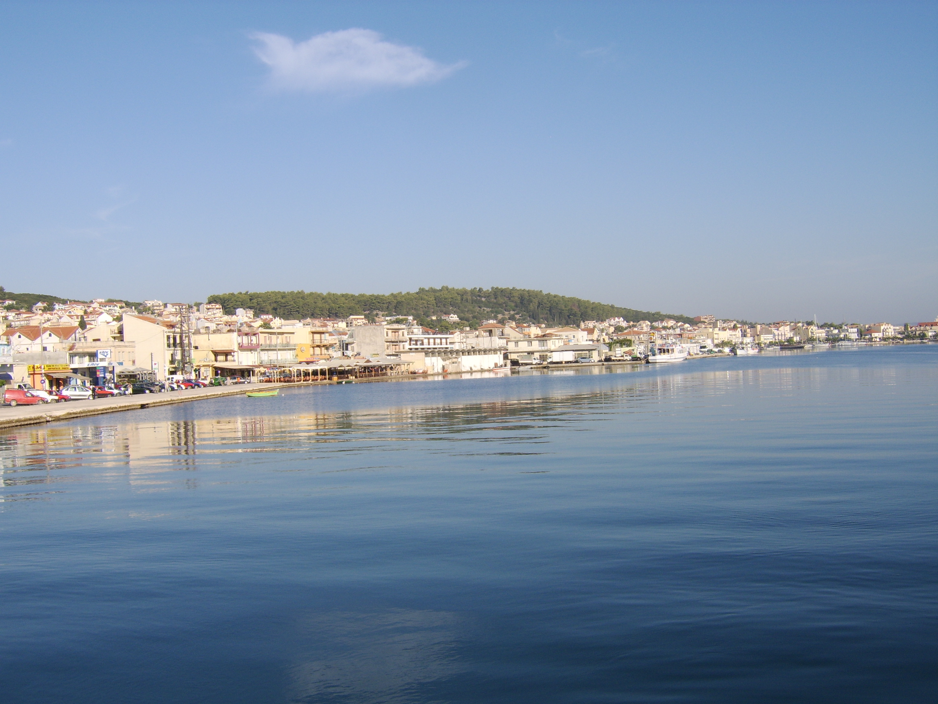
caption_skyline = A View from the Bridge
city_
city_
districts =
party =
since =
elevation_min = 0
elevation_max = 10Argostoli (Modern: _el. Αργοστόλι, Ancient/Katharevousa: -ον, "-on") has been the capital and administrative centre of
Kefalonia ,Greece , since 1757, following a population shift down from the old capital of Agios Georgios (also known as Kastro) to take advantage of the trading opportunities provided by the sheltered bay upon which Argostoli sits. Argostoli developed in to one of the busiest ports inGreece , leading to prosperity and growth, but between 1866 and 1999 the administrative borders changed little. Following the “Kapodistrias Law” of 1997, communities around the town united to form a larger Municipality of Argostoli, which now includes the settlements of Spilia, Helmata, Kompothekrata, Lassi, Minies and ten former communities: Agona, Davgata, Dilinata, Zola, Thinia, Kourouklata, Nifi, Troyiannata, Faraklata and Farsa. The 2001 census recorded a population of 12,589 in the Argostoli municipality. Its largest towns are Argostóli (pop. 9,037), Dilináta (739), Farakláta (411), and Kardakáta (362).Urban landscape
To the east of Argostoli, at the end of the bay, beneath the aforementioned Castle of St. George, sits the Koutavos Lagoon, a feeding ground for the Loggerhead turtles (Caretta caretta). Now a nature reserve, the Koutavos Lagoon was once an almost impassable
swamp wheremosquito es andmalaria were rife. Under the British governor of the island, General Sir Charles James Napier, a wooden bridge was constructed across thelagoon in 1813 by Colonel Charles Philip de Bosset, aSwiss engineer in the employ of the British army.Four years later stone arches were added and, after some 26 years, the entire bridge was rebuilt in stone. In continuous use until 2005, this narrow bridge is now closed to traffic, awaiting renovation by the Greek Ministry of Culture. Almost halfway along the Drepano Bridge stands a stone column built by the British to celebrate their presence.
The coastal road out of Argostoli to the west was known during the Venetian period as the ‘Piccolo Gyro’. Along the Piccolo Gyro, in the Vlikha area facing Lixouri, lie the ‘Swallow Holes’ of Katovothres, a geological phenomenon. Sea water disappears underground and travels under the island, re-emerging some fourteen days later in the Karavomylos area of Sami, having passed through the nearby, underground Melissani lake. The power of this sea water was harnessed, in 1835, to power a water mill. Further along the Piccolo Gyro is the Agion Theodoron lighthouse, named after the small adjacent church. More commonly known as the Fanari lighthouse, this too was built during the British occupation, in 1829. The original building was destroyed in the earthquake of 1953, the recently restored present structure was rebuilt, complete with Doric-style columns, from the original plans.
Buildings that weren’t shattered by German bombing in 1943 were destroyed in 1953 by the earthquake that razed virtually all of Kefalonia, apart from the
Fiskardo area, to the ground.Opposite the Archaeological Museum are the law courts, originally constructed by the British with stone from the Cyclopean site at nearby Krani. Along Lithostroto, next to the Catholic Church, is a tiny museum (open some mornings and most evenings) dedicated to the soldiers of the "Acqui Division". A little further along is the Bell Tower. Rebuilt in 1985 to house the original clock mechanism.
Municipal districts
*
Agkon
*Argostoli
**Kokolata
**Kompothekrata
**Minia
*Davgata
*Dilinata
*Faraklata
**Drapano
**Prokopata
**Razata
*Farsa
*Kardakata
*Kourouklata
*Nyfi
*Troianata
**Demoutsanata
**Mitakata
*ZolaNearest Places
*
Lassi (southwest)
*Peratata (southeast)Transportation
Between the Koutavos Lagoon and the Drepano Bridge is the new bus station which connects Argostoli with the other towns and some of the villages on the island, as well as with
Athens andPatras . The old bus station, just past these market stalls, is likely to accommodate a proposed seaplane service connecting Argostoli withPatras , due to commence Spring 2006. The main ferry port, connecting Argostoli with the mainland (viaKyllini ) andZakynthos (also known asZante ) is next to this building with the Lixouri ferry (once an hour in winter, twice an hour in summer) docking a little further along.* Car ferry service to
Kyllini (mainland) andZakynthos (Zante )
* Car ferry toLixouri
* KTEL Bus service toAthens , viaKyllini ,Patras and theCorinth Canal bridge
* Infrequent bus service to Poros, Sami, Skala, Fiskardo and various villages en route
* Frequent summer service to Lassi
* NO bus service to Kefalonia Airport
* Scheduled flights to Zakynthos and Athens, charter flight in summer, via Kefalonia Airport
* Seaplane service, Argostoli - Patras (due Spring 2006)
* Taxis from Plateia Valianos and seafront, car and motorcycle/scooter hireHistorical population:
People
*
Christian Zervos (1889-1970), art collector
*Ioannis Metaxas (1971-1941), dictator
*Antonis Tritsis (1937-1992), mayor of Athensee also
*
Communities of Kefalonia References
External links
* [http://www.argostoli.gr Municipality of Argostoli official website]
* [http://www.gtp.gr/LocPage.asp?id=6264 GTP - Argostoli]
* [http://www.gtp.gr/LocPage.asp?id=3263 GTP - Municipality of Argosoli]
*Coordinates: coord|38|10|27|N|20|29|19|E|type:city(12589)_region:GRGeographic Location (8-way)
Centre = Argostoli
North = Pylaris
Northeast =
East =Omalon
Southeast = Leivathos
South =Ionian Sea
Southwest =
West =Argostoli Gulf
Northwest =
Wikimedia Foundation. 2010.