- Olin's Covered Bridge
-
Olin's Bridge 
Locale Ashtabula County, Ohio, United States Design single span, Town truss Total length 115 feet (35.1 m) Construction begin 1873 
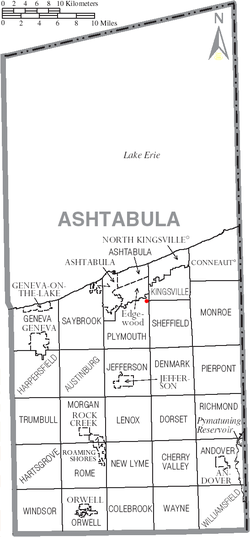
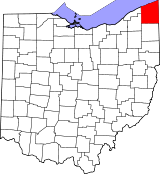
Olin's Bridge, or Olin Bridge, is a covered bridge that carries Dewey Road over the Ashtabula River in Plymouth Township, Ashtabula County, Ohio, United States. The bridge, one of currently 16 drivable bridges in the county, is a single span Town truss design, and is currently the only bridge in the county named for a family. The Olin family has owned property next to the bridge since it was built.[1] Members of the Olin family also operate a small museum and gift shop just east of the bridge at the house previously owned by Joyce Grandbouche. The bridge’s WGCB number is 35-04-03,[2] and it is located at 41°51′45.648″N 80°43′15.204″W / 41.86268°N 80.72089°W (41.86268, 80.72089)[3] approximately 3.6 mi (5.7 km) east of Ashtabula.
Contents
Directions to bridge
- From Interstate 90 exit 235, head south on State Route 193 approximately 1.6 miles.
- Turn right (west) on Plymouth Ridge Road (C-20) and continue 1.7 miles.
- Turn right (north) on Dibble Road (T-357) and continue 0.4 miles.
- Turn left (west) on Dewey Road (T-334) and continue 1.3 miles to the bridge.[4]
History
The Olin family owned land next to the bridge. Alson and Alvina (Bennett) Olin were a pioneering family, coming to this area in 1832 from New York. His son Alson Olin, bought land in 1860, next to where the bridge now sits.
Dimensions
- Length: 115 feet (35.1 m)
- Overhead clearance: 12 feet (3.7 m)
Gallery
See also
References
- ^ a b c http://www.coveredbridgefestival.org/bridges.htm Ashtabula County Ohio Covered Bridge Festival
- ^ http://www.dalejtravis.com/bridge/ohio/htm/3500403.htm Ohio Covered Bridges List, 35-04-03
- ^ http://mapper.acme.com/?ll=41.86268,-80.72089&z=14&t=H ACME Mapper 2.0
- ^ http://local.live.com/default.aspx?v=2&cp=41.866077~-80.692735&style=r&lvl=14&tilt=-90&dir=0&alt=-1000&rtp=pos.qz8h1x88b16f_Origin~pos.qz9dk1885xx6_Destination Windows Live Local
External links
- Olin's Covered Bridge is at coordinates 41°51′46″N 80°43′15″W / 41.86268°N 80.72089°WCoordinates: 41°51′46″N 80°43′15″W / 41.86268°N 80.72089°W
- Ohio Covered Bridges List
- Ohio Covered Bridge Homepage
- The Covered Bridge Numbering System
- Ohio Historic Bridge Association
- Olin's Covered Bridge from Ohio Covered Bridges, Historic Bridges
- Olin Family Society (OFS)
Categories:- Covered bridges in Ashtabula County, Ohio
- Bridges completed in 1873
- Road bridges in Ohio
Wikimedia Foundation. 2010.


