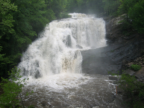
- Bald River
Infobox River
river_name = Bald River

caption = Bald River Falls as seen from a bridge over the river.
origin =
mouth =Tellico River inMonroe County, Tennessee
basin_countries =USA
length =
elevation =
mouth_elevation = 1,348 ft (411 m) Gnis|1327494|Bald River]
discharge =
watershed = The Bald River is ariver located inMonroe County, Tennessee in theCherokee National Forest . It is a tributary of theTellico River . Just before it empties into the Tellico, the river falls over a large waterfall,Bald River Falls , which is variously reported as being between 80 and 100 feet (25 and 30 m) high. The river then flows under a bridge on Forest Service Road 120 (the falls and the river mouth are both very readily visible from the bridge). The falls is regarded as the most impressive and scenic waterfall inEast Tennessee . The river is short in length but powerful as it flows through a steep, densely wooded valley and it is constantly replenished by the area's frequent rains. It rises just north of theNorth Carolina state line near the crest of theUnicoi Mountains and flows northeast for a short distance before turning to the northwest.The forests of the Bald River basin and the Tellico River basin were almost completely logged by the
Babcock Lumber Company during the early 20th century, from their local base of operation at Tellico Plains. The present road up the Tellico River was built on the old logging railroad bed built by Babcock. The Bald River and convert|3721|acre|km2 of its watershed are now part of the Bald River Gorge Wilderness, designated as awilderness area by the U.S. Forest Service in 1984.References
Wikimedia Foundation. 2010.
