Northmavine

Northmavine

Northmavine (Old Norse: Norðan Mæfeið, meaning "the land North of the Mæfeið isthmus (Mavis Grind)") is a peninsula of Shetland in Scotland. It is in the north west of the island, and contains the villages of Hillswick, Ollaberry, and North Roe. The peninsula includes the northernmost part of Mainland, and the civil parish, spelt Northmaven, comprises a number of adjacent islands, and measures 16 miles (26 km) by 8 miles (13 km).

An isthmus, Mavis Grind, about a hundred yards across, forms the sole connection with the rest of Mainland.

The coast is indented by numerous bays and consists largely of high, steep rocks. It has a number of high, fissured, cavernous cliffs on the west coast and consists of many skerries, islets, and offshore rocks.

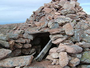
The interior has a very small amount of arable land; it consists mostly of rough, rising ground, including Ronas Hill, the highest point in all Shetland.

Remains of ancient watch houses and remains of barrows and forts are numerous.

References

This article incorporates text from - Wilson, Rev. John The Gazetteer of Scotland (Edinburgh, 1882) Published by W. & A.K. Johnstone

Coordinates: 60°30′N 1°24′W / 60.5°N 1.4°W / 60.5; -1.4


Wikimedia Foundation. 2010.

Игры ⚽ Поможем написать реферат

Look at other dictionaries:

  • Northmavine —    NORTHMAVINE, a parish, in the Mainland district, county of Shetland, 30 miles (N. W. by N.) from Lerwick; containing, with the hamlet of Hillswick, 2504 inhabitants. This is a peninsula of nearly triangular form, joined to the remaining… …   A Topographical dictionary of Scotland

  • Northmavine — 60°30′N 1°24′W / 60.5, 1.4 …   Wikipédia en Français

  • Uyea, Northmavine — Infobox Scottish island latitude=60.62 longitude= 1.43 GridReference=HU313929 celtic name= norse name= ve øy meaning of name= possibly Old Norse for island of the sacred place area=45 area rank=200= highest elevation=70 m Population= 0 population …   Wikipedia

  • Ronas Hill — or Rönies Hill gbm4ibx|HU305835; appears in various spellings) is the highest point of Mainland, Shetland, and the entire Shetland archipelago.cite book| author=Haswell Smith, Hamish| year=2004| title=The Scottish Islands| location=Edinburgh|… …   Wikipedia

  • Список Шетландских островов — Шетландский архипелаг …   Википедия

  • Shetland — For other uses, see Shetland (disambiguation). Shetland Sealtainn …   Wikipedia

  • Mainland, Shetland — Location OS grid reference …   Wikipedia

  • Brae — Infobox UK place official name= Brae country= Scotland population= 660 [cite web|publisher=Scotland s Census Results Online|title =Comparative Population Profile: Brae Locality | url=http://www.scrol.gov.uk/scrol/browser/profile.jsp?profile=Popula… …   Wikipedia

  • Tom Anderson (fiddler) — Dr. Tom (Tammie) Anderson MBE, (1910 1991) was a renowned Shetland fiddler and teacher. He was affectionately known to his peers as Muckle Tammie (Big Tommy). Dr. Tom Anderson was known to many in Shetland as the saviour of Shetland s musical… …   Wikipedia

  • Esha Ness Lighthouse — Infobox lighthouse|name= Esha Ness Lighthouse location= Northmavine peninsula, Shetland, Scotland caption= coordinates = 60°29.3’N 01°37.6’W yearbuilt = yearlit= 1929 yeardeactivated= automated= 1974 intensity= 46,500 CD elevation= 61 m range= 46 …   Wikipedia

Share the article and excerpts

Direct link
Do a right-click on the link above
and select “Copy Link”