- Ordinary high water mark
-
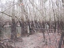 Floodplain of the Lynches River, Johnsonville, South Carolina. The sharp distinction in shading on the tree trunks shows the ordinary high water mark.
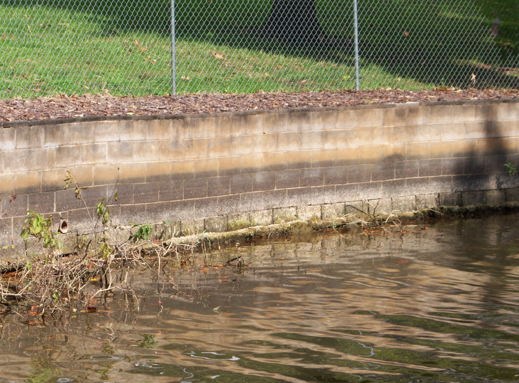
 High Rock Lake high water mark as shown on a block wall.
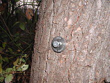 This USGS survey marker is designed to be a standard nail to be used by the USGS to mark high-watermarks, set reference points, set bench marks, set reference marks, and turning points for levels. This nail is designed to be recovered at later dates without any question that the nail was set by the USGS.
Ordinary high water mark refers to the highest level reached by a body of water that has been maintained for a sufficient period of time to leave evidence on the landscape. It may be indicated by destruction of terrestrial vegetation, the presence of marks on trees (see image at right) or debris deposits. It is usually the point at which natural vegetation shifts from predominately hydrophytic (water-dependent) species to terrestrial species.
The U.S. state of Wisconsin has a public trust doctrine that makes rivers and lakes public resources held in trust by the state as the common property of all citizens. In the case of lakes, the ordinary high water mark establishes the boundary between public jurisdiction and private property.
See also
References
- Diana Shooting Club v. Husting, 145 NW 816, 820 (Wis. 1914)
- Wisconsin Department of Natural Resources
- Minnesota Department of Natural Resources
- A Model Wetlands Ordinance for Indiana Communities
Categories:- Hydrology
- Lakes
- Rivers
- Riparian
- Wetlands


Wikimedia Foundation. 2010.