- Daisy Nook
-
Daisy Nook is a country park in Failsworth, Greater Manchester, England. The park runs through the Medlock Valley in an area once called Waterhouses. Waterhouses was one of three 'houses' in the Failsworth area, the other two being Millhouses (now Clayton Bridge) and Woodhouses.
Contents
History
The name Daisy Nook came from a book by Benjamin Brierley titled 'A day out' or 'A Summer Ramble'. Brierley asked his friend Charles Potter, an Oldham Artist, to draw an imaginary place called Daisy Nook. Potter came to nearby Waterhouses to complete his drawing - and from then on the area was known as Daisy Nook.
Brierley's description of Daisy Nook was 'Two Banks seemed to have opened to receive a group of neat whitewashed cottages and after filling them with happiness, surrounded them with a curtain of trees, to shelter them from the outside world. Most of the cottages have gardens attached, growing flowers and vegetables, and there a small orchard displaying its ripening apples'.
Most of Daisy Nook now belongs to the National Trust after it was left to them by the late James Lublam, J.P. 'in order that the fields and woods be kept as a pleasure area'. The park is maintained by Oldham Metropolitan Borough Council.
Daisy Nook hosts an annual Easter Fair along Stannybrook Road.
Crime Lake
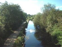
Crime Lake is halfway between Woodhouses and the Visitors' Centre and forms part of the Country Park. It resulted from canal works at the time construction in 1794 . As built, the canal severed the course of a brook and a culvert was made below the canal to accommodate this. A landslip blocked this and the waters were impounded on the offside of the canal. The new lake and canal became one and the lake was officially known as Crime Bank Reservoir but it is far better known by its later name of Crime Lake. The lake has always been a focal point and attracts visitors with its beautiful scenery and wildlife.
A popular pastime is to feed the geese and ducks on the lake. They are so used to the public that their friendliness may surprise you!
Hollinwood Branch Canal
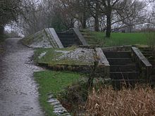
Daisy Nook is centred around the disused Hollinwood Branch Canal. The canal ran from Fairfield in nearby Droylsden to Hollinwood and opened in 1797. It runs through Daisy Nook, Woodhouses and Failsworth before entering Hollinwood in Oldham. The canal also has a branch which ran to Bardsley in Oldham, known as the Fairbottom Branch Canal.
The canal and series of aqueducts are the centre of a campaign to restore the waterway by the Hollinwood Canal Society[1], which is run by local residents and waterway enthusiasts.
Painting of the park by L. S. Lowry
On 8 June 2007 a 1946 work by L. S. Lowry entitled "Good Friday, Daisy Nook" was sold for £3,772,000, the highest price paid for one of his paintings at auction. The painting depicts the park in party mood a year after World War II.[2]
See also
References
- ^ Hollinwood Canal Society
- ^ "Lowry work fetches record £3.8M". BBC Online. 2007-06-08. http://news.bbc.co.uk/1/hi/entertainment/6735087.stm. Retrieved 2008-01-16.
External links
- Ashton-under-Lyne's website featuring photos and information on Daisy Nook.
- Website run by the local Labour Party with lots of interesting facts and historical information.
- Website of the Hollinwood Canal Society, a group dedicated to reopening and restoring the Hollinwood Branch Canal which runs through the park.
- Events and activities at Daisy Nook by Oldham Council, updated on a regular basis.
Categories:- Parks and commons in Oldham
- Country parks in Greater Manchester
Wikimedia Foundation. 2010.


