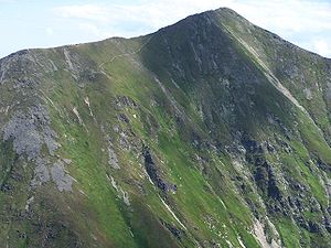
Быстра — словацк. Bystrá … Википедия
West-Tatra — 49.219.752248Koordinaten: 49° 12′ N, 19° 45′ O Die Westtatra (auch Westliche Tatra, slowak. Západné Tatry, poln. Tatry Zachodnie) ist ein Gebirge an der Grenze … Deutsch Wikipedia
Westliche Tatra — 49.219.752248Koordinaten: 49° 12′ N, 19° 45′ O Die Westtatra (auch Westliche Tatra, slowak. Západné Tatry, poln. Tatry Zachodnie) ist ein Gebirge an der Grenze … Deutsch Wikipedia
Zapadne Tatry — 49.219.752248Koordinaten: 49° 12′ N, 19° 45′ O Die Westtatra (auch Westliche Tatra, slowak. Západné Tatry, poln. Tatry Zachodnie) ist ein Gebirge an der Grenze … Deutsch Wikipedia
Západné Tatry — 49.219.752248Koordinaten: 49° 12′ N, 19° 45′ O Die Westtatra (auch Westliche Tatra, slowak. Západné Tatry, poln. Tatry Zachodnie) ist ein Gebirge an der Grenze … Deutsch Wikipedia
Iglesias de madera de los Cárpatos — Iglesias de madera de los Cárpatos1 Patrimonio de la Humanidad Unesco Iglesia católica en Hervartov … Wikipedia Español
Carpathian Wooden Churches — Infobox World Heritage Site WHS = Wooden Churches of the Slovak part of the Carpathian Mountain Area State Party = Slovakia Type = Cultural Criteria = iii, iv ID = 1273 Region = Europe and North AmericaCore Area 2.5644 ha Year = 2008 Session =… … Wikipedia
Tatra Mountains — The Tatra Mountains, Tatras or Tatra (Tatry in both Polish and Slovak), constitute a mountain range which forms a natural border between Poland and Slovakia. They occupy an area of 750 km², the major part (600km²) of which lies in Slovakia. The… … Wikipedia
Tatra National Park, Slovakia — Infobox protected area | name = Tatra National Park Tatranský národný park iucn category = II caption = Western Tatras location = Tatra mountains, North Central Slovakia lat degrees = 49 lat minutes = 10 lat seconds = 49 lat direction = N long… … Wikipedia
Prešov Region — Geobox | Region name = Prešov category = Region image caption = image caption = symbol = symbol type = etymology = official name = motto = nickname = country = Slovakia country state = region = district = commune = municipality = border = part… … Wikipedia

