- Hubina
Geobox | Settlement
name = Hubina
other_name =
category = Village
image_caption =
symbol =
etymology =
official_name =
motto =
nickname =
country = Slovakia
country_
state =
region = Trnava
district = Piešťany
commune =
municipality =
part =
river =
location =
elevation = 200
lat_d = 48
lat_m = 37
lat_NS = N
long_d = 17
long_m = 53
long_s = 16
long_EW = E
coordinates_type = region:SK_type:city
highest =
highest_elevation =
highest_lat_d =
highest_long_d =
lowest =
lowest_elevation =
lowest_lat_d =
lowest_long_d =
area = 26.84
area_round = 2
population = 480
population_date = 2004-12-31
population_density = auto
established = 1353
established_type = First mentioned
mayor =
timezone =
timezone_DST =
postal_code = 922 21
area_code = +421-33
code = PN
code_type = Car plate
free =

map_background = Slovakia - background map.png
map_locator = Slovakia
map1 = Trnava Region - outline map.svg
map1_size = 160
map1_background = Trnava Region - background map.png
map1_locator = Trnava Region
commons =
statistics = [http://www.statistics.sk/mosmis/eng/prvav2.jsp?txtUroven420204&lstObec556581&Okruhzaklad MOŠ/MIS]
website =
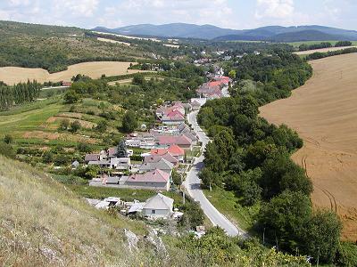
footnotes =Hubina is a
village andmunicipality inPiešťany District in theTrnava Region of westernSlovakia .History
In historical records the
village was first mentioned in1353 .Geography
The
municipality lies at analtitude of 200metres and covers anarea of 26.843km². It has apopulation of about 480 people.External links


Wikimedia Foundation. 2010.