- Chunggang
-
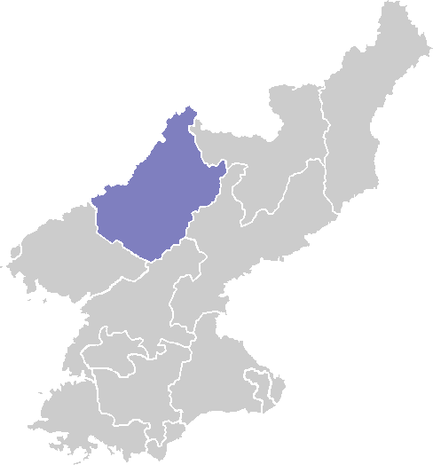
Chunggang Chosŏn'gŭl 중강군 Hancha 中江郡 McCune–Reischauer Chunggang kun Revised Romanization Junggang-gun Statistics Area 620 km2 (239.4 sq mi) Population (1991) 33,000 (est.) Population density 53.2/km2 (137.9/sq mi) Administrative divisions 1 ŭp, 1 workers' district, 8 ri Chunggang is a kun, or county, in northern Chagang province, North Korea. It was originally part of Huchang county in Ryanggang, and for that reason older sources still identify it as being part of Huchang. The county seat was originally known as Chunggangjin (중강진), but is now known as Chunggang ŭp. Chunggang looks across the Yalu River at China, and borders Ryanggang province to the south.
The climate of Chunggang is continental, with extremely cold winters. On January 12, 1933, a temperature of -43 °C was recorded at Chunggangjin. [1] The average January temperature is -19.5 °C, with temperatures rising to a July average of 22.5 °C.
It has been reported that a Taepodong missile base was constructed in Chunggang in the early 1990s, and that its missiles are targeted at Okinawa.[2]
Contents
Notes
- ^ Bukhan Yeonguso (1983), p. 49.
- ^ "Chunggang-up". GlobalSecurity.org. http://www.globalsecurity.org/wmd/world/dprk/chunggang-up.htm. Retrieved 2006-11-11.
References
- Bukhan Yeonguso (1983). 북한총람 [Bukhan chongram]. Seoul: Author.
See also
External links
- Climatological data
- (Korean) In Korean language online encyclopedias:
Chagang Capital 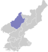
Cities Counties Categories:- Counties of Chagang
- North Korea geography stubs
Wikimedia Foundation. 2010.