- Beavertail Lighthouse
Infobox_nrhp | name =Beavertail Light
nrhp_type =
caption =
nearest_city=Jamestown, RI
area =
built =1856
architect= Unknown
architecture= No Style Listed
added =December 12 ,1977
governing_body =United States Coast Guard
mpsub=Lighthouses of Rhode Island TR (AD)
refnum=77000024 cite web|url=http://www.nr.nps.gov/|title=National Register Information System|date=2007-01-23|work=National Register of Historic Places|publisher=National Park Service]Beavertail Lighthouse, built in
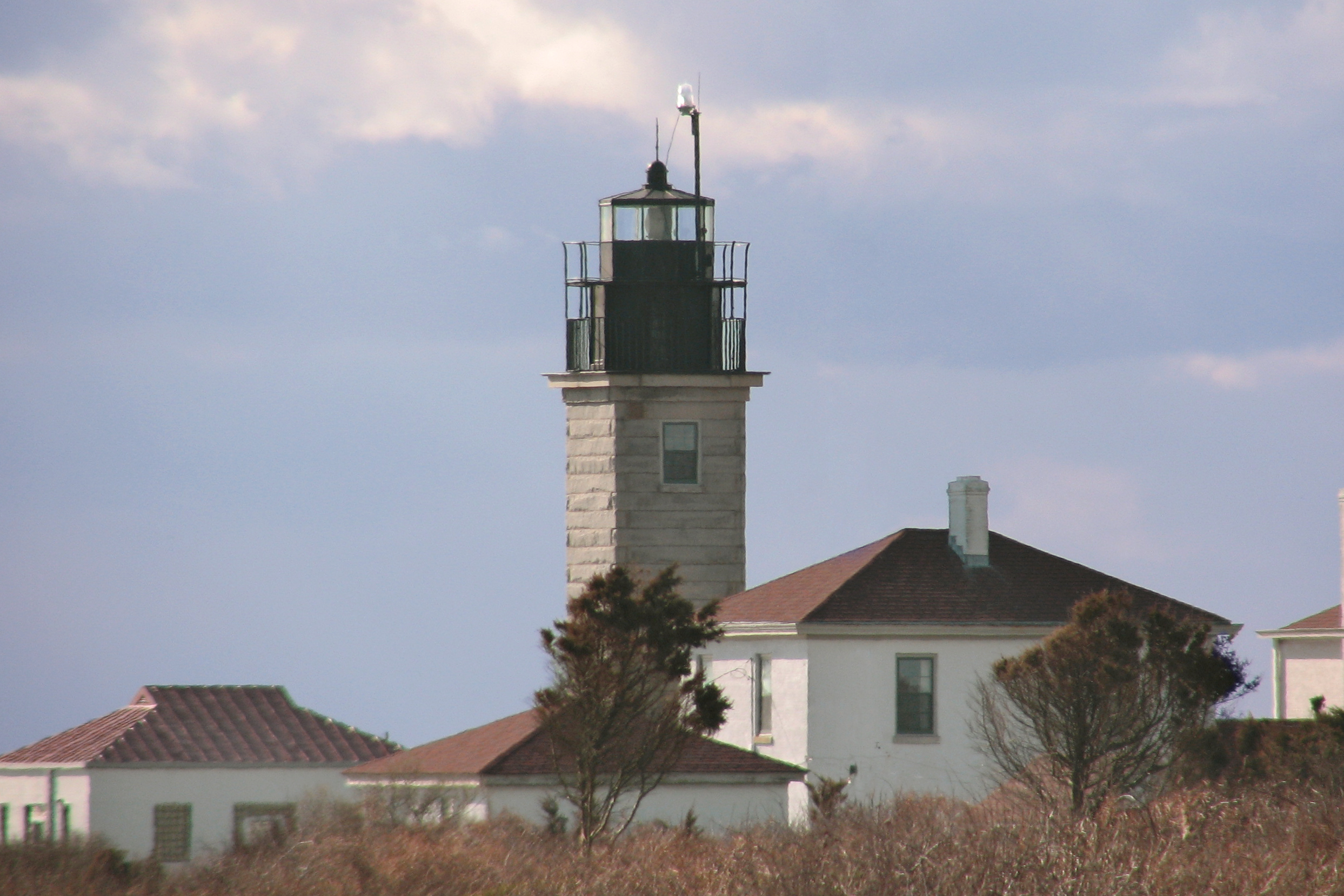
1749 , was and still is the premier lighthouse inRhode Island ,USA , especially for entrance intoNarragansett Bay . The 45 foot lighthouse lies on the southernmost point ofConanicut Island in the town ofJamestown, Rhode Island inBeavertail State Park . The light has been reconstructed multiple times since its erection, most recently after theHurricane of 1938 . Restoration projects have come and gone since. The light provides navigation for boats and ships enteringNarragansett Bay in theEast Passage betweenConanicut Island andNewport, Rhode Island onAquidneck Island . Other lighthouses, such asCastle Hill Lighthouse ,Point Judith Light , andRose Island Light are visible from Beavertail Lighthouse.Its white light rotates
counterclockwise and makes a full rotation in about six or seven seconds. The light is on 24 hours per day, unlike many lighthouses that are near it. It has a loudfoghorn that blasts about every 30 seconds during thefog .History
Prior to the establishment of a lighthouse at Bevertail, local native Americans would keep pitch fires burning, to warn sailors away from the rocky coastline. In 1749, a wooden tower was built, and the light (which was then known as "Newport light") became the third lighthouse established in the colonies, preceded only by
Boston Light in Boston Harbor, andBrant Point Light , Nantucket. A fire was lit at the top of the tower, as was common for the time. Four years later it burned down and was replaced by a stone tower.In 1779, as British sailors retreating from Newport near the end of the
American Revolutionary war , they left a trail of destruction behind them. This included burning the lighthouse and removing the optics, which left the light dark for the rest of the war.In
1856 , the tower was again replaced with what is now the current tower, made of granite which is 10 ft square, and 64 feet from ground to beacon. A 3rd orderFresnel lens was placed and over the next forty years it was the site of numerous fog-signal tests, under the supervision of the United State Lighthouse board. In 1898 quarters for an assistant keeper were added to the keeper's house, the assistant helped, among other things, with fog-signaling.During the 1938 hurricane, the whistle house was destroyed, revealing the original base for the 1749 structure, which sits 100 feet from the current tower. A few miles southwest of Beavertail point, whale rock can be seen, resembling a submarine attempting to surface.
Whale Rock Lighthouse , and its keeper, Walter Eberle, were swept into the waters of Narragansett bay during the hurricane of 1938; Eberle's body was never recovered.In 1939, the
US Coast guard took command of all lighthouses and navigational aids, and in 1989 Beavertail light was automated, as part of a program by the Coast Guard, which ended the job the keeper at all stations except for Boston light, which to this day, remains the only manned lighthouse in America.In
1989 , following a joint effort by the US Coast Guard, Rhode Island Parks Management, the Rhode Island Department of Environmental Management, and the town of Jamestown, the building was restored and reopened to the public. In1993 , BLMA (Beavertail Lighthouse Museum Association) was established to oversee the operations of the museum. To this day it continues its efforts in restoring and preserving the light, and surrounding areas, as well as educating the public.References
External links
* [http://www.beavertaillight.org/ Official website]
Wikimedia Foundation. 2010.