Crookhill Brick Pit — (grid reference SY644798) is a 4.77 hectare biological and geological Site of Special Scientific Interest in Dorset, notified in 2003. It supports a large population of Great Crested Newts. Source English Nature citation sheet for the site… … Wikipedia
Ryton, Tyne and Wear — infobox UK place country = England official name= Ryton latitude= 54.9729 longitude= 1.7634 population = around 8,000 metropolitan borough= Gateshead metropolitan county= Tyne and Wear region= North East England constituency westminster= Blaydon… … Wikipedia
Billy Ayre — Football manager infobox playername = Billy Ayre fullname = William Ayre nickname = dateofbirth = birth date|1952|5|7|mf=y cityofbirth = Crookhill countryofbirth = England dateofdeath = death date and age|2002|4|16|1952|5|7 cityofdeath = Ormskirk … Wikipedia
Thomas Hardy — This article is about the novelist and poet. For other uses, see Thomas Hardy (disambiguation). Thomas Hardy Born 2 June 1840(1840 06 02) Stinsford, Dorchester, Dorset, England … Wikipedia
Chesil Beach — Coordinates: 50°36′14″N 2°30′58″W / 50.604°N 2.516°W / 50.604; 2.516 … Wikipedia
Metropolitan Borough of Gateshead — Metropolitan borough Gateshead Council Building, the seat of the Borough Council … Wikipedia
Cerne Abbas — Cerne redirects here. For other uses, see Cerne (disambiguation). Coordinates: 50°48′34″N 2°28′52″W / 50.8095°N 2.4810°W / 5 … Wikipedia
Blaydon (UK Parliament constituency) — UK constituency infobox Name = Blaydon Map1 = Blaydon Map2 = TyneWear Type = Borough Year = 1918 Entity = Tyne and Wear County = Tyne and Wear EP = North East England MP = David Anderson Party = LabourBlaydon is a constituency represented in the… … Wikipedia
List of places in Tyne and Wear — This is a list of cities, towns and villages in the ceremonial county of Tyne and Wear, England. See the list of places in England for places in other counties.compactTOC NOTOC AAlbany, Annitsford, Ashbrooke, Ayton, Abbey Farm, Abbey Grange,… … Wikipedia
Crook Hill — The twin summits of Crook Hill above Ladybower Reservoir Elevation 382 m (1,253 … Wikipedia
 Crookhill
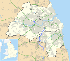
 Crookhill shown within Tyne and Wear