- San Francisco de los Romo
Infobox Settlement
name = San Francisco de los Romo
settlement_type =Municipality
other_name =
native_name =
nickname =
motto =
imagesize =
image_caption =
flag_size =
image_
seal_size =
image_shield =
shield_size =
image_blank_emblem =
blank_emblem_type =
blank_emblem_size =
mapsize =
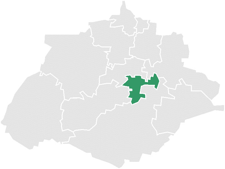
map_caption = Municipality location in Aguascalientes
mapsize1 =
map_caption1 =
image_dot_
dot_mapsize =
dot_map_caption =
dot_x = |dot_y =
pushpin_
pushpin_label_position =bottom
pushpin_mapsize =280
pushpin_map_caption =Location in Mexico
subdivision_type = Country
subdivision_name = flag|Mexico
subdivision_type1 = State
subdivision_name1 =Aguascalientes
subdivision_type2 =
subdivision_name2 =
subdivision_type3 =
subdivision_name3 =
subdivision_type4 =
subdivision_name4 =
government_footnotes =
government_type =
leader_title =
leader_name =
leader_title1 =
leader_name1 =
leader_title2 =
leader_name2 =
leader_title3 =
leader_name3 =
leader_title4 =
leader_name4 =
established_title =
established_date =
established_title2 =
established_date2 =
established_title3 =
established_date3 =
area_magnitude =
unit_pref =Imperial
area_footnotes =
area_total_km2 = 134.07
area_land_km2 =
area_water_km2 =
area_total_sq_mi =
area_land_sq_mi =
area_water_sq_mi =
area_water_percent =
area_urban_km2 =
area_urban_sq_mi =
area_metro_km2 =
area_metro_sq_mi =
area_blank1_title =
area_blank1_km2 =
area_blank1_sq_mi =
population_as_of =2005
population_footnotes =
population_note =
population_total =28,832
population_density_km2 =
population_density_sq_mi =
population_metro =13,262
population_density_metro_km2 =
population_density_metro_sq_mi =
population_urban =
population_density_urban_km2 =
population_density_urban_sq_mi =
population_blank1_title =Ethnicities
population_blank1 =
population_blank2_title =Religions
population_blank2 =
population_density_blank1_km2 =
population_density_blank1_sq_mi =
timezone =
utc_offset =
timezone_DST =
utc_offset_DST =
latd=22 |latm=05|lats= |latNS=N
longd=102|longm=16|longs=|longEW=W
elevation_footnotes =
elevation_m =
elevation_ft =
postal_code_type =
postal_code =
area_code =
blank_name =
blank_info =
blank1_name =
blank1_info =
website =
footnotes =San Francisco de los Romo is a town and its surrounding municipality of the same name in the
Mexican state ofAguascalientes . It stands at coord|22|05|N|102|16|W| in the central part of the state. The town, which is the sixth-largest community in the state, is located at the northwest corner of the municipality and serves as its municipal seat. It had a 2005 census population of 13,262 inhabitants. The municipality, which has an area of 134.07 km² (51.76 sq mi), reported a population of 28,832.References
* [http://www.inegi.gob.mx/est/contenidos/espanol/sistemas/conteo2005/localidad/iter/ Link to tables of population data from Census of 2005] INEGI: Instituto Nacional de Estadística, Geografía e Informática
* [http://www.e-local.gob.mx/wb2/ELOCAL/EMM_aguascalientes Aguascalientes] Enciclopedia de los Municipios de MéxicoExternal links
* [http://www.sanfranciscodelosromo.gob.mx/ Ayuntamiento de San Francisco de los Romo] Official website
* [http://www.aguascalientes.gob.mx/ Gobierno del Estado de Aguascalientes] Official website of State of Aguascalientes
Wikimedia Foundation. 2010.

