- Cova Joana
-
Cova Joana
Kova JuanaStatistics Island: Brava Municipality: Brava Distance from the island capital: about 2 to 3 km south Vila Nova Sintra Area code: - Cova Joana (ALUPEC or ALUPEK: Kova Juana, Brava Creole: same name), is a village in the central part of the island of Brava, Cape Verde.
Contents
Geography
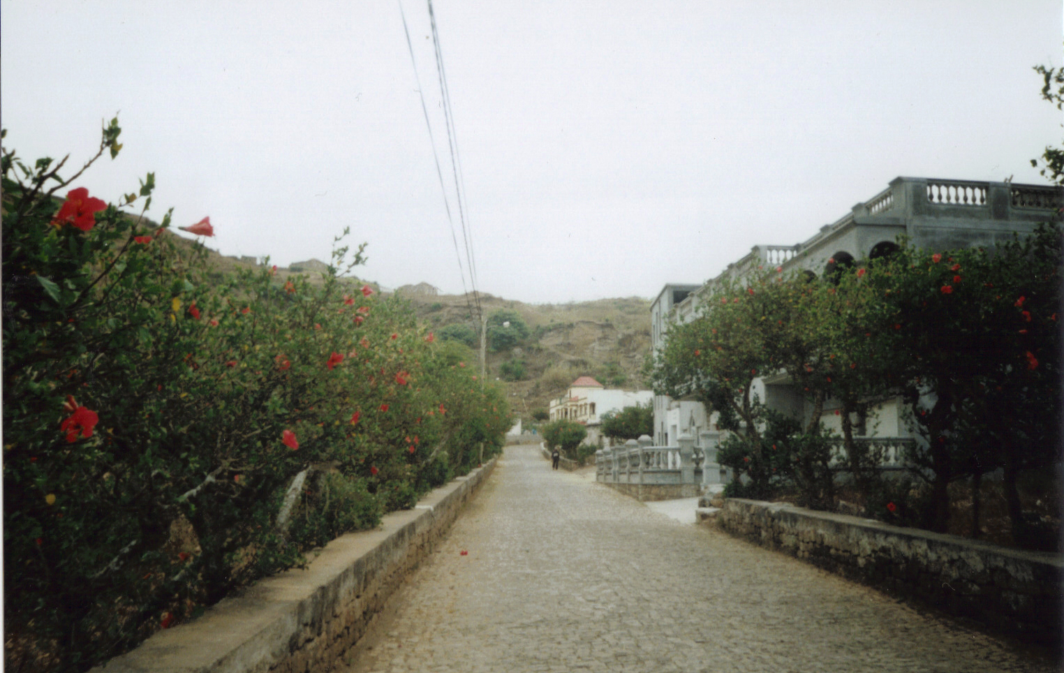
 Cova Joana, Main Street.
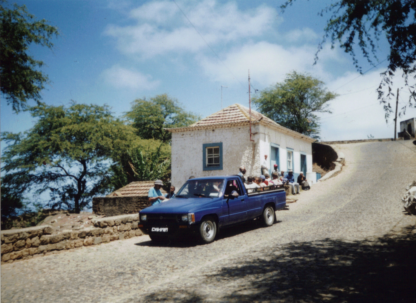
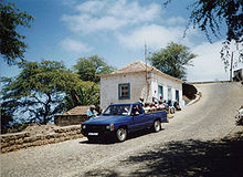 Aluguer bus on Brava.
Cova Joana is in the mountains nearly exactly in the middle of the island in a depression. The name of the village refers to the location, as the creole word cova means crater, depression or valley.[1] The village is linked by a good paved road to Vila Nova Sintra, the capital of Brava which is about seven kilometers away, and to Nossa Senhora do Monte, a pilgrimage place which is about one kilometer to the South. The small harbour Fajã de Água on the West coast can be reached on a beautiful walking track as well as the Fontainhas, the highest mountain of Brava reaching a height of 976 meters.
Brava is known as the greenest island of Cape Verde. Frequently Brava is covered by clouds, so that evaporization is comparatively low and the island can keep its humidity.[2] Humidity is kept even longer in the depression of Cova Joana, where agriculture (especially maize, bananas and beans) is the main source of income. Many houses have a garden where vegetables are grown.
Sights
The main street of Cova Joana is a picturesque tree-lined avenue with tall hibiscus bushes. Several new houses in the village were built in the traditional style of sobrados, i.e. large colonial houses of wealthy land-owners.
Raúl de Pina, one of the most important musicians of Cape Verde, lived in Cova Joana. He had more than 30 children and he even owned a stradivari.[3] His house is on the right side of the main street and it can be visited after appointment.[4] Raúl de Pina was a friend of Eugénio Tavares (1867-1930), an important writer and composer of Cape Verde who also lived on Brava.
Infrastructure
There is a small shop, a restaurant and a guesthouse (pensão) in Main Street. Cova Joana has a school, but no church. In the neighbouring village of Nossa Senhora do Monte which can easily be reached on foot or by bus, there are some more shops and a sightworthy pilgrimage church which was founded in 1826.
Traffic connections
Several times a day, Cova Joana can be reached from Vila Nova de Sintra and from Nossa Senhora do Monte by "Aluguer" busses. There is, however, no fixed schedule, as the busses depart as soon as there are enough passengers.
Nearest settlements
- Vila Nova Sintra, northeast
- Nossa Senhora do Monte, south
- Fajã de Água, west
References
- ^ Reitmeier, Pitt: Cabo Verde, p. 416. Bielefeld 2009.
- ^ Reitmeier, Pitt: Cabo Verde, p. 415. Bielefeld 2009.
- ^ Osang, Rolf: Kapverdische Inseln, p. 156. Köln 2001.
- ^ Lipps, Susanne: Kapverdische Inseln, p. 278. Ostfildern 2009.
The Island of Brava Communities and settlements Cachaço · Campo Baixo · Cova Joana · Cova Rodela · Fajã de Agua · Furna · Lime Doce · Mato Grande · Nova Sintra, Vila · Nova Sintra do Monte · Santa Bárbara · TantumOther geographical features FontainhasCoordinates: 14°51′47″N 24°43′19″W / 14.86306°N 24.72194°W
Categories:- Villages and settlements in Brava, Cape Verde
Wikimedia Foundation. 2010.