- Nova Sintra
-
Nova Sintra
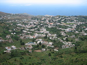
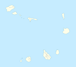
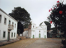
Bila or Nóva SintraView over Nova Sintra. Location in Cape Verde Coordinates: 14°52′15″N 24°41′45″W / 14.87083°N 24.69583°WCoordinates: 14°52′15″N 24°41′45″W / 14.87083°N 24.69583°W Country  Cape Verde
Municipality Brava (seat) Nova Sintra is a city in the central part of the island of Brava in southwestern and western Cape Verde and also serves as the seat of the Brava Municipality. With a population of about 1,800, the city is the nineteenth largest community in Cape Verde after Sal Rei. It is named after the Portuguese town of Sintra.
Contents
Transport
Nova Sintra is linked with roads to the northern, the eastern, the southcentral and the western parts of the island as well as to the former airfield. The "aluguer" busses to the other villages start from Praça Eugénio Tavares. A few taxis are available as well.
Economy
Agriculture is the predominant source of income on Brava. Tourism is less developed, but there are a few small hotels and guest houses. Industry is rare to find. The GDP for the town is between low and middle range. A part of the population lives in poverty and living standards are between low and moderate.
Sights
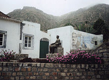
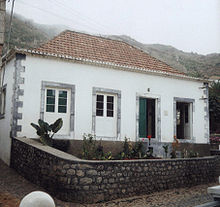
- Nova Sintra's popular fame is Eugénio Tavares, a famous Capeverdean writer. There is a monument of him beside the house where he lived which is museum today. It is located in a garden with pine trees, other trees and flowers including roses and sunflowers.
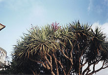
- The square Praça Eugénio Tavares is the center of town. There is a well-kept park, a music pavillon, a post office, a bank, a pharmacy and the city Hall. The protestant church Igreja do Nazareno is the oldest church of the island. Opposite the bank one of the rare dragon trees (Dracaena draco) can be seen.
- The Catholic Church is worth a visit. It was built around 1880. There is also a New Apostolic Church, an Adventist Church, a Kingdom Hall of Jehova's Witnesses and a parish of the Church of Jesus Christ of Latter Day Saints in Nova Sintra.
- Rua da Cultura is a historic street in the center of the town. Well-preserved colonial architecture can be seen here.
- In the Eastern part of the town there is a sightworthy monument and viewpoint shaped like a ship. The name "Santa Maria" which is painted on the ship refers to the ship of Christopher Columbus. From here there is a beautiful view over the village of Santa Bárbara to the East coast of Brava and the harbour of Furna. There are similar monuments in other villages as well, e.g. in Campo Baixo in the South of Brava.
Nearest places
- Cova Rodela, west
- Furna, northeast
- Tantum
Historical population
A part of the population has moved to mainly North America and Europe and to the other islands especially in the 1900s.
Year Population Change Density 1990 (June 23, Census) 1,890 - - 2000 (June 16, Census) 1,930 - - 2005 (January 1, Computing) 1,873 - - 2008 (Estimate) 1,813 - - Sports
The football/soccer team in town is Bravense.
Intrastructure
Nova Sintra has a school or a collegiate, the island's only middle school and secondary school, a small market hall, a few super markets and many shops. There is even a driving school, but only one bank. The streets in Nova Sintra are mainly cobbled and paved. The main street is a tree-lined avenue in the heart of the town. The hospital, petrol station, bakery, several shops and the Court are in the avenue. The panorama includes the islands north of Brava and the neighbouring island Fogo with the town São Filipe.
External links
- Map and aerial photos
- Street map from Mapquest, MapPoint, Google or Yahoo! Maps
- Satellite images: Google or Microsoft Virtual Earth - image now available
Categories:- Towns in Cape Verde
- Brava, Cape Verde
- Cape Verde geography stubs
Wikimedia Foundation. 2010.

