- Pueblo Bello
Infobox City
official_name = Pueblo Bello
nickname =
motto = Work, Tenacity and Honesty
( _es. Trabajo, teson y honradez)
imagesize =
image_caption =
image_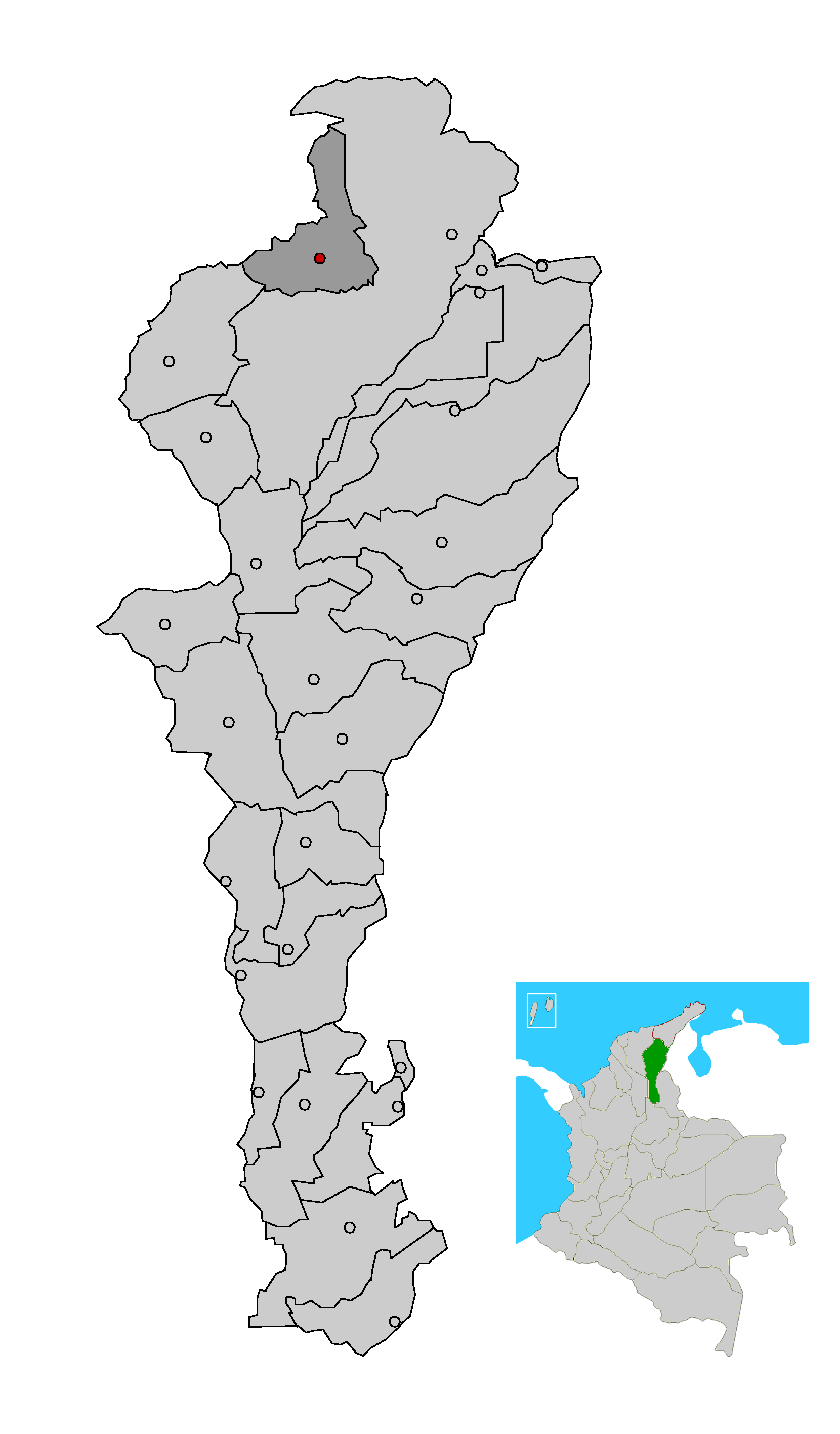
mapsize = 200px
map_caption = Location of the municipality and town of Pueblo Bello in the Department of Cesar.
subdivision_type =Country
subdivision_type1 = Region
subdivision_type2 = Department
subdivision_name =Colombia
subdivision_name1 = Caribbean
subdivision_name2 = Cesar
leader_title =Mayor
leader_name =Wilfran Pianeta
(Alas Equipo Colombia) [ [http://www.interpolitico.com/noticias//noticia.php?cid=1&nid=344 es icon Interpolitico.com: Mayors of Cesar - 2008-2011] ]
established_title = Foundation
established_date =1590
area_magnitude =
area_total_sq_mi =
area_total_km2 =
area_land_sq_mi =
area_land_km2 =
area_water_sq_mi =
area_water_km2 =
area_water_percent =
area_urban_sq_mi =
area_urban_km2 =
area_metro_sq_mi =
area_metro_km2 =
population_as_of =2005
population_note = [ [http://www.colombiassh.org/site/IMG/png/demografia.pngColombiassh.org: Census 2005: Pueblo Bello] ] [ [http://www.dane.gov.co/files/censo2005/regiones/cesar/pueblo_bello.pdf es icon DANE 2005 Census: Pueblo Bello] ]
population_total = 16942
population_metro =
population_urban =
population_density_km2 =
population_density_sq_mi =
timezone =
utc_offset = -5
timezone_DST =
utc_offset_DST =
latd= |latm= |lats= |latNS=
longd= |longm= |longs= |longEW=
elevation_m =
elevation_ft =
website =
[http://www.pueblobello-cesar.gov.co/nuestromunicipio.shtml?apc=m-s1--&m=f www.pueblobello-cesar.gov.co]
footnotes =Pueblo Bello (Pretty Village), is a village and municipality in the northern region of the
Department of Cesar ,Colombia . It is located in the mountains of theSierra Nevada de Santa Marta and is home toamerindians pertaining to the Arhuaco ethnicity, whom consider Pueblo Bello a sanctuary but by the name of "Arumake" in their language. Pueblo Bello is the main producer ofcoffee in theCaribbean Region of Colombia .Geography
Pueblo Bello is the only municipality that is completely within the
Sierra Nevada de Santa Marta mountains. The municipality borders to the north with theDepartment of Magdalena ; to the east and south with the municipality ofValledupar and to the southwest with the municipality ofEl Copey . The municipality of Pueblo Bello is also part a Forest Reserve, the Sierra Nevada de Santa Marta National Park and the indigenous reserve. The municipality is crossed by two rivers; theAriguaní River and theAriguanicito River . [ [http://www.sinic.gov.co/SINIC/ColombiaCultural/ColCulturalBusca.aspx?AREID=3&SECID=8&IdDep=20&COLTEM=213 es icon National System for Cultural Information: Pueblo Bello] ]Climate
Pueblo Bello presents an average temperature though out the year between 16°C and 22°C predominantly characterized by mountain climate. [ [http://www.sinic.gov.co/SINIC/ColombiaCultural/ColCulturalBusca.aspx?AREID=3&SECID=8&IdDep=20&COLTEM=213 es icon National System for Cultural Information: Pueblo Bello] ]
History
The region was first inhabited by the
Arhuacos andChimilas Maconganas. Upon the arrival of the Spanish, during theSpanish colonization of the Americas , the first European explorers to arrive were men under the orders of Lope de Orozco and had named it "Valle de Taironaca" (Valley of Taironaca). [Harvnb|Gutierrez Hinojosa|2000|p=119]The village was founded by Captain Antonio Florez in c.
1590 with the name "Dulce Nombre de Jesus" but due to constant attacks from the Chimilas the town was moved nearer to Valledupar. The old village was named; Pueblo Viejo (named changed to Pueblo Bello in the 20th Century) and the new town; Nueva Valencia. [Harvnb|Gutierrez Hinojosa|2000|p=119]Pueblo Bello was a corregimiento of Valledupar until 1997 when it was elevated to municipality by Ordinance 037 of
December 10 , 1997; later Decree 000239 ofMay 6 , 1998 the Ordinance was recognized and enforced. [ [http://www.sinic.gov.co/SINIC/ColombiaCultural/ColCulturalBusca.aspx?AREID=3&SECID=8&IdDep=20&COLTEM=213 es icon National System for Cultural Information: Pueblo Bello] ]Culture
Pueblo Bello celebrates the "
Festival del Café y la Mochila Arhuaca " and the "Regional Olympics ". OnJuly 16 of each year the town celebrates theRoman Catholic tradition of the Virgin of El Carmen. [ [http://www.sinic.gov.co/SINIC/ColombiaCultural/ColCulturalBusca.aspx?AREID=3&SECID=8&IdDep=20&COLTEM=213 es icon National System for Cultural Information: Pueblo Bello] ]Notes
References
*citation|last=Gutierrez Hinojosa|first= Tomas Dario|last2=|first2=|authorlink=|title=Valledupar Musica de una Historia|location=Bogota|publisher=Editorial Grijalbo LTDA|year=2000|isbn=958-639175-2
External links
*es icon [http://www.pueblobello-cesar.gov.co/nuestromunicipio.shtml?apc=m-s1--&m=f Pueblo Bello official website]
*es icon [http://www.gobcesar.gov.co/infonoticia.asp?idnot=1014 Government of Cesar - Pueblo Bello]
Wikimedia Foundation. 2010.